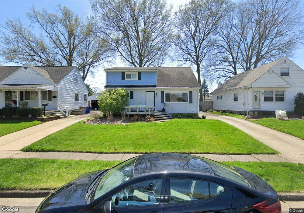
312 Lehigh Ave Cuyahoga Falls, OH 44221
Mud Brook NeighborhoodEstimated Value: $228,997 - $258,000
4
Beds
2
Baths
1,518
Sq Ft
$160/Sq Ft
Est. Value
About This Home
This home is located at 312 Lehigh Ave, Cuyahoga Falls, OH 44221 and is currently estimated at $243,499, approximately $160 per square foot. 312 Lehigh Ave is a home located in Summit County with nearby schools including Lincoln Elementary School, Roberts Middle School, and Cuyahoga Falls High School.
Ownership History
Date
Name
Owned For
Owner Type
Purchase Details
Closed on
Apr 28, 2005
Sold by
Humphrey David G and Humphrey Sheryl A
Bought by
Ricker Christopher J and Ricker Dorian K
Current Estimated Value
Home Financials for this Owner
Home Financials are based on the most recent Mortgage that was taken out on this home.
Original Mortgage
$132,600
Interest Rate
6.06%
Mortgage Type
Fannie Mae Freddie Mac
Create a Home Valuation Report for This Property
The Home Valuation Report is an in-depth analysis detailing your home's value as well as a comparison with similar homes in the area
Home Values in the Area
Average Home Value in this Area
Purchase History
| Date | Buyer | Sale Price | Title Company |
|---|---|---|---|
| Ricker Christopher J | $132,600 | Village Title Agency |
Source: Public Records
Mortgage History
| Date | Status | Borrower | Loan Amount |
|---|---|---|---|
| Closed | Ricker Christopher J | $132,600 |
Source: Public Records
Tax History Compared to Growth
Tax History
| Year | Tax Paid | Tax Assessment Tax Assessment Total Assessment is a certain percentage of the fair market value that is determined by local assessors to be the total taxable value of land and additions on the property. | Land | Improvement |
|---|---|---|---|---|
| 2025 | $3,556 | $65,860 | $11,988 | $53,872 |
| 2024 | $3,556 | $65,860 | $11,988 | $53,872 |
| 2023 | $3,556 | $65,860 | $11,988 | $53,872 |
| 2022 | $3,189 | $47,971 | $8,624 | $39,347 |
| 2021 | $3,188 | $47,971 | $8,624 | $39,347 |
| 2020 | $3,136 | $47,970 | $8,620 | $39,350 |
| 2019 | $2,992 | $41,680 | $8,280 | $33,400 |
| 2018 | $2,541 | $41,680 | $8,280 | $33,400 |
| 2017 | $2,347 | $41,680 | $8,280 | $33,400 |
| 2016 | $2,348 | $39,010 | $8,280 | $30,730 |
| 2015 | $2,347 | $39,010 | $8,280 | $30,730 |
| 2014 | $2,348 | $39,010 | $8,280 | $30,730 |
| 2013 | $2,337 | $39,180 | $8,280 | $30,900 |
Source: Public Records
Map
Nearby Homes
- 435 Roanoke Ave
- 455 Marguerite Ave
- 306 Hollywood Ave
- 3044 Bailey Rd
- 2886 Norwood St
- 2890 Bailey Rd
- 419 Keenan Ave
- 3320 Hudson Dr
- 2835 Bailey Rd
- 2834 Norwood St
- 229 Hayes Ave
- Greenfield Plan at Miller's Landing
- Riverton Plan at Miller's Landing
- Woodside Plan at Miller's Landing
- Willwood Plan at Miller's Landing
- Westchester Plan at Miller's Landing
- Amberwood Plan at Miller's Landing
- Hilltop Plan at Miller's Landing
- 242 Monroe Ave
- 223 Filmore Ave
- 318 Lehigh Ave
- 306 Lehigh Ave
- 324 Lehigh Ave
- 300 Lehigh Ave
- 315 Franklin Ave
- 307 Franklin Ave
- 313 Lehigh Ave
- 242 Lehigh Ave
- 325 Franklin Ave
- 325 Franklin Ave
- 330 Lehigh Ave
- 319 Lehigh Ave
- 331 Franklin Ave
- 307 Lehigh Ave
- 335 Lehigh Ave
- 255 Franklin Ave
- 301 Lehigh Ave
- 236 Lehigh Ave
- 337 Franklin Ave
- 3122 Norwood St