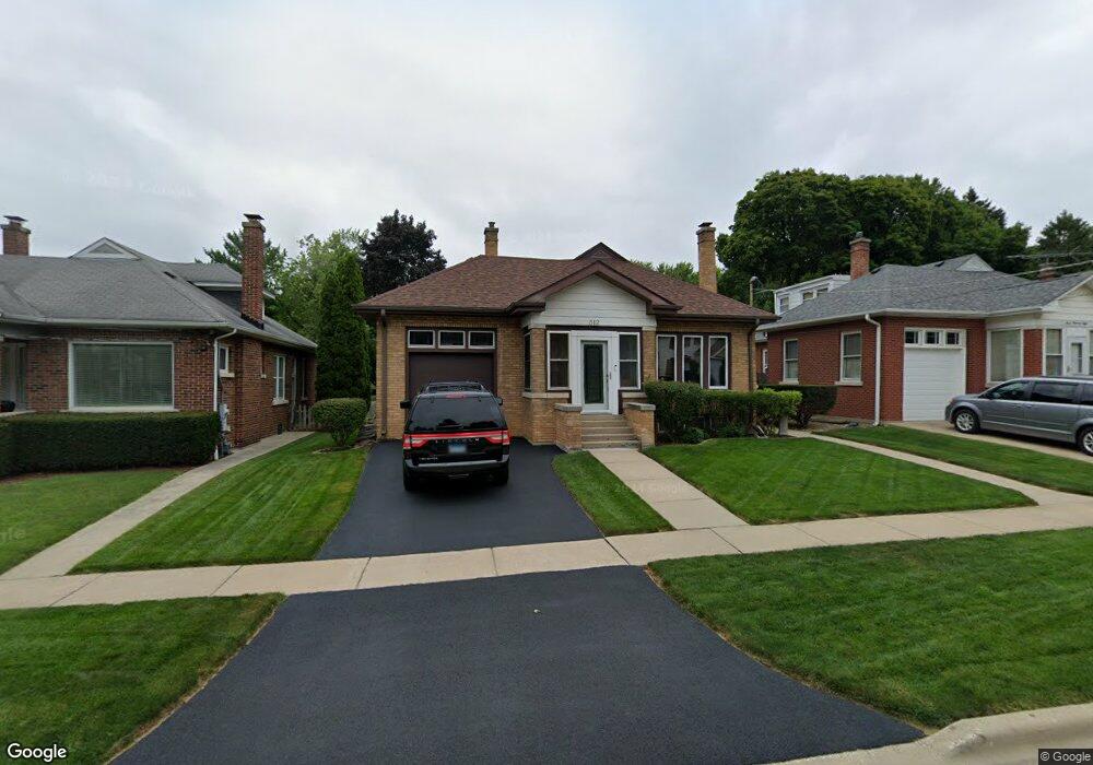
312 Mckinley Ave Libertyville, IL 60048
South Libertyville NeighborhoodEstimated Value: $421,920 - $529,000
--
Bed
1
Bath
1,305
Sq Ft
$362/Sq Ft
Est. Value
About This Home
This home is located at 312 Mckinley Ave, Libertyville, IL 60048 and is currently estimated at $472,230, approximately $361 per square foot. 312 Mckinley Ave is a home located in Lake County with nearby schools including Rockland Elementary School, Highland Middle School, and Libertyville High School.
Ownership History
Date
Name
Owned For
Owner Type
Purchase Details
Closed on
Jul 16, 2015
Sold by
Gratz Gregory L and Gratz Diana R
Bought by
Gratz Living Family Trust
Current Estimated Value
Purchase Details
Closed on
Feb 20, 2015
Sold by
Gratz Leroy H
Bought by
Gratz Gregory L and Gratz Diana R
Purchase Details
Closed on
Aug 16, 1999
Sold by
Bank Of Northern Illinois Na
Bought by
Finch Brenda and Larkin Barbara
Create a Home Valuation Report for This Property
The Home Valuation Report is an in-depth analysis detailing your home's value as well as a comparison with similar homes in the area
Home Values in the Area
Average Home Value in this Area
Purchase History
| Date | Buyer | Sale Price | Title Company |
|---|---|---|---|
| Gratz Living Family Trust | -- | None Available | |
| Gratz Gregory L | $295,000 | Multiple | |
| Finch Brenda | -- | -- |
Source: Public Records
Tax History Compared to Growth
Tax History
| Year | Tax Paid | Tax Assessment Tax Assessment Total Assessment is a certain percentage of the fair market value that is determined by local assessors to be the total taxable value of land and additions on the property. | Land | Improvement |
|---|---|---|---|---|
| 2024 | $6,470 | $95,771 | $52,348 | $43,423 |
| 2023 | $6,310 | $88,334 | $48,283 | $40,051 |
| 2022 | $6,310 | $84,903 | $46,407 | $38,496 |
| 2021 | $6,070 | $83,075 | $45,408 | $37,667 |
| 2020 | $6,240 | $86,893 | $47,495 | $39,398 |
| 2019 | $6,086 | $86,066 | $47,043 | $39,023 |
| 2018 | $3,104 | $84,004 | $46,653 | $37,351 |
| 2017 | $5,643 | $81,352 | $45,180 | $36,172 |
| 2016 | $5,444 | $77,133 | $42,837 | $34,296 |
| 2015 | $5,378 | $72,093 | $40,038 | $32,055 |
| 2014 | $5,082 | $66,473 | $36,917 | $29,556 |
| 2012 | $4,919 | $67,728 | $37,614 | $30,114 |
Source: Public Records
Map
Nearby Homes
- 308 Mckinley Ave
- 1754 Glenmore Rd
- 423 Ames St
- 551 W Park Ave Unit E
- 0 Ames St
- 212 Elm Ct
- 426 S Milwaukee Ave
- 505 Lange Ct
- 420 W Cook Ave
- 217 E Church St
- 533 Drake St
- 112 3rd St
- 401 S 4th Ave
- 121 4th St
- 747 Garfield Ave Unit C
- 601 Broadway St
- 777 Garfield Ave Unit A
- 700 E Sunnyside Ave
- 224 Newberry Ave
- 851 Garfield Ave Unit C
- 322 Mckinley Ave
- 318 Mckinley Ave
- 304 Mckinley Ave
- 304 Mckinley Ave Unit 304 McKinley Ave. -
- 326 Mckinley Ave
- 242 Florence Ct
- 236 Florence Ct
- 234 Mckinley Ave
- 234 Florence Ct
- 340 Mckinley Ave
- 248 Florence Ct Unit 248
- 246 Florence Ct
- 230 Florence Ct
- 224 Mckinley Ave
- 260 Florence Ct
- 344 Mckinley Ave
- 224 Florence Ct
- 220 Mckinley Ave
- 317 Mckinley Ave
- 315 Mckinley Ave