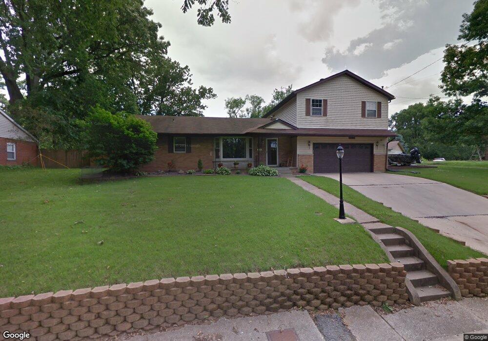
312 Oak St East Alton, IL 62024
Estimated Value: $151,000 - $189,000
4
Beds
2
Baths
1,680
Sq Ft
$99/Sq Ft
Est. Value
About This Home
This home is located at 312 Oak St, East Alton, IL 62024 and is currently estimated at $166,963, approximately $99 per square foot. 312 Oak St is a home located in Madison County with nearby schools including Eastwood Elementary School, East Alton Middle School, and East Alton-Wood River High School.
Ownership History
Date
Name
Owned For
Owner Type
Purchase Details
Closed on
Feb 28, 2003
Sold by
Zick Stephen and Zick Sherri L
Bought by
York Steve L and York Sheila L
Current Estimated Value
Home Financials for this Owner
Home Financials are based on the most recent Mortgage that was taken out on this home.
Original Mortgage
$81,600
Outstanding Balance
$35,387
Interest Rate
6%
Mortgage Type
Purchase Money Mortgage
Estimated Equity
$131,576
Create a Home Valuation Report for This Property
The Home Valuation Report is an in-depth analysis detailing your home's value as well as a comparison with similar homes in the area
Home Values in the Area
Average Home Value in this Area
Purchase History
| Date | Buyer | Sale Price | Title Company |
|---|---|---|---|
| York Steve L | $102,000 | Community Title & Escrow |
Source: Public Records
Mortgage History
| Date | Status | Borrower | Loan Amount |
|---|---|---|---|
| Open | York Steve L | $81,600 |
Source: Public Records
Tax History Compared to Growth
Tax History
| Year | Tax Paid | Tax Assessment Tax Assessment Total Assessment is a certain percentage of the fair market value that is determined by local assessors to be the total taxable value of land and additions on the property. | Land | Improvement |
|---|---|---|---|---|
| 2024 | $2,645 | $45,770 | $5,480 | $40,290 |
| 2023 | $2,645 | $42,670 | $5,110 | $37,560 |
| 2022 | $2,692 | $39,390 | $4,720 | $34,670 |
| 2021 | $3,522 | $36,710 | $4,400 | $32,310 |
| 2020 | $3,391 | $35,360 | $4,240 | $31,120 |
| 2019 | $3,337 | $34,300 | $4,110 | $30,190 |
| 2018 | $3,256 | $32,590 | $3,900 | $28,690 |
| 2017 | $3,055 | $31,810 | $3,810 | $28,000 |
| 2016 | $3,001 | $31,810 | $3,810 | $28,000 |
| 2015 | $2,871 | $31,470 | $3,770 | $27,700 |
| 2014 | $2,871 | $31,470 | $3,770 | $27,700 |
| 2013 | $2,871 | $31,920 | $3,820 | $28,100 |
Source: Public Records
Map
Nearby Homes
- 225 Lakeside Ave
- 604 Wood River Ave
- 523 Lincoln Ave
- 420 Bowman Ave
- 523 Broadway
- 250 Hi Pointe Place
- 283 Hi Pointe Place
- 323 Church St
- 304 W Main St
- 133 Lincoln Ave
- 129 N Pence St
- 405 Dry St
- 121 Whitelaw Ave
- 104 Whitelaw Ave
- 98 Wood River Ave
- 345 Illinois Ave
- 109 S Shamrock St
- 141 S 9th St
- 144 S 9th St
- 211 S 9th St