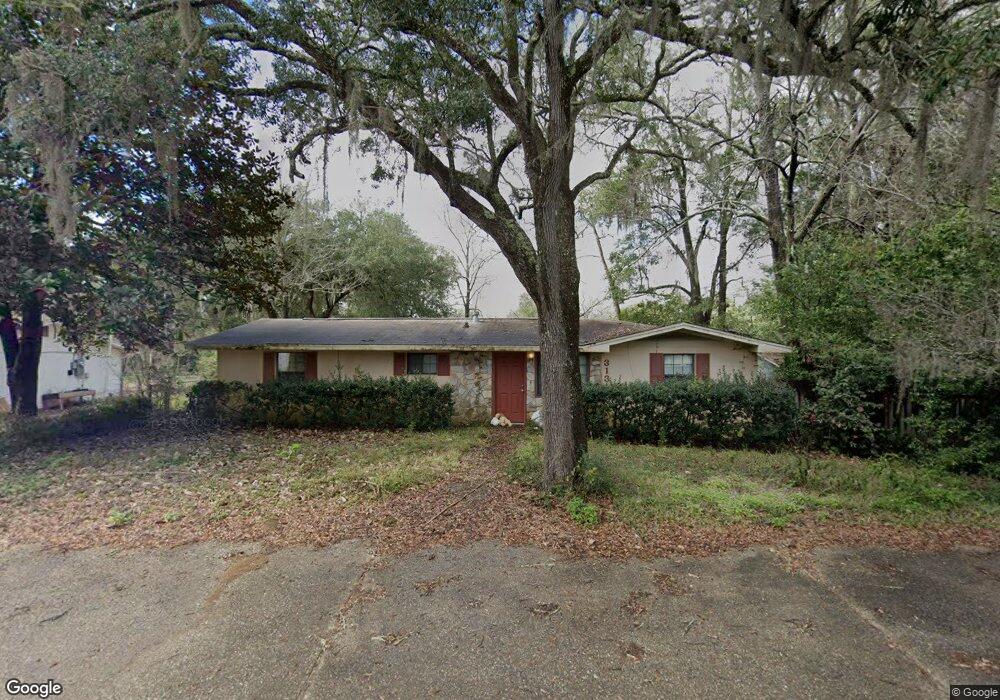
313 Cedar Ave S Niceville, FL 32578
Estimated Value: $125,000 - $351,000
2
Beds
1
Bath
130
Sq Ft
$1,896/Sq Ft
Est. Value
About This Home
This home is located at 313 Cedar Ave S, Niceville, FL 32578 and is currently estimated at $246,436, approximately $1,895 per square foot. 313 Cedar Ave S is a home located in Okaloosa County with nearby schools including Lula J. Edge Elementary School, C.W. Ruckel Middle School, and Niceville Senior High School.
Ownership History
Date
Name
Owned For
Owner Type
Purchase Details
Closed on
Jun 16, 2022
Sold by
Watson Jil K
Bought by
Rf Thomas Llc
Current Estimated Value
Purchase Details
Closed on
Mar 8, 2010
Sold by
Buckhead Holdings Inc
Bought by
Watson Richard L and Watson Jil K
Home Financials for this Owner
Home Financials are based on the most recent Mortgage that was taken out on this home.
Original Mortgage
$417,000
Interest Rate
4.97%
Mortgage Type
VA
Purchase Details
Closed on
Jun 27, 2000
Sold by
Feist Robert John and Feist Jill Karen
Bought by
Feist Jil K
Create a Home Valuation Report for This Property
The Home Valuation Report is an in-depth analysis detailing your home's value as well as a comparison with similar homes in the area
Home Values in the Area
Average Home Value in this Area
Purchase History
| Date | Buyer | Sale Price | Title Company |
|---|---|---|---|
| Rf Thomas Llc | $65,000 | Matthews & Jones Llp | |
| Watson Richard L | $86,400 | First Natl Land Title Co Inc | |
| Feist Jil K | -- | -- |
Source: Public Records
Mortgage History
| Date | Status | Borrower | Loan Amount |
|---|---|---|---|
| Previous Owner | Watson Richard L | $417,000 |
Source: Public Records
Tax History Compared to Growth
Tax History
| Year | Tax Paid | Tax Assessment Tax Assessment Total Assessment is a certain percentage of the fair market value that is determined by local assessors to be the total taxable value of land and additions on the property. | Land | Improvement |
|---|---|---|---|---|
| 2024 | $1,118 | $83,596 | $39,730 | $43,866 |
| 2023 | $1,118 | $83,898 | $39,336 | $44,562 |
| 2022 | $867 | $79,687 | $37,463 | $42,224 |
| 2021 | $744 | $60,631 | $26,061 | $34,570 |
| 2020 | $628 | $46,167 | $25,803 | $20,364 |
| 2019 | $617 | $44,801 | $25,803 | $18,998 |
| 2018 | $928 | $80,175 | $0 | $0 |
| 2017 | $888 | $77,103 | $0 | $0 |
| 2016 | $846 | $75,060 | $0 | $0 |
| 2015 | $819 | $71,626 | $0 | $0 |
| 2014 | $1,131 | $77,417 | $0 | $0 |
Source: Public Records
Map
Nearby Homes
- 315 Boxer Ave
- 119 Mcewen Dr
- 807 S B S Cedar Ave
- 1101 Palm Blvd S
- 813 Bayshore Dr
- 111 Beverly Dr
- 609 32nd St
- 203 22nd St
- 202 22nd St
- TBD Bayshore Dr
- 302 22nd St
- 310 22nd St
- 0 Bayshore Dr
- 1970 Hattie Mae Ln
- 232 Abner Way Unit Lot 4
- 420 Bullock Blvd
- 703 Cypress Dr
- 1200 Cedar Ave S
- 1901 Cottage Grove Ln Unit 1
- 1117 Cedar Ave S