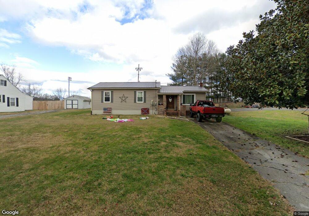
313 Fain Dr Blountville, TN 37617
Estimated Value: $215,000 - $447,000
3
Beds
1
Bath
1,171
Sq Ft
$253/Sq Ft
Est. Value
About This Home
This home is located at 313 Fain Dr, Blountville, TN 37617 and is currently estimated at $296,185, approximately $252 per square foot. 313 Fain Dr is a home located in Sullivan County with nearby schools including Holston Elementary School, Sullivan Central Middle School, and Tri-Cities Christian Academy.
Ownership History
Date
Name
Owned For
Owner Type
Purchase Details
Closed on
Mar 25, 2019
Sold by
Wood Melissa D
Bought by
Ford Michael A and Ford Rachael B
Current Estimated Value
Home Financials for this Owner
Home Financials are based on the most recent Mortgage that was taken out on this home.
Original Mortgage
$95,243
Outstanding Balance
$85,113
Interest Rate
5.25%
Mortgage Type
FHA
Estimated Equity
$211,072
Purchase Details
Closed on
Mar 25, 2008
Bought by
Wood Melissa D
Purchase Details
Closed on
Nov 19, 1998
Sold by
Michael Jones Henry
Bought by
Kitty Salyer
Purchase Details
Closed on
Aug 21, 1992
Create a Home Valuation Report for This Property
The Home Valuation Report is an in-depth analysis detailing your home's value as well as a comparison with similar homes in the area
Home Values in the Area
Average Home Value in this Area
Purchase History
| Date | Buyer | Sale Price | Title Company |
|---|---|---|---|
| Ford Michael A | $97,000 | None Available | |
| Wood Melissa D | $102,500 | -- | |
| Kitty Salyer | $69,000 | -- | |
| -- | $15,000 | -- |
Source: Public Records
Mortgage History
| Date | Status | Borrower | Loan Amount |
|---|---|---|---|
| Open | Ford Michael A | $95,243 |
Source: Public Records
Tax History Compared to Growth
Tax History
| Year | Tax Paid | Tax Assessment Tax Assessment Total Assessment is a certain percentage of the fair market value that is determined by local assessors to be the total taxable value of land and additions on the property. | Land | Improvement |
|---|---|---|---|---|
| 2024 | $572 | $22,925 | $4,000 | $18,925 |
| 2023 | $552 | $22,925 | $4,000 | $18,925 |
| 2022 | $552 | $22,925 | $4,000 | $18,925 |
| 2021 | $552 | $22,925 | $4,000 | $18,925 |
| 2020 | $553 | $22,925 | $4,000 | $18,925 |
| 2019 | $553 | $21,500 | $3,500 | $18,000 |
| 2018 | $548 | $21,500 | $3,500 | $18,000 |
| 2017 | $548 | $21,500 | $3,500 | $18,000 |
| 2016 | $614 | $23,850 | $3,500 | $20,350 |
| 2014 | $550 | $23,857 | $0 | $0 |
Source: Public Records
Map
Nearby Homes
- 355 Holston Dr
- The Quinn Plan at Ashland Oaks
- The Audrey Plan at Ashland Oaks
- Phoenix Single Plan at Ashland Oaks
- 132 Sanders St
- 210 Centenary Rd
- 2188 Tennessee 75
- 205 Grande Harbor Way
- 191 Grande Harbor Way
- 129 Forest Ln N
- 148 Forest Ln S
- 205 Forest Ct
- 239 Brown Cir
- 145 Grande Harbor Way
- 156 Forest Ln N
- 164 Forest Ln N
- 295 Brown Cir
- 112 Cardinal Point
- 101 Bond Town Rd
- 290 Candy Creek Private Dr
- 305 Fain Dr
- 325 Fain Dr
- 341 Fain Dr
- 590 Holston Dr
- 516 Holston Dr
- 577 Holston Dr
- 577 Holston Dr
- 595 Holston Private Dr
- 477 Holston Dr
- 479 Holston Dr
- 406 Holston Dr
- 412 Holston Dr
- 429 Holston Dr
- 0 Holston Private Dr
- 2390 Muddy Creek Rd
- 1470 Muddy Creek Rd
- 208 Cash Ave
- TBD Holston Private Dr
- 413 Holston Dr
- 2400 Muddy Creek Rd