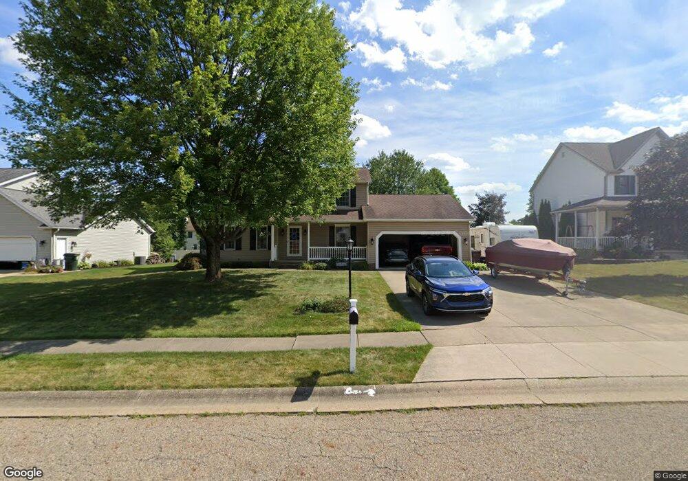
314 Shawnee Cir Louisville, OH 44641
Estimated Value: $285,000 - $312,000
3
Beds
3
Baths
1,848
Sq Ft
$161/Sq Ft
Est. Value
About This Home
This home is located at 314 Shawnee Cir, Louisville, OH 44641 and is currently estimated at $297,954, approximately $161 per square foot. 314 Shawnee Cir is a home located in Stark County with nearby schools including Louisville High School and St. Thomas Aquinas High School & Middle School.
Ownership History
Date
Name
Owned For
Owner Type
Purchase Details
Closed on
Sep 19, 2011
Sold by
Strouse Richard G and Strouse Wendy L
Bought by
Strouse Richard G and Strouse Wendy L
Current Estimated Value
Home Financials for this Owner
Home Financials are based on the most recent Mortgage that was taken out on this home.
Original Mortgage
$120,000
Outstanding Balance
$10,633
Interest Rate
4.32%
Mortgage Type
New Conventional
Estimated Equity
$287,321
Purchase Details
Closed on
Jun 23, 1995
Sold by
Oswalt Kurt S
Bought by
Stouse Richard G and Shull Wendy
Home Financials for this Owner
Home Financials are based on the most recent Mortgage that was taken out on this home.
Original Mortgage
$120,000
Interest Rate
7.9%
Mortgage Type
New Conventional
Purchase Details
Closed on
Dec 12, 1994
Sold by
Buffalo Ridge Allotment
Bought by
Oswalt Kurt S
Create a Home Valuation Report for This Property
The Home Valuation Report is an in-depth analysis detailing your home's value as well as a comparison with similar homes in the area
Home Values in the Area
Average Home Value in this Area
Purchase History
| Date | Buyer | Sale Price | Title Company |
|---|---|---|---|
| Strouse Richard G | -- | Attorney | |
| Stouse Richard G | $126,400 | -- | |
| Oswalt Kurt S | $18,500 | -- |
Source: Public Records
Mortgage History
| Date | Status | Borrower | Loan Amount |
|---|---|---|---|
| Open | Strouse Richard G | $120,000 | |
| Closed | Stouse Richard G | $120,000 |
Source: Public Records
Tax History Compared to Growth
Tax History
| Year | Tax Paid | Tax Assessment Tax Assessment Total Assessment is a certain percentage of the fair market value that is determined by local assessors to be the total taxable value of land and additions on the property. | Land | Improvement |
|---|---|---|---|---|
| 2025 | -- | $92,510 | $17,360 | $75,150 |
| 2024 | -- | $92,510 | $17,360 | $75,150 |
| 2023 | $2,757 | $64,160 | $17,220 | $46,940 |
| 2022 | $2,763 | $64,160 | $17,220 | $46,940 |
| 2021 | $2,771 | $64,160 | $17,220 | $46,940 |
| 2020 | $2,311 | $58,110 | $15,510 | $42,600 |
| 2019 | $2,320 | $53,560 | $15,510 | $38,050 |
| 2018 | $2,131 | $53,560 | $15,510 | $38,050 |
| 2017 | $1,980 | $48,020 | $12,670 | $35,350 |
| 2016 | $2,021 | $48,020 | $12,670 | $35,350 |
| 2015 | $2,026 | $48,020 | $12,670 | $35,350 |
| 2014 | $1,881 | $41,440 | $10,920 | $30,520 |
| 2013 | $944 | $41,440 | $10,920 | $30,520 |
Source: Public Records
Map
Nearby Homes
- 1702 View Pointe Ave
- 1639 Horizon Dr
- 908 Sand Lot Cir
- 8225 Georgetown St
- 510 S Bauman Ct
- 6969 Georgetown St NE
- 204 E Broad St
- 728 E Broad St
- 520 S Silver St
- 107 E Broad St
- 641 S Nickelplate St
- 2425 Miday Ave NE
- 308 Superior St
- 1715 High St
- 2110 Edmar St
- 3390 Meese Rd NE
- 1812 E Broad St
- 325 Lincoln Ave
- 201 Indiana Ave
- 4060 Hambleton Ave NE
- 304 Shawnee Cir
- 404 Shawnee Cir
- 315 Buffalo Ridge St
- 305 Buffalo Ridge St
- 405 Buffalo Ridge St
- 214 Shawnee Cir
- 414 Shawnee Cir
- 315 Shawnee Cir
- 405 Shawnee Cir
- 305 Shawnee Cir
- 215 Buffalo Ridge St
- 415 Buffalo Ridge St
- 204 Shawnee Cir
- 1825 Cherokee Ave
- 215 Shawnee Cir
- 205 Buffalo Ridge St
- 504 Shawnee St
- 205 Shawnee Cir
- 114 Shawnee Cir
- 314 Buffalo Ridge St