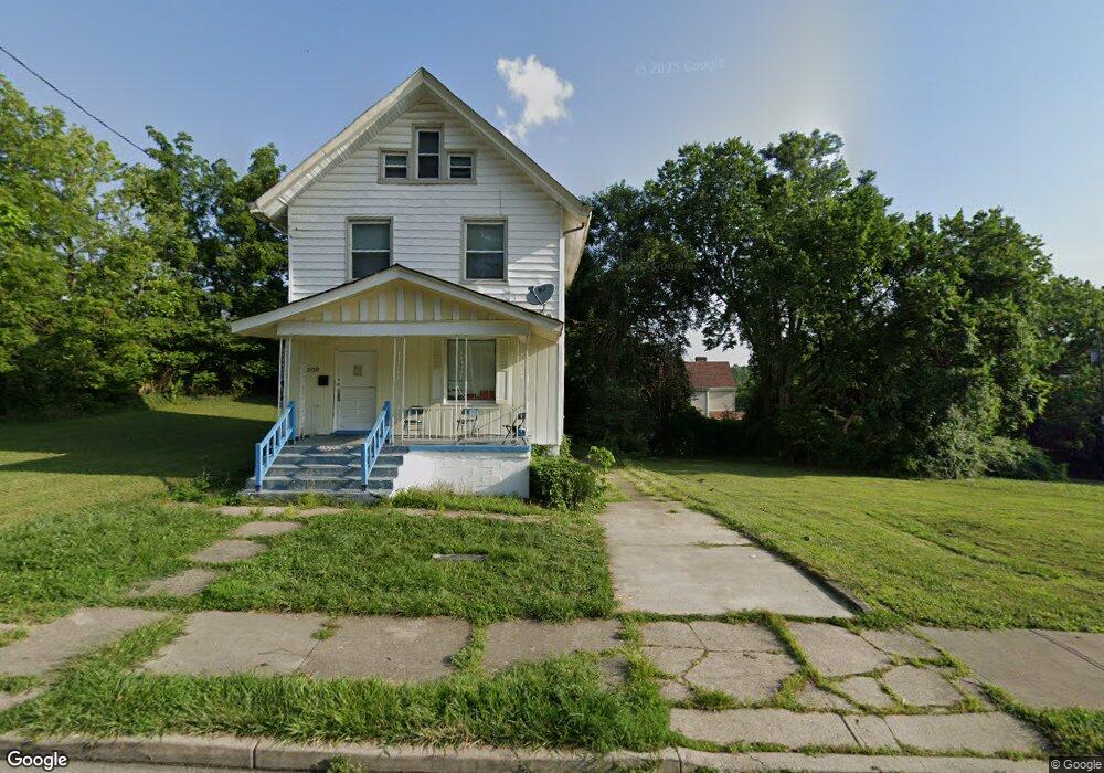
3141 Gaff Ave Cincinnati, OH 45206
Walnut Hills NeighborhoodEstimated Value: $71,131
4
Beds
2
Baths
1,380
Sq Ft
$52/Sq Ft
Est. Value
About This Home
This home is located at 3141 Gaff Ave, Cincinnati, OH 45206 and is currently estimated at $71,131, approximately $51 per square foot. 3141 Gaff Ave is a home located in Hamilton County with nearby schools including Frederick Douglass Elementary School, Robert A. Taft Information Technology High School, and Clark Montessori High School.
Ownership History
Date
Name
Owned For
Owner Type
Purchase Details
Closed on
Aug 26, 2019
Sold by
3235 Beresford Ave Llc
Bought by
Hamilton County Land Reutilization Corp
Current Estimated Value
Home Financials for this Owner
Home Financials are based on the most recent Mortgage that was taken out on this home.
Original Mortgage
$100
Outstanding Balance
$88
Interest Rate
3.7%
Mortgage Type
Purchase Money Mortgage
Estimated Equity
$71,043
Purchase Details
Closed on
Jan 8, 2019
Sold by
Smcl Inc
Bought by
3235 Beresford Ave Llc
Purchase Details
Closed on
Oct 10, 1990
Sold by
Newbill Grace
Bought by
Smcl Inc
Create a Home Valuation Report for This Property
The Home Valuation Report is an in-depth analysis detailing your home's value as well as a comparison with similar homes in the area
Home Values in the Area
Average Home Value in this Area
Purchase History
| Date | Buyer | Sale Price | Title Company |
|---|---|---|---|
| Hamilton County Land Reutilization Corp | -- | None Available | |
| 3235 Beresford Ave Llc | $40,000 | None Available | |
| Smcl Inc | $7,500 | -- |
Source: Public Records
Mortgage History
| Date | Status | Borrower | Loan Amount |
|---|---|---|---|
| Open | Hamilton County Land Reutilization Corp | $100 |
Source: Public Records
Tax History Compared to Growth
Tax History
| Year | Tax Paid | Tax Assessment Tax Assessment Total Assessment is a certain percentage of the fair market value that is determined by local assessors to be the total taxable value of land and additions on the property. | Land | Improvement |
|---|---|---|---|---|
| 2024 | -- | $4,515 | $4,515 | -- |
| 2023 | $0 | $4,515 | $4,515 | $0 |
| 2022 | $0 | $2,268 | $2,268 | $0 |
| 2021 | $750 | $2,268 | $2,268 | $0 |
| 2020 | $750 | $2,268 | $2,268 | $0 |
| 2019 | $749 | $9,720 | $2,268 | $7,452 |
| 2018 | $750 | $9,720 | $2,268 | $7,452 |
| 2017 | $722 | $9,720 | $2,268 | $7,452 |
| 2016 | $1,052 | $13,867 | $2,261 | $11,606 |
| 2015 | $941 | $13,867 | $2,261 | $11,606 |
| 2014 | $946 | $13,867 | $2,261 | $11,606 |
| 2013 | $981 | $14,151 | $2,307 | $11,844 |
Source: Public Records
Map
Nearby Homes
- 3219 Beresford Ave
- 3048 Gilbert Ave
- 3025 Gilbert Ave
- 3206 Gilbert Ave
- 3079 Kerper Ave
- 1537 Dixmont Ave
- 1521 Blair Ave
- 3144 Durrell Ave
- 1517 Saint Leger Place
- 3217 Gilbert Ave
- 1545 Ruth Ave
- 1541 Blair Ave
- 3409 Fernside Place
- 3238 Gilbert Ave
- 3121 Harvard Ave
- 3136 Harvard Ave
- 3319 Milton Ct
- 871 Hutchins Ave
- 3427 Woodburn Ave
- 855 Rockdale Ave