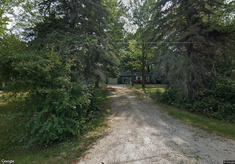
315 Huntington Rd Houghton Lake, MI 48629
Estimated Value: $151,000 - $247,000
--
Bed
1
Bath
1,488
Sq Ft
$127/Sq Ft
Est. Value
About This Home
This home is located at 315 Huntington Rd, Houghton Lake, MI 48629 and is currently estimated at $188,848, approximately $126 per square foot. 315 Huntington Rd is a home with nearby schools including Collins Upper Elementary School, Collins Elementary School, and Houghton Lake High School.
Ownership History
Date
Name
Owned For
Owner Type
Purchase Details
Closed on
Jul 6, 2022
Sold by
Bovee Sandra R
Bought by
Britton William
Current Estimated Value
Home Financials for this Owner
Home Financials are based on the most recent Mortgage that was taken out on this home.
Original Mortgage
$30,000
Outstanding Balance
$25,174
Interest Rate
4.32%
Mortgage Type
New Conventional
Estimated Equity
$163,674
Purchase Details
Closed on
Jun 28, 2005
Sold by
Britton Sandra R and Britton Robert L
Bought by
Britton Sandra R and Uponen Brenda L
Create a Home Valuation Report for This Property
The Home Valuation Report is an in-depth analysis detailing your home's value as well as a comparison with similar homes in the area
Home Values in the Area
Average Home Value in this Area
Purchase History
| Date | Buyer | Sale Price | Title Company |
|---|---|---|---|
| Britton William | -- | None Listed On Document | |
| Britton Sandra R | -- | None Available |
Source: Public Records
Mortgage History
| Date | Status | Borrower | Loan Amount |
|---|---|---|---|
| Open | Britton William | $30,000 |
Source: Public Records
Tax History Compared to Growth
Tax History
| Year | Tax Paid | Tax Assessment Tax Assessment Total Assessment is a certain percentage of the fair market value that is determined by local assessors to be the total taxable value of land and additions on the property. | Land | Improvement |
|---|---|---|---|---|
| 2025 | $1,674 | $79,400 | $0 | $0 |
| 2024 | $431 | $75,200 | $0 | $0 |
| 2023 | $412 | $75,200 | $0 | $0 |
| 2022 | $2,127 | $56,400 | $0 | $0 |
| 2021 | $1,364 | $44,200 | $0 | $0 |
| 2020 | $1,381 | $44,900 | $0 | $0 |
| 2019 | $1,343 | $40,500 | $0 | $0 |
| 2018 | $1,312 | $38,500 | $0 | $0 |
| 2016 | $1,190 | $38,900 | $0 | $0 |
| 2015 | -- | $37,800 | $0 | $0 |
| 2014 | -- | $36,000 | $0 | $0 |
| 2013 | -- | $33,300 | $0 | $0 |
Source: Public Records
Map
Nearby Homes
- 305 Huntington Rd
- 4048 W Houghton Lake Dr
- 1106 Houghton View Dr
- 125 Wickham Ave
- 802 Houghton View Dr
- V/L Town Line Rd
- 608 Ridgeview Dr
- 116 Valley Dr
- LOT 9 Heightsview
- 199 Gasoline Alley
- 203 Gasoline Alley
- 201 Gasoline Alley
- 128 Maple Bluff Ave
- 6119 W Nestel Rd
- 4860 W Houghton Lake Dr
- 414 Ridgeview Dr
- 100 Corral St
- 5734 Old Orchard Rd
- 108 Corral St
- 6698 Birdsong Ln
- 319 Huntington Rd
- 311 Huntington Rd
- 320 Huntington Rd
- 312 Huntington Rd
- 221 Huntington Rd
- 325 Huntington Rd
- 310 Huntington Rd
- 310 Huntington Dr
- 213 Roberts Rd
- 214 Roberts Rd
- 206 Homestead Rd
- 205 Roberts Rd
- 208 Roberts Rd
- 212 Roberts Rd
- 311 Boatman Rd
- 201 Roberts Rd
- 204 Homestead Rd
- 200 Homestead Rd
- 215 Huntington Rd
- 219 Huntington Rd