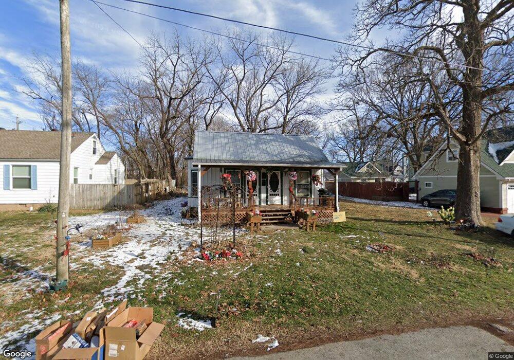
315 Siloam Place Siloam Springs, AR 72761
Estimated Value: $127,187 - $189,000
--
Bed
2
Baths
1,113
Sq Ft
$149/Sq Ft
Est. Value
About This Home
This home is located at 315 Siloam Place, Siloam Springs, AR 72761 and is currently estimated at $165,547, approximately $148 per square foot. 315 Siloam Place is a home located in Benton County with nearby schools including Northside Elementary School, Delbert Pete & Pat Allen Elementary School, and Southside Elementary School.
Ownership History
Date
Name
Owned For
Owner Type
Purchase Details
Closed on
May 26, 2017
Sold by
Kelly James Buck D
Bought by
Oliver Lori Alice and Hanlon Melinda Jean O
Current Estimated Value
Home Financials for this Owner
Home Financials are based on the most recent Mortgage that was taken out on this home.
Original Mortgage
$55,000
Outstanding Balance
$45,651
Interest Rate
4.03%
Mortgage Type
Seller Take Back
Estimated Equity
$119,896
Purchase Details
Closed on
Jun 8, 2012
Sold by
Carroll Reid R and Mechell Carroll E
Bought by
Kelly James Buck D
Purchase Details
Closed on
Sep 7, 2002
Bought by
Carroll
Create a Home Valuation Report for This Property
The Home Valuation Report is an in-depth analysis detailing your home's value as well as a comparison with similar homes in the area
Home Values in the Area
Average Home Value in this Area
Purchase History
| Date | Buyer | Sale Price | Title Company |
|---|---|---|---|
| Oliver Lori Alice | $60,000 | None Available | |
| Kelly James Buck D | $53,000 | Rt | |
| Carroll | $40,000 | -- |
Source: Public Records
Mortgage History
| Date | Status | Borrower | Loan Amount |
|---|---|---|---|
| Open | Oliver Lori Alice | $55,000 |
Source: Public Records
Tax History Compared to Growth
Tax History
| Year | Tax Paid | Tax Assessment Tax Assessment Total Assessment is a certain percentage of the fair market value that is determined by local assessors to be the total taxable value of land and additions on the property. | Land | Improvement |
|---|---|---|---|---|
| 2025 | $567 | $17,341 | $7,400 | $9,941 |
| 2024 | $582 | $17,341 | $7,400 | $9,941 |
| 2023 | $582 | $12,320 | $5,600 | $6,720 |
| 2022 | $207 | $12,320 | $5,600 | $6,720 |
| 2021 | $205 | $12,320 | $5,600 | $6,720 |
| 2020 | $180 | $9,630 | $5,600 | $4,030 |
| 2019 | $180 | $9,630 | $5,600 | $4,030 |
| 2018 | $205 | $9,630 | $5,600 | $4,030 |
| 2017 | $446 | $9,630 | $5,600 | $4,030 |
| 2016 | $446 | $9,630 | $5,600 | $4,030 |
| 2015 | $406 | $7,050 | $1,600 | $5,450 |
| 2014 | $406 | $7,050 | $1,600 | $5,450 |
Source: Public Records
Map
Nearby Homes
- 506 E Ashley St
- 0 Tbd St Andrews
- 403 E University St
- 101 E Central St
- 210 E Ashley St
- 414 N Maxwell St
- 517 N Madison St
- 110 N Gunter St
- 503 N Wright St
- 607 E Delaware St
- 605 N Wright St
- 1.94 AC Lot 2 S Britt St
- 4.94 AC Lots 1 & 2 S Britt St
- 3 AC Lot 1 S Britt St
- 114 S College St
- 411 N Maple St
- 509 S Washington St
- 716 N Mount Olive St
- 111 E Helena St
- TBD South N Elm St
- 321 Siloam Place
- 305 Siloam Place
- 0 Lots 1-18 Blk Unit 1313074
- 0 Tbd Unit 1313074
- 509 E Ashley St
- 0 S 59 Hwy Unit 565818
- 0 S 59 Hwy Unit 665786
- 0 S 59 Hwy Unit 693029
- 0 S 59 Hwy Unit 1104592
- 155 W 412 Hwy
- 0 S 59 Hwy Unit 1221339
- 0 S 59 Hwy Unit 1221341
- 0 S 59 Hwy Unit 659503
- 0 S 59 Hwy Unit 1185707
- 0 S 59 Hwy Unit 1002798
- 0 S 59 Hwy Unit 1105264
- 0 S 59 Hwy Unit 1104596
- 0 S 59 Hwy Unit 1104588
- 320 Siloam Place
- 306 Siloam Place