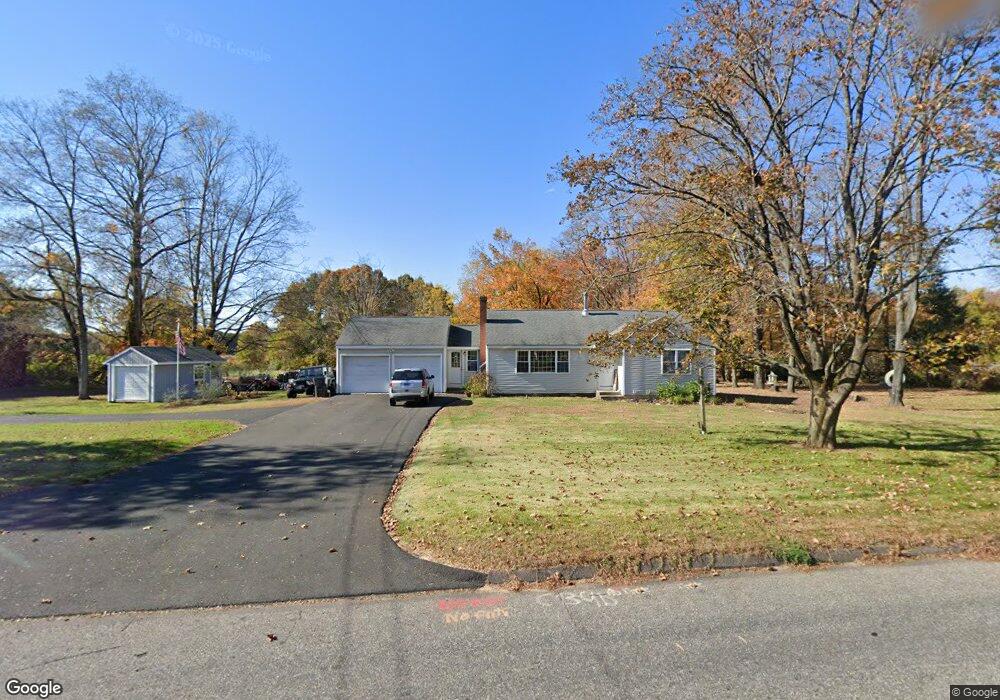
316 Rye St Broad Brook, CT 06016
Estimated Value: $338,000 - $365,000
3
Beds
1
Bath
1,248
Sq Ft
$282/Sq Ft
Est. Value
About This Home
This home is located at 316 Rye St, Broad Brook, CT 06016 and is currently estimated at $351,484, approximately $281 per square foot. 316 Rye St is a home located in Hartford County with nearby schools including Broad Brook Elementary School, East Windsor Middle School, and East Windsor High School.
Ownership History
Date
Name
Owned For
Owner Type
Purchase Details
Closed on
Nov 13, 2021
Sold by
Mader Nicholas and Dagesse Sarah
Bought by
Mader Nicholas and Mader Sarah
Current Estimated Value
Home Financials for this Owner
Home Financials are based on the most recent Mortgage that was taken out on this home.
Original Mortgage
$134,800
Outstanding Balance
$87,852
Interest Rate
3.01%
Mortgage Type
Stand Alone Refi Refinance Of Original Loan
Estimated Equity
$263,632
Purchase Details
Closed on
May 11, 2006
Sold by
Est Walter Shirley and Scanlon Leslie
Bought by
Mader Nichaolas and Dagerse Sarah
Home Financials for this Owner
Home Financials are based on the most recent Mortgage that was taken out on this home.
Original Mortgage
$147,600
Interest Rate
6.4%
Create a Home Valuation Report for This Property
The Home Valuation Report is an in-depth analysis detailing your home's value as well as a comparison with similar homes in the area
Home Values in the Area
Average Home Value in this Area
Purchase History
| Date | Buyer | Sale Price | Title Company |
|---|---|---|---|
| Mader Nicholas | -- | None Available | |
| Mader Nicholas | -- | None Available | |
| Mader Nichaolas | $184,500 | -- | |
| Mader Nichaolas | $184,500 | -- |
Source: Public Records
Mortgage History
| Date | Status | Borrower | Loan Amount |
|---|---|---|---|
| Open | Mader Nicholas | $134,800 | |
| Closed | Mader Nicholas | $134,800 | |
| Previous Owner | Mader Nichaolas | $145,500 | |
| Previous Owner | Mader Nichaolas | $147,600 | |
| Previous Owner | Mader Nichaolas | $36,900 |
Source: Public Records
Tax History Compared to Growth
Tax History
| Year | Tax Paid | Tax Assessment Tax Assessment Total Assessment is a certain percentage of the fair market value that is determined by local assessors to be the total taxable value of land and additions on the property. | Land | Improvement |
|---|---|---|---|---|
| 2025 | $5,003 | $188,850 | $74,360 | $114,490 |
| 2024 | $4,638 | $188,850 | $74,360 | $114,490 |
| 2023 | $3,566 | $104,030 | $49,250 | $54,780 |
| 2022 | $3,577 | $104,030 | $49,250 | $54,780 |
| 2021 | $3,589 | $104,030 | $49,250 | $54,780 |
| 2020 | $3,612 | $104,030 | $49,250 | $54,780 |
| 2019 | $3,563 | $104,030 | $49,250 | $54,780 |
| 2018 | $3,527 | $104,030 | $49,250 | $54,780 |
| 2017 | $3,493 | $106,590 | $59,240 | $47,350 |
| 2016 | $3,297 | $106,590 | $59,240 | $47,350 |
| 2015 | $3,231 | $106,590 | $59,240 | $47,350 |
| 2014 | $3,174 | $106,590 | $59,240 | $47,350 |
Source: Public Records
Map
Nearby Homes
- 74 Alison Dr
- 31 Wendy Dr
- 0 Ellsworth Rd
- 153 Scantic Rd
- 145 Scantic Rd
- 43 W River Rd
- 23 Cathy (Lot 21) Ln
- 21 Ln
- 19 Cathy (Lot 19) Ln
- 17 Cathy (Lot 18) Ln
- 22 Cathy (Lot 15) Ln
- 26 Cathy (Lot 13) Ln
- 24 Cathy (Lot 14) Ln
- 29 W River Rd
- 20 Cathy (Lot 16) Ln
- 18 Cathy (Lot 17) Ln
- 27 W River Rd
- 34 W River Rd
- 0 Apothecaries Hall Rd
- 372 Scantic Rd Unit 8