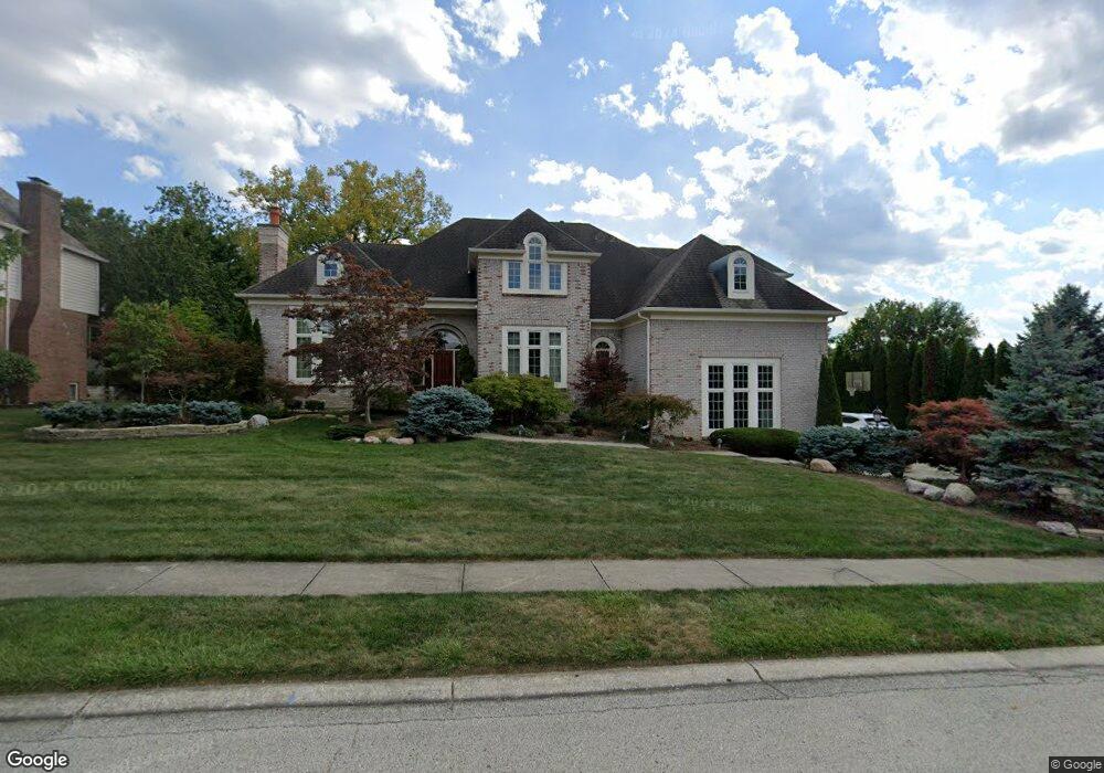
3161 Smokey Ridge Trail Carmel, IN 46033
East Carmel NeighborhoodEstimated Value: $833,000 - $909,687
5
Beds
6
Baths
5,833
Sq Ft
$150/Sq Ft
Est. Value
About This Home
This home is located at 3161 Smokey Ridge Trail, Carmel, IN 46033 and is currently estimated at $876,422, approximately $150 per square foot. 3161 Smokey Ridge Trail is a home located in Hamilton County with nearby schools including Cherry Tree Elementary School, Clay Middle School, and Carmel High School.
Ownership History
Date
Name
Owned For
Owner Type
Purchase Details
Closed on
Nov 21, 2005
Sold by
Carter Robert W
Bought by
Craddock William D and Craddock Younga J
Current Estimated Value
Home Financials for this Owner
Home Financials are based on the most recent Mortgage that was taken out on this home.
Original Mortgage
$359,600
Outstanding Balance
$198,113
Interest Rate
6.13%
Mortgage Type
Fannie Mae Freddie Mac
Estimated Equity
$678,309
Purchase Details
Closed on
Jun 11, 2003
Sold by
Hopping David R
Bought by
Carter Robert W
Home Financials for this Owner
Home Financials are based on the most recent Mortgage that was taken out on this home.
Original Mortgage
$361,200
Interest Rate
5.4%
Mortgage Type
Purchase Money Mortgage
Purchase Details
Closed on
Jun 27, 2002
Sold by
Hopping Melissa G
Bought by
Hopping David R
Create a Home Valuation Report for This Property
The Home Valuation Report is an in-depth analysis detailing your home's value as well as a comparison with similar homes in the area
Home Values in the Area
Average Home Value in this Area
Purchase History
| Date | Buyer | Sale Price | Title Company |
|---|---|---|---|
| Craddock William D | -- | -- | |
| Carter Robert W | -- | Ctic Carmel | |
| Hopping David R | -- | -- |
Source: Public Records
Mortgage History
| Date | Status | Borrower | Loan Amount |
|---|---|---|---|
| Open | Craddock William D | $359,600 | |
| Previous Owner | Carter Robert W | $361,200 |
Source: Public Records
Tax History Compared to Growth
Tax History
| Year | Tax Paid | Tax Assessment Tax Assessment Total Assessment is a certain percentage of the fair market value that is determined by local assessors to be the total taxable value of land and additions on the property. | Land | Improvement |
|---|---|---|---|---|
| 2024 | $7,279 | $770,900 | $161,400 | $609,500 |
| 2023 | $7,279 | $649,500 | $104,100 | $545,400 |
| 2022 | $6,642 | $581,300 | $104,100 | $477,200 |
| 2021 | $5,717 | $505,100 | $104,100 | $401,000 |
| 2020 | $5,578 | $493,000 | $104,100 | $388,900 |
| 2019 | $5,605 | $495,300 | $102,600 | $392,700 |
| 2018 | $5,503 | $495,300 | $102,600 | $392,700 |
| 2017 | $5,214 | $469,500 | $102,600 | $366,900 |
| 2016 | $5,030 | $460,300 | $102,600 | $357,700 |
| 2014 | $5,000 | $457,600 | $101,600 | $356,000 |
| 2013 | $5,000 | $457,600 | $101,600 | $356,000 |
Source: Public Records
Map
Nearby Homes
- 13615 Smokey Hollow Place
- 14011 Grisham Dr
- 2913 Twain Dr
- 3172 Smokey Ridge Ln
- 2945 Millgate Dr
- 253 Brierley Way
- 1346 Smokey Row Ln
- 781 Dayton Dr
- 728 E Main St
- 712 E Main St
- 1483 Spruce Dr
- 128 1st Ct
- 317 2nd Ave NE
- 1504 Dorchester Place
- 131 Blairsden Ave
- 720 N Rangeline Rd
- 210 Belden Dr
- 231 1st Ave NE
- 610 N Rangeline Rd
- 74 Monon Ln
- 3175 Smokey Ridge Trail
- 13656 Smokey Hollow Place
- 13700 Smokey Ridge Trace
- 13700 Smokey Ridge Trace
- 13653 Smokey Hollow Place
- 3187 Smokey Ridge Trail
- 13648 Smokey Hollow Place
- 13699 Smokey Ridge Trace
- 13699 Smokey Ridge Trace
- 13710 Smokey Ridge Trace
- 13645 Smokey Hollow Place
- 3199 Smokey Ridge Trail
- 13709 Smokey Ridge Trace
- 3196 Smokey Ridge Trail
- 13668 Smokey Ridge Place
- 13630 Smokey Hollow Place
- 13661 Smokey Ridge Place
- 13627 Smokey Hollow Place
- 13720 Smokey Ridge Trace
- 3221 Smokey Ridge Trail