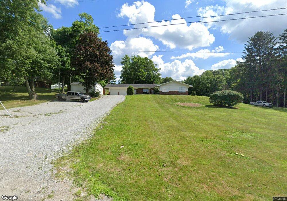
317 County Road 2000 Jeromesville, OH 44840
Estimated Value: $316,000 - $355,000
3
Beds
2
Baths
2,022
Sq Ft
$165/Sq Ft
Est. Value
About This Home
This home is located at 317 County Road 2000, Jeromesville, OH 44840 and is currently estimated at $333,644, approximately $165 per square foot. 317 County Road 2000 is a home located in Ashland County with nearby schools including Hillsdale Elementary School, Hillsdale Middle School, and Hillsdale High School.
Ownership History
Date
Name
Owned For
Owner Type
Purchase Details
Closed on
Aug 28, 2025
Sold by
Shawn G Payne Trust and Payne Shawn G
Bought by
Stewart Tristin S T and Stewart Madeleane Rose
Current Estimated Value
Home Financials for this Owner
Home Financials are based on the most recent Mortgage that was taken out on this home.
Original Mortgage
$297,350
Outstanding Balance
$297,094
Interest Rate
6.75%
Mortgage Type
New Conventional
Estimated Equity
$36,550
Purchase Details
Closed on
May 20, 2025
Sold by
Payne Shawn G
Bought by
Shawn G Payne Trust and Payne
Purchase Details
Closed on
Dec 10, 2020
Bought by
S Payne Properties Llc
Purchase Details
Closed on
Apr 2, 1987
Bought by
White Edward M
Create a Home Valuation Report for This Property
The Home Valuation Report is an in-depth analysis detailing your home's value as well as a comparison with similar homes in the area
Home Values in the Area
Average Home Value in this Area
Purchase History
| Date | Buyer | Sale Price | Title Company |
|---|---|---|---|
| Stewart Tristin S T | $313,000 | Heartland Title | |
| Shawn G Payne Trust | -- | None Listed On Document | |
| S Payne Properties Llc | $250,000 | -- | |
| White Edward M | $95,000 | -- |
Source: Public Records
Mortgage History
| Date | Status | Borrower | Loan Amount |
|---|---|---|---|
| Open | Stewart Tristin S T | $297,350 |
Source: Public Records
Tax History Compared to Growth
Tax History
| Year | Tax Paid | Tax Assessment Tax Assessment Total Assessment is a certain percentage of the fair market value that is determined by local assessors to be the total taxable value of land and additions on the property. | Land | Improvement |
|---|---|---|---|---|
| 2024 | $3,626 | $103,300 | $11,470 | $91,830 |
| 2023 | $3,626 | $103,300 | $11,470 | $91,830 |
| 2022 | $3,107 | $69,490 | $8,820 | $60,670 |
| 2021 | $3,107 | $69,380 | $8,820 | $60,560 |
| 2020 | $2,850 | $69,380 | $8,820 | $60,560 |
| 2019 | $1,988 | $56,130 | $8,650 | $47,480 |
| 2018 | $1,929 | $56,130 | $8,650 | $47,480 |
| 2017 | $1,659 | $56,130 | $8,650 | $47,480 |
| 2016 | $1,659 | $49,670 | $7,650 | $42,020 |
| 2015 | $1,638 | $49,670 | $7,650 | $42,020 |
| 2013 | $2,028 | $55,410 | $7,770 | $47,640 |
Source: Public Records
Map
Nearby Homes
- 2057 State Route 89
- 14 E South St
- 112 Ohio 95
- 0 Ashland County Road 2175
- 0 Ashland County Road 2175
- 1845 County Road 655
- 150 E Main St
- 144 Township Road 1650
- 10610 W Old Lincoln Way Unit 6201 Newkirk Rd.
- 560 Township Road 2402
- 820 County Road 30a
- 2289 N Reedsburg Rd
- 2445 S Elyria Rd
- 609 Ohio 95
- 8191 Blachleyville Rd
- 0 Twp Rd 1806 Unit 11591470
- 0 Angling Rd
- 317 Co Rd 2000
- 313 County Road 2000
- 2004 Ohio 89
- 308 County Road 2000
- 308 County Road 2000
- 2009 State Route 89
- 2009 Ohio 89
- 338 County Road 2000
- 303 County Road 2000
- 303 County Road 2000
- 303 Co Rd 2000
- 304 Cr 2000
- 304 County Road 2000
- 1984 Ohio 89
- 1984 State Route 89
- 1984 State Route 89
- 295 County Road 2000
- 340 County Road 2000
- 340 Cr 2000
- 340 County Road 2000