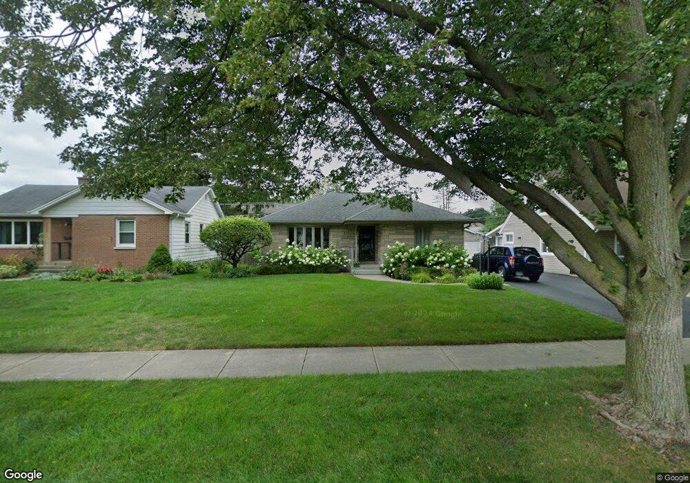
319 Garfield Ave Libertyville, IL 60048
South Libertyville NeighborhoodEstimated Value: $413,270 - $496,000
--
Bed
1
Bath
1,298
Sq Ft
$359/Sq Ft
Est. Value
About This Home
This home is located at 319 Garfield Ave, Libertyville, IL 60048 and is currently estimated at $465,818, approximately $358 per square foot. 319 Garfield Ave is a home located in Lake County with nearby schools including Rockland Elementary School, Highland Middle School, and Libertyville High School.
Ownership History
Date
Name
Owned For
Owner Type
Purchase Details
Closed on
Apr 24, 2013
Sold by
Hays Sara L and Wilmer D Hays Living Trust
Bought by
Kuehn Frederick T and Kuehn Jessica R
Current Estimated Value
Home Financials for this Owner
Home Financials are based on the most recent Mortgage that was taken out on this home.
Original Mortgage
$201,875
Outstanding Balance
$148,944
Interest Rate
4.5%
Mortgage Type
New Conventional
Estimated Equity
$316,874
Purchase Details
Closed on
Apr 28, 2000
Sold by
Hays Wilmer D and Hays Carol J
Bought by
Hays Wilmer D and Hays Carol J
Create a Home Valuation Report for This Property
The Home Valuation Report is an in-depth analysis detailing your home's value as well as a comparison with similar homes in the area
Home Values in the Area
Average Home Value in this Area
Purchase History
| Date | Buyer | Sale Price | Title Company |
|---|---|---|---|
| Kuehn Frederick T | $212,500 | None Available | |
| Hays Wilmer D | -- | -- |
Source: Public Records
Mortgage History
| Date | Status | Borrower | Loan Amount |
|---|---|---|---|
| Open | Kuehn Frederick T | $201,875 |
Source: Public Records
Tax History Compared to Growth
Tax History
| Year | Tax Paid | Tax Assessment Tax Assessment Total Assessment is a certain percentage of the fair market value that is determined by local assessors to be the total taxable value of land and additions on the property. | Land | Improvement |
|---|---|---|---|---|
| 2024 | $8,563 | $123,950 | $77,346 | $46,604 |
| 2023 | $8,317 | $114,324 | $71,339 | $42,985 |
| 2022 | $8,317 | $109,993 | $68,569 | $41,424 |
| 2021 | $8,004 | $107,625 | $67,093 | $40,532 |
| 2020 | $7,700 | $105,816 | $65,965 | $39,851 |
| 2019 | $7,509 | $104,810 | $65,338 | $39,472 |
| 2018 | $7,413 | $106,954 | $66,966 | $39,988 |
| 2017 | $7,307 | $103,578 | $64,852 | $38,726 |
| 2016 | $7,057 | $98,207 | $61,489 | $36,718 |
| 2015 | $6,981 | $91,791 | $57,472 | $34,319 |
| 2014 | $5,823 | $84,635 | $52,991 | $31,644 |
| 2012 | $5,533 | $81,733 | $49,492 | $32,241 |
Source: Public Records
Map
Nearby Homes
- 551 W Park Ave Unit E
- 423 Ames St
- 308 Mckinley Ave
- 0 Ames St
- 1754 Glenmore Rd
- 533 Drake St
- 212 Elm Ct
- 420 W Cook Ave
- 505 Lange Ct
- 426 S Milwaukee Ave
- 747 Garfield Ave Unit C
- 217 E Church St
- 777 Garfield Ave Unit A
- 1137 Pine Tree Ln
- 851 Garfield Ave Unit C
- 112 3rd St
- 401 S 4th Ave
- 121 4th St
- 323 W Golf Rd
- 1330 W Park Ave
- 323 Garfield Ave
- 315 Garfield Ave
- 327 Garfield Ave
- 322 Ames St
- 334 Ames St
- 307 Garfield Ave
- 338 Ames St
- 401 Garfield Ave
- 316 Ames St
- 320 Garfield Ave
- 328 Garfield Ave
- 306 Ames St
- 437 Mckinley Ave
- 406 Ames St
- 409 Garfield Ave
- 501 Mckinley Ave
- 414 W Lincoln Ave
- 433 Mckinley Ave
- 515 Mckinley Ave
- 414 Ames St