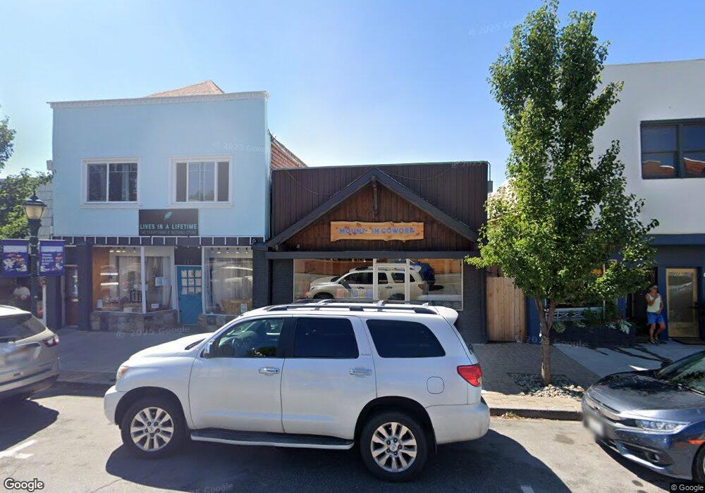
319 N Mount Shasta Blvd Mount Shasta, CA 96067
Estimated Value: $207,273
--
Bed
1
Bath
1,200
Sq Ft
$173/Sq Ft
Est. Value
About This Home
This home is located at 319 N Mount Shasta Blvd, Mount Shasta, CA 96067 and is currently estimated at $207,273, approximately $172 per square foot. 319 N Mount Shasta Blvd is a home located in Siskiyou County with nearby schools including Mt. Shasta Elementary School, Mt. Shasta High School, and Golden Eagle Charter School.
Ownership History
Date
Name
Owned For
Owner Type
Purchase Details
Closed on
Jun 16, 2021
Sold by
Betton Scott and Thornton Diana
Bought by
Hotshots Incorporated
Current Estimated Value
Purchase Details
Closed on
Feb 13, 2017
Sold by
Derwingson Jacqueline Jean and Ernest Nagel Revocable Family
Bought by
Betton Scott and Thornton Diana
Create a Home Valuation Report for This Property
The Home Valuation Report is an in-depth analysis detailing your home's value as well as a comparison with similar homes in the area
Home Values in the Area
Average Home Value in this Area
Purchase History
| Date | Buyer | Sale Price | Title Company |
|---|---|---|---|
| Hotshots Incorporated | $180,000 | Mt Shasta Title & Escrow Co | |
| Betton Scott | $175,000 | Mt Shasta Title & Escrow Co |
Source: Public Records
Tax History Compared to Growth
Tax History
| Year | Tax Paid | Tax Assessment Tax Assessment Total Assessment is a certain percentage of the fair market value that is determined by local assessors to be the total taxable value of land and additions on the property. | Land | Improvement |
|---|---|---|---|---|
| 2025 | $2,121 | $194,837 | $54,121 | $140,716 |
| 2023 | $2,121 | $187,272 | $52,020 | $135,252 |
| 2022 | $2,043 | $183,600 | $51,000 | $132,600 |
| 2021 | $2,090 | $187,634 | $48,248 | $139,386 |
| 2020 | $2,090 | $185,711 | $47,754 | $137,957 |
| 2019 | $2,053 | $182,070 | $46,818 | $135,252 |
| 2018 | $2,015 | $178,500 | $45,900 | $132,600 |
| 2017 | $1,494 | $128,701 | $36,764 | $91,937 |
| 2016 | $1,467 | $126,179 | $36,044 | $90,135 |
| 2015 | -- | $124,285 | $35,503 | $88,782 |
| 2014 | -- | $121,851 | $34,808 | $87,043 |
Source: Public Records
Map
Nearby Homes
- Parcel 1,2,3 Pine Field St
- 0 Alma St Apn #057-203-040
- lot 7 Ream Ave
- parcel 3 Deetz Rd
- 208 Mccloud Ave
- 114 Smith St
- 322 E Jessie St
- 0 Berry St
- 109 N Washington Dr
- 619 Spring St
- 506 Eiler Rd
- 509 Mccloud Ave
- Financing Miningclaim Ownership
- Financing Miningclaim Ownership
- 704 Marjorie St
- 206 E Hinckley St
- 809 Caroline Ave
- 00 Kenneth Marjorie
- 201 Terry Lynn Ave
- 1007 Mccloud Ave
- 317 N Mount Shasta Blvd
- 315 N Mount Shasta Blvd
- 309 N Mount Shasta Blvd
- 314 N Mount Shasta Blvd
- 312 N Mount Shasta Blvd
- 308 N Mt Shasta Blvd
- 322 N Mount Shasta Blvd
- 320 N Mt Shasta Blvd
- 320 N Mt Shasta Blvd
- 320 N Mount Shasta Blvd
- 326 N Mount Shasta Blvd
- 304 N Mount Shasta Blvd
- 315 Chestnut St
- 101 W Lake St
- 110 W Castle St
- 301 Chestnut St
- 230 N Mount Shasta Blvd
- 204 W Lake St
- 204 W Lake St
- 404 N Mount Shasta Blvd