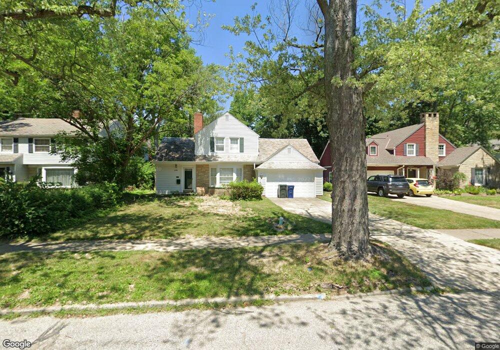
3199 Rumson Rd Cleveland, OH 44118
Estimated Value: $224,000 - $275,000
3
Beds
2
Baths
1,657
Sq Ft
$154/Sq Ft
Est. Value
About This Home
This home is located at 3199 Rumson Rd, Cleveland, OH 44118 and is currently estimated at $255,606, approximately $154 per square foot. 3199 Rumson Rd is a home located in Cuyahoga County with nearby schools including Boulevard Elementary School, Monticello Middle School, and Cleveland Heights High School.
Ownership History
Date
Name
Owned For
Owner Type
Purchase Details
Closed on
Mar 10, 2005
Sold by
Pai Rish K and Pai Elizabeth H Fisher
Bought by
Liu Raymond W
Current Estimated Value
Home Financials for this Owner
Home Financials are based on the most recent Mortgage that was taken out on this home.
Original Mortgage
$169,000
Outstanding Balance
$81,333
Interest Rate
4.85%
Mortgage Type
Purchase Money Mortgage
Estimated Equity
$174,273
Purchase Details
Closed on
Dec 31, 2002
Sold by
Pai Ram and Pai Raju
Bought by
Pai Rish K and Fisher Pai Elizabeth H
Home Financials for this Owner
Home Financials are based on the most recent Mortgage that was taken out on this home.
Original Mortgage
$93,500
Interest Rate
5%
Purchase Details
Closed on
Jun 8, 1998
Sold by
Bell Ann Z
Bought by
Pai Ram and Pai Raju
Purchase Details
Closed on
Jan 1, 1975
Bought by
Bell Edward B and Bell Ann Z
Create a Home Valuation Report for This Property
The Home Valuation Report is an in-depth analysis detailing your home's value as well as a comparison with similar homes in the area
Home Values in the Area
Average Home Value in this Area
Purchase History
| Date | Buyer | Sale Price | Title Company |
|---|---|---|---|
| Liu Raymond W | $188,000 | Chicago Title Insurance C | |
| Pai Rish K | -- | Midland Title Security Inc | |
| Pai Ram | $144,000 | Midland Title Security Inc | |
| Bell Edward B | -- | -- |
Source: Public Records
Mortgage History
| Date | Status | Borrower | Loan Amount |
|---|---|---|---|
| Open | Liu Raymond W | $169,000 | |
| Previous Owner | Pai Rish K | $93,500 |
Source: Public Records
Tax History Compared to Growth
Tax History
| Year | Tax Paid | Tax Assessment Tax Assessment Total Assessment is a certain percentage of the fair market value that is determined by local assessors to be the total taxable value of land and additions on the property. | Land | Improvement |
|---|---|---|---|---|
| 2024 | $7,614 | $89,810 | $14,000 | $75,810 |
| 2023 | $5,932 | $54,430 | $10,710 | $43,720 |
| 2022 | $5,902 | $54,430 | $10,710 | $43,720 |
| 2021 | $5,782 | $54,430 | $10,710 | $43,720 |
| 2020 | $5,521 | $46,940 | $9,240 | $37,700 |
| 2019 | $5,217 | $134,100 | $26,400 | $107,700 |
| 2018 | $5,200 | $46,940 | $9,240 | $37,700 |
| 2017 | $5,473 | $45,820 | $6,510 | $39,310 |
| 2016 | $5,462 | $45,820 | $6,510 | $39,310 |
| 2015 | $6,211 | $45,820 | $6,510 | $39,310 |
| 2014 | $6,211 | $55,200 | $7,840 | $47,360 |
Source: Public Records
Map
Nearby Homes
- 3060 Chelsea Dr
- 1558 Ivydale Rd
- 3195 Whitethorn Rd
- 3186 Whitethorn Rd
- 3142 Eastwick Dr
- 3153 Eastwick Dr
- 3181 Sycamore Rd
- 1659 Ivydale Rd
- 1301 Forest Hills Blvd
- 1148 Rutherford Rd
- 1683 Colonial Dr
- 3165 Oak Rd
- 1645 Cumberland Rd
- 1695 Lee Rd
- 1602 Rydalmount Rd
- 3430 Mayfield Rd
- 1492 S Taylor Rd
- 1560 S Taylor Rd
- 1725 Preyer Ave
- 3320 Beechwood Ave