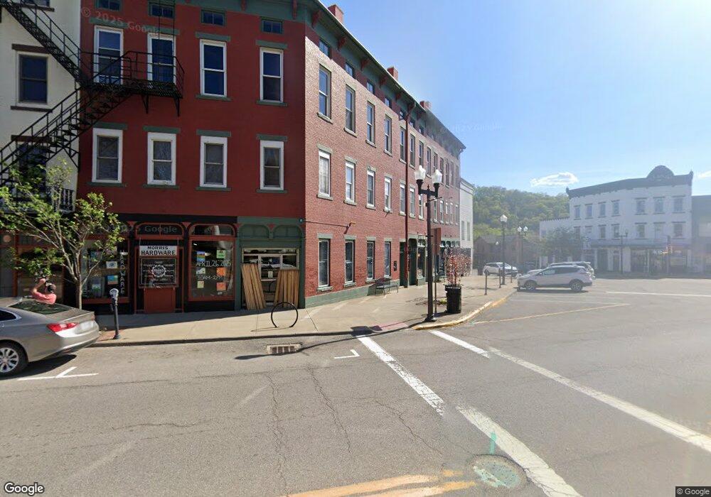
32 E Main St Mc Connelsville, OH 43756
--
Bed
--
Bath
11,247
Sq Ft
6,970
Sq Ft Lot
About This Home
This home is located at 32 E Main St, Mc Connelsville, OH 43756. 32 E Main St is a home located in Morgan County with nearby schools including Morgan High School.
Ownership History
Date
Name
Owned For
Owner Type
Purchase Details
Closed on
Sep 10, 2024
Sold by
C-Bad Llc
Bought by
Morris Block Llc
Purchase Details
Closed on
Oct 4, 2010
Sold by
Lowe Duane M and Lowe Carol Sue
Bought by
C Bad Llc
Purchase Details
Closed on
Jan 21, 2009
Sold by
Lyon Carrie M
Bought by
Lyon Carrie M and The Carrie M Lyon Revocable Trust
Create a Home Valuation Report for This Property
The Home Valuation Report is an in-depth analysis detailing your home's value as well as a comparison with similar homes in the area
Home Values in the Area
Average Home Value in this Area
Purchase History
| Date | Buyer | Sale Price | Title Company |
|---|---|---|---|
| Morris Block Llc | $300,000 | None Listed On Document | |
| Morris Block Llc | $300,000 | None Listed On Document | |
| C Bad Llc | $136,000 | None Available | |
| Lyon Carrie M | -- | None Available |
Source: Public Records
Tax History Compared to Growth
Tax History
| Year | Tax Paid | Tax Assessment Tax Assessment Total Assessment is a certain percentage of the fair market value that is determined by local assessors to be the total taxable value of land and additions on the property. | Land | Improvement |
|---|---|---|---|---|
| 2024 | $2,417 | $61,580 | $10,530 | $51,050 |
| 2023 | $1,798 | $45,860 | $7,790 | $38,070 |
| 2022 | $1,806 | $45,860 | $7,790 | $38,070 |
| 2021 | $1,861 | $45,820 | $7,790 | $38,030 |
| 2020 | $1,887 | $45,820 | $7,790 | $38,030 |
| 2019 | $1,912 | $45,820 | $7,790 | $38,030 |
| 2018 | $1,818 | $45,820 | $7,790 | $38,030 |
| 2017 | $1,819 | $39,092 | $6,496 | $32,596 |
| 2016 | $1,813 | $39,092 | $6,496 | $32,596 |
| 2015 | $1,807 | $39,092 | $6,496 | $32,596 |
| 2014 | $1,850 | $39,092 | $6,496 | $32,596 |
| 2013 | $1,880 | $39,092 | $6,496 | $32,596 |
Source: Public Records
Map
Nearby Homes
- 41 W Bell Ave
- 142 N 5th St
- 262 N 5th St
- 274 N 8th St
- 346 E Union Ave
- 284 N Kennebec Ave
- 361 W Jefferson Ave
- 422 N Kennebec Ave
- 20 2nd St
- 545 E Mcconnel Ave
- 774 N Kennebec Ave
- 112 S 16th St
- 3810 N Dugan Rd NW
- 3955 Wedgewood Dr
- 95 Sunset Dr
- 1096 N Kennebec Ave
- 102 8th St
- 6475 Ohio 669
- 0 Upper Douda Rd Unit 225030416
- 0 Coler Rd
- 8 E Main St
- 25 S Kennebec Ave
- 25 S Kennebec Ave Unit 25-31
- 31 S Kennebec Ave
- 35 S Kennebec Ave
- 6938 Ohio 60
- 61 S Kennebec Ave
- 61 S Kennebec Ave Unit B
- 61 S Kennebec Ave Unit C
- 61 S Kennebec Ave Unit A
- 0 Ohio 60 Unit 9922626
- 0 Ohio 60 Unit 9922387
- 0 Ohio 60 Unit 4466775
- 0 Ohio 60
- 0 Ohio 376
- 0 Ohio 78
- 2079 Ohio 78
- 2147 Ohio 78
- 2077 Ohio 78
- 2145 Ohio 78