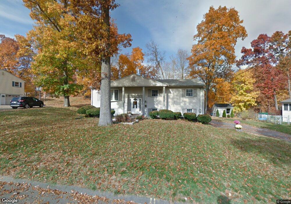
32 Joanne Dr Holyoke, MA 01040
Estimated Value: $399,000 - $500,000
3
Beds
3
Baths
2,371
Sq Ft
$181/Sq Ft
Est. Value
About This Home
This home is located at 32 Joanne Dr, Holyoke, MA 01040 and is currently estimated at $429,075, approximately $180 per square foot. 32 Joanne Dr is a home located in Hampden County with nearby schools including Harriet Bishop Elementary School, Lt. Clayre Sullivan Elementary School, and Holyoke High School.
Ownership History
Date
Name
Owned For
Owner Type
Purchase Details
Closed on
Mar 22, 2023
Sold by
Stevenson Raymond F
Bought by
Miller Tina M and Stevenson Sean P
Current Estimated Value
Purchase Details
Closed on
Apr 10, 1973
Bought by
Stevenson Raymond F and Stevenson Karen L
Create a Home Valuation Report for This Property
The Home Valuation Report is an in-depth analysis detailing your home's value as well as a comparison with similar homes in the area
Home Values in the Area
Average Home Value in this Area
Purchase History
| Date | Buyer | Sale Price | Title Company |
|---|---|---|---|
| Miller Tina M | -- | None Available | |
| Stevenson Raymond F | -- | -- |
Source: Public Records
Mortgage History
| Date | Status | Borrower | Loan Amount |
|---|---|---|---|
| Previous Owner | Stevenson Raymond F | $78,000 | |
| Previous Owner | Stevenson Raymond F | $75,000 |
Source: Public Records
Tax History Compared to Growth
Tax History
| Year | Tax Paid | Tax Assessment Tax Assessment Total Assessment is a certain percentage of the fair market value that is determined by local assessors to be the total taxable value of land and additions on the property. | Land | Improvement |
|---|---|---|---|---|
| 2025 | $4,971 | $284,700 | $79,100 | $205,600 |
| 2024 | $4,808 | $253,700 | $75,400 | $178,300 |
| 2023 | $4,611 | $245,800 | $75,400 | $170,400 |
| 2022 | $4,453 | $231,200 | $75,400 | $155,800 |
| 2021 | $4,393 | $226,100 | $75,400 | $150,700 |
| 2020 | $4,152 | $217,600 | $75,400 | $142,200 |
| 2019 | $4,064 | $210,700 | $75,400 | $135,300 |
| 2018 | $3,925 | $203,600 | $75,400 | $128,200 |
| 2017 | $3,903 | $203,600 | $75,400 | $128,200 |
| 2016 | $3,912 | $204,600 | $77,600 | $127,000 |
| 2015 | $3,896 | $204,600 | $77,600 | $127,000 |
Source: Public Records
Map
Nearby Homes
- 4 Claren Dr
- 102 W Meadowview Rd
- 11 Longfellow Rd
- 55 Longfellow Rd
- 1205 Northampton St
- 179 Central Park Dr
- 1212 Northampton St
- 77 Central Park Dr
- 119 Central Park Dr
- 37 Laura Ln
- 89 Jarvis Ave
- 154 Madison Ave
- 22 Liberty St
- 10 Radcliffe St
- 27 Lexington Ave
- 129 Morgan St
- 31 Wellesley Rd
- 68 Fairfield Ave
- 165 Lincoln St
- 151 Lincoln St