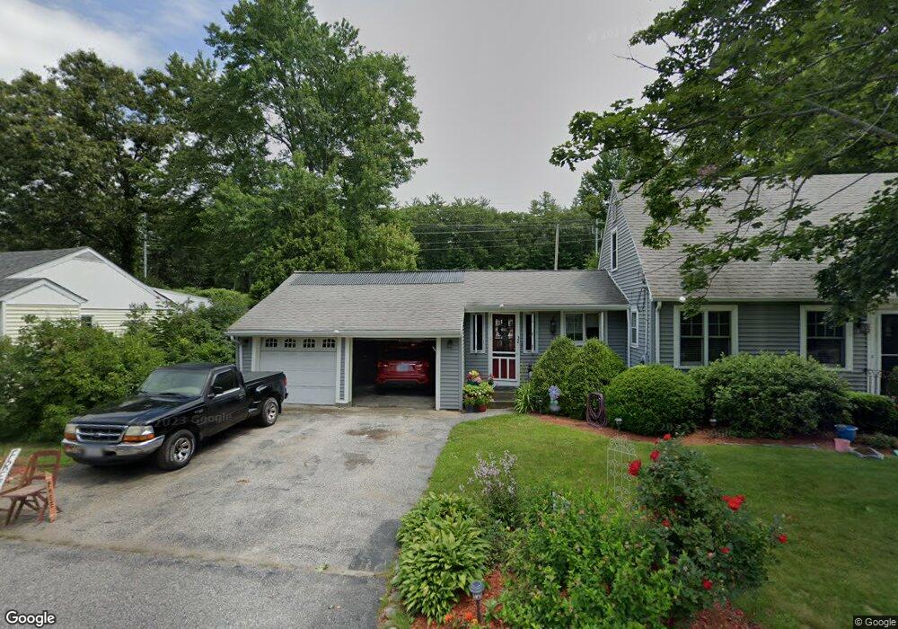
32 Millbury Ave Millbury, MA 01527
Estimated Value: $336,000 - $441,000
3
Beds
1
Bath
1,485
Sq Ft
$277/Sq Ft
Est. Value
About This Home
This home is located at 32 Millbury Ave, Millbury, MA 01527 and is currently estimated at $410,804, approximately $276 per square foot. 32 Millbury Ave is a home located in Worcester County with nearby schools including Elmwood Street Elementary School, Raymond E. Shaw Elementary School, and Millbury Junior/Senior High School.
Ownership History
Date
Name
Owned For
Owner Type
Purchase Details
Closed on
Jul 16, 1991
Sold by
Mahan Richard M and Mahan Emily
Bought by
Mahan Kevin P and Mahan Cheryl
Current Estimated Value
Home Financials for this Owner
Home Financials are based on the most recent Mortgage that was taken out on this home.
Original Mortgage
$65,000
Interest Rate
9.35%
Mortgage Type
Purchase Money Mortgage
Create a Home Valuation Report for This Property
The Home Valuation Report is an in-depth analysis detailing your home's value as well as a comparison with similar homes in the area
Home Values in the Area
Average Home Value in this Area
Purchase History
| Date | Buyer | Sale Price | Title Company |
|---|---|---|---|
| Mahan Kevin P | $50,000 | -- | |
| Mahan Kevin P | $50,000 | -- |
Source: Public Records
Mortgage History
| Date | Status | Borrower | Loan Amount |
|---|---|---|---|
| Open | Mahan Kevin P | $28,000 | |
| Closed | Mahan Kevin P | $25,000 | |
| Closed | Mahan Kevin P | $65,000 |
Source: Public Records
Tax History Compared to Growth
Tax History
| Year | Tax Paid | Tax Assessment Tax Assessment Total Assessment is a certain percentage of the fair market value that is determined by local assessors to be the total taxable value of land and additions on the property. | Land | Improvement |
|---|---|---|---|---|
| 2025 | $4,743 | $354,200 | $106,700 | $247,500 |
| 2024 | $4,246 | $320,900 | $98,800 | $222,100 |
| 2023 | $3,756 | $259,900 | $69,300 | $190,600 |
| 2022 | $3,684 | $245,600 | $69,300 | $176,300 |
| 2021 | $3,614 | $234,200 | $69,300 | $164,900 |
| 2020 | $3,503 | $228,500 | $69,300 | $159,200 |
| 2019 | $3,646 | $230,000 | $62,900 | $167,100 |
| 2018 | $5,296 | $218,900 | $62,900 | $156,000 |
| 2017 | $3,169 | $192,900 | $62,900 | $130,000 |
| 2016 | $2,913 | $177,000 | $62,900 | $114,100 |
| 2015 | $2,933 | $178,200 | $67,000 | $111,200 |
| 2014 | $2,873 | $168,000 | $67,000 | $101,000 |
Source: Public Records
Map
Nearby Homes
- 123 Riverlin St
- 64 Millbury Ave
- 17 Atwood Ave
- 15 Rayburn Dr
- 16 Jackie Dr
- 19 Rice Rd
- 40 River St
- 4 Thomas Hill Rd
- 90 Macarthur Dr
- 16 Elm Ct
- 20 Woodridge Rd
- 10 Leslie Ln
- 52 Clearview Terrace Unit 39
- Lot 1 Cooper Rd
- 8 Autumn Gate Cir
- 38 W Main St
- 15 Clearview Terrace Unit 68
- 2 Jessica j Dr
- 12 Alstead Path
- 4 Jessica j Dr
- 34 Millbury Ave
- 30 Millbury Ave
- 36 Millbury Ave
- 33 Millbury Ave
- 38 Millbury Ave
- 31 Millbury Ave
- 26 Millbury Ave
- 11 Blanchard Dr
- 29 Millbury Ave
- 24 Millbury Ave
- 27 Millbury Ave
- 9 Blanchard Dr
- 23 Millbury Ave
- 22 Millbury Ave
- 40 Millbury Ave
- 20 Millbury Ave
- 21 Millbury Ave
- 7 Blanchard Dr
- 19 Millbury Ave
- 18 Millbury Ave