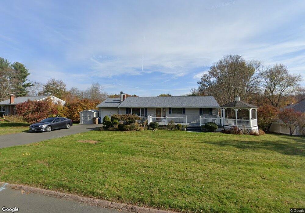
32 Riverside Dr Vernon Rockville, CT 06066
North Vernon NeighborhoodEstimated Value: $299,000 - $403,000
3
Beds
1
Bath
1,116
Sq Ft
$310/Sq Ft
Est. Value
About This Home
This home is located at 32 Riverside Dr, Vernon Rockville, CT 06066 and is currently estimated at $345,455, approximately $309 per square foot. 32 Riverside Dr is a home located in Tolland County with nearby schools including Skinner Road School, Vernon Center Middle School, and Rockville High School.
Ownership History
Date
Name
Owned For
Owner Type
Purchase Details
Closed on
Jul 25, 2024
Sold by
Berube Joel R
Bought by
Berube Vera A
Current Estimated Value
Purchase Details
Closed on
Jan 30, 1987
Sold by
Vokell Frances
Bought by
Berube Joel
Home Financials for this Owner
Home Financials are based on the most recent Mortgage that was taken out on this home.
Original Mortgage
$90,320
Interest Rate
9.26%
Mortgage Type
Purchase Money Mortgage
Create a Home Valuation Report for This Property
The Home Valuation Report is an in-depth analysis detailing your home's value as well as a comparison with similar homes in the area
Home Values in the Area
Average Home Value in this Area
Purchase History
| Date | Buyer | Sale Price | Title Company |
|---|---|---|---|
| Berube Vera A | -- | None Available | |
| Berube Joel | $112,900 | -- |
Source: Public Records
Mortgage History
| Date | Status | Borrower | Loan Amount |
|---|---|---|---|
| Previous Owner | Berube Joel | $85,000 | |
| Previous Owner | Berube Joel | $16,500 | |
| Previous Owner | Berube Joel | $90,320 |
Source: Public Records
Tax History Compared to Growth
Tax History
| Year | Tax Paid | Tax Assessment Tax Assessment Total Assessment is a certain percentage of the fair market value that is determined by local assessors to be the total taxable value of land and additions on the property. | Land | Improvement |
|---|---|---|---|---|
| 2025 | $5,565 | $154,190 | $44,450 | $109,740 |
| 2024 | $5,411 | $154,190 | $44,450 | $109,740 |
| 2023 | $5,148 | $154,190 | $44,450 | $109,740 |
| 2022 | $5,148 | $154,190 | $44,450 | $109,740 |
| 2021 | $5,257 | $132,650 | $45,500 | $87,150 |
| 2020 | $5,257 | $132,650 | $45,500 | $87,150 |
| 2019 | $5,257 | $132,650 | $45,500 | $87,150 |
| 2018 | $5,257 | $132,650 | $45,500 | $87,150 |
| 2017 | $5,135 | $132,650 | $45,500 | $87,150 |
| 2016 | $4,870 | $128,060 | $47,250 | $80,810 |
| 2015 | $4,870 | $128,060 | $47,250 | $80,810 |
| 2014 | $4,624 | $128,060 | $47,250 | $80,810 |
Source: Public Records
Map
Nearby Homes
- 325 Kelly Rd
- 325 Kelly Rd Unit L5
- 33 Sunset Terrace
- 242 Talcottville Rd Unit 105
- 107 Main St
- 441 Millstream Dr Unit 441
- 69 Merline Rd
- 25 Oakview Place
- 5 Allison Rd
- 68 Kent Ln
- 34 Benedict Dr
- 413 Lady Bug Ln Unit 413
- 128 Pond Ln
- 29 Shady Brook Ln Unit 29
- 178 Beelzebub Rd
- 343 Merline Rd
- 229 Phoenix St
- 119 Trout Stream Dr
- 721 Dart Hill Rd
- 169 Avery St
- 42 Riverside Dr
- 24 Riverside Dr
- 46 Riverside Dr
- 31 Riverside Dr
- 35 Riverside Dr
- 25 Fernwood Dr
- 21 Riverside Dr
- 21 Fernwood Dr
- 50 Riverside Dr
- 16 Riverside Dr
- 26 Fernwood Dr
- 30 Fernwood Dr
- 54 Riverside Dr
- 17 Riverside Dr
- 10 Riverside Dr
- 11 Riverside Dr
- 43 Riverside Dr
- 47 Riverside Dr
- 15 Fernwood Dr
- 39 Riverside Dr