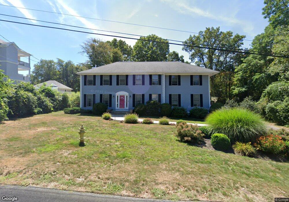
32 Starr Dr W Narragansett, RI 02882
Estimated Value: $1,190,076 - $1,542,000
4
Beds
4
Baths
2,876
Sq Ft
$488/Sq Ft
Est. Value
About This Home
This home is located at 32 Starr Dr W, Narragansett, RI 02882 and is currently estimated at $1,404,269, approximately $488 per square foot. 32 Starr Dr W is a home located in Washington County with nearby schools including Narragansett Elementary School, Narragansett Pier Middle School, and Narragansett High School.
Ownership History
Date
Name
Owned For
Owner Type
Purchase Details
Closed on
Jul 11, 2013
Sold by
Wallor Michael T and Wallor Elaine M
Bought by
Difilippo Nicholas M and Difilippo Jessica A
Current Estimated Value
Home Financials for this Owner
Home Financials are based on the most recent Mortgage that was taken out on this home.
Original Mortgage
$350,000
Outstanding Balance
$252,703
Interest Rate
3.83%
Estimated Equity
$1,151,566
Purchase Details
Closed on
Oct 20, 1995
Sold by
Crenca David J and Crenca Lisa
Bought by
Wallor Michael Tf and Wallor Elaine
Home Financials for this Owner
Home Financials are based on the most recent Mortgage that was taken out on this home.
Original Mortgage
$203,000
Interest Rate
7.6%
Create a Home Valuation Report for This Property
The Home Valuation Report is an in-depth analysis detailing your home's value as well as a comparison with similar homes in the area
Home Values in the Area
Average Home Value in this Area
Purchase History
| Date | Buyer | Sale Price | Title Company |
|---|---|---|---|
| Difilippo Nicholas M | $440,000 | -- | |
| Wallor Michael Tf | $215,000 | -- |
Source: Public Records
Mortgage History
| Date | Status | Borrower | Loan Amount |
|---|---|---|---|
| Open | Wallor Michael Tf | $75,000 | |
| Open | Wallor Michael Tf | $350,000 | |
| Previous Owner | Wallor Michael Tf | $354,200 | |
| Previous Owner | Wallor Michael Tf | $203,000 |
Source: Public Records
Tax History Compared to Growth
Tax History
| Year | Tax Paid | Tax Assessment Tax Assessment Total Assessment is a certain percentage of the fair market value that is determined by local assessors to be the total taxable value of land and additions on the property. | Land | Improvement |
|---|---|---|---|---|
| 2025 | $6,236 | $918,400 | $295,900 | $622,500 |
| 2024 | $6,016 | $918,400 | $295,900 | $622,500 |
| 2023 | $5,885 | $632,100 | $211,300 | $420,800 |
| 2022 | $5,689 | $632,100 | $211,300 | $420,800 |
| 2021 | $5,600 | $632,100 | $211,300 | $420,800 |
| 2020 | $5,139 | $490,400 | $157,700 | $332,700 |
| 2019 | $5,017 | $490,400 | $157,700 | $332,700 |
| 2018 | $4,879 | $490,400 | $157,700 | $332,700 |
| 2017 | $4,927 | $466,600 | $166,300 | $300,300 |
| 2016 | $4,703 | $466,600 | $166,300 | $300,300 |
| 2015 | $4,638 | $466,600 | $166,300 | $300,300 |
| 2014 | $5,100 | $508,000 | $172,200 | $335,800 |
Source: Public Records
Map
Nearby Homes
- 19 Castle Rd
- 275 Boston Neck Rd
- 20 Narragansett Ave Unit 905
- 56 Wanda St
- 14 Robinson St
- 16 Courtway St
- 137A Kingstown Rd
- 137 Kingstown Rd
- 20 5th Ave
- 126 Boon St
- 73 Camden Ct
- 150 Camden Ct
- 31 Avice St
- 49 Westmoreland St
- 27 Westmoreland St
- 30 Sweet Meadows Ct Unit 26
- 135 Cliff Dr
- 229 Saugatucket Rd
- 727 Boston Neck Rd
- 70 Broad Rock Rd
- 26 Starr Dr W
- 0 Starr Dr W
- 20 Starr Dr W
- 33 Starr Dr W Unit 8
- 33 Starr Dr W Unit 7
- 33 Starr Dr W Unit 6
- 33 Starr Dr W Unit 4
- 33 Starr Dr W Unit 3
- 33 Starr Dr W Unit 2
- 33 Starr Dr W Unit 1
- 33 Starr Dr W Unit 2
- 0 Marble Rd Unit 1247306
- 10 Starr Dr W
- 29 South Trail
- 15 Starr Dr W
- 21 Starr Dr Unit 204
- 21 Starr Dr Unit 101
- 21 Starr Dr Unit 201
- 21 Starr Dr Unit 104
- 21 Starr Dr Unit 102