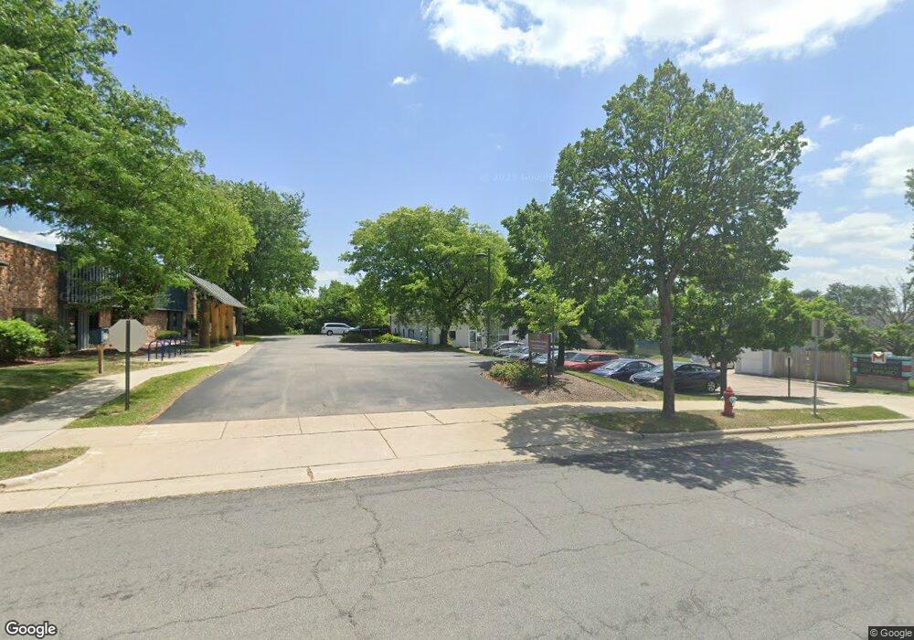
3205 Latham Dr Madison, WI 53713
Estimated Value: $625,837
--
Bed
--
Bath
4,200
Sq Ft
$149/Sq Ft
Est. Value
About This Home
This home is located at 3205 Latham Dr, Madison, WI 53713 and is currently estimated at $625,837, approximately $149 per square foot. 3205 Latham Dr is a home located in Dane County with nearby schools including Thoreau Elementary School, Cherokee Heights Middle School, and West High School.
Ownership History
Date
Name
Owned For
Owner Type
Purchase Details
Closed on
Feb 26, 2020
Sold by
Richard & Mary White Revocable Trust
Bought by
Dane County Friends Of Ferals Inc
Current Estimated Value
Home Financials for this Owner
Home Financials are based on the most recent Mortgage that was taken out on this home.
Original Mortgage
$285,000
Outstanding Balance
$252,885
Interest Rate
3.6%
Mortgage Type
Commercial
Estimated Equity
$372,952
Create a Home Valuation Report for This Property
The Home Valuation Report is an in-depth analysis detailing your home's value as well as a comparison with similar homes in the area
Home Values in the Area
Average Home Value in this Area
Purchase History
| Date | Buyer | Sale Price | Title Company |
|---|---|---|---|
| Dane County Friends Of Ferals Inc | $390,000 | None Available |
Source: Public Records
Mortgage History
| Date | Status | Borrower | Loan Amount |
|---|---|---|---|
| Open | Dane County Friends Of Ferals Inc | $285,000 |
Source: Public Records
Tax History Compared to Growth
Tax History
| Year | Tax Paid | Tax Assessment Tax Assessment Total Assessment is a certain percentage of the fair market value that is determined by local assessors to be the total taxable value of land and additions on the property. | Land | Improvement |
|---|---|---|---|---|
| 2024 | -- | -- | -- | -- |
| 2021 | $8,683 | $0 | $0 | $0 |
| 2020 | $8,683 | $390,000 | $70,000 | $320,000 |
| 2019 | $6,068 | $272,500 | $55,000 | $217,500 |
| 2018 | $6,059 | $272,500 | $55,000 | $217,500 |
| 2017 | $5,695 | $247,500 | $55,000 | $192,500 |
| 2016 | $5,566 | $235,500 | $50,000 | $185,500 |
| 2015 | $5,455 | $217,500 | $50,000 | $167,500 |
| 2014 | $5,192 | $217,500 | $50,000 | $167,500 |
| 2013 | $5,487 | $217,500 | $50,000 | $167,500 |
Source: Public Records
Map
Nearby Homes
- 2829 Coho St Unit 7
- 2829 Coho St Unit 6
- 2127 Luann Ln Unit 6
- 2233 Luann Ln Unit 2
- 2929 Turbot Dr
- 2923 Turbot Dr
- 2212 Pike Dr Unit 1B
- 2727 Ski Ln
- 2747 Ski Ln
- 1505 Martin St Unit 3
- 1501 Martin St Unit 8
- 2025 Dunn Place
- 3117 Todd Dr
- 2801 Rimrock Rd
- 2894 S Syene Rd
- 5431 Caddis Bend
- 3109 Ashford Ln
- 4993 W Clayton Rd
- 3322 Leopold Way Unit A
- 5231 Blazingstar Ln
- 3209 Latham Dr
- 3220 Kingsley Way
- 3214 Kingsley Way Unit 1
- 3218 Kingsley Way
- 3101 Latham Dr
- 3205 Kingsley Way
- 3201 Kingsley Way
- 1110 Post Rd
- 1108 Post Rd
- 2841 Index Rd
- 1102 Post Rd
- 3225 Kingsley Way
- 1106 Post Rd
- 3318 Latham Dr
- 2.85 Ac Index Rd
- 3102 Watford Way
- 1007 Stewart St
- 1001 Stewart St
- 0 Index Rd Unit 1639152
- 1001/1007/3102 Stewart St Watford St
