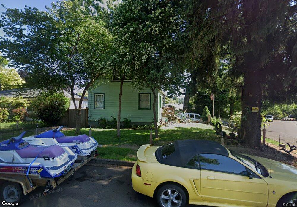
3206 SE Wister St Milwaukie, OR 97222
Lake Road NeighborhoodEstimated Value: $448,701 - $507,000
2
Beds
1
Bath
1,808
Sq Ft
$271/Sq Ft
Est. Value
About This Home
This home is located at 3206 SE Wister St, Milwaukie, OR 97222 and is currently estimated at $489,675, approximately $270 per square foot. 3206 SE Wister St is a home located in Clackamas County with nearby schools including Milwaukie Elementary School, Rowe Middle School, and Milwaukie High School.
Ownership History
Date
Name
Owned For
Owner Type
Purchase Details
Closed on
Jan 23, 1998
Sold by
Maxwell Patricia Carey
Bought by
Maxwell Richard Alan
Current Estimated Value
Home Financials for this Owner
Home Financials are based on the most recent Mortgage that was taken out on this home.
Original Mortgage
$78,000
Interest Rate
6.98%
Mortgage Type
Purchase Money Mortgage
Purchase Details
Closed on
Aug 9, 1997
Sold by
Maxwell Patricia Carey
Bought by
Maxwell Richard Alan
Create a Home Valuation Report for This Property
The Home Valuation Report is an in-depth analysis detailing your home's value as well as a comparison with similar homes in the area
Home Values in the Area
Average Home Value in this Area
Purchase History
| Date | Buyer | Sale Price | Title Company |
|---|---|---|---|
| Maxwell Richard Alan | -- | Transnation Title Insurance | |
| Maxwell Richard Alan | -- | -- |
Source: Public Records
Mortgage History
| Date | Status | Borrower | Loan Amount |
|---|---|---|---|
| Closed | Maxwell Richard Alan | $78,000 |
Source: Public Records
Tax History Compared to Growth
Tax History
| Year | Tax Paid | Tax Assessment Tax Assessment Total Assessment is a certain percentage of the fair market value that is determined by local assessors to be the total taxable value of land and additions on the property. | Land | Improvement |
|---|---|---|---|---|
| 2025 | $3,159 | $143,561 | -- | -- |
| 2024 | $3,051 | $139,380 | -- | -- |
| 2023 | $3,051 | $135,321 | $0 | $0 |
| 2022 | $2,817 | $131,380 | $0 | $0 |
| 2021 | $2,719 | $127,554 | $0 | $0 |
| 2020 | $2,634 | $123,839 | $0 | $0 |
| 2019 | $2,595 | $120,233 | $0 | $0 |
| 2018 | $2,307 | $116,731 | $0 | $0 |
| 2017 | $2,241 | $113,331 | $0 | $0 |
| 2016 | $2,166 | $110,030 | $0 | $0 |
| 2015 | $2,063 | $106,825 | $0 | $0 |
| 2014 | $1,956 | $103,714 | $0 | $0 |
Source: Public Records
Map
Nearby Homes
- 11332 SE 31st Ave
- 11265 SE 30th Ave
- 10845 SE Myrtle St
- 10801 SE Myrtle St
- 12425 SE 27th Ave
- 12712 SE 31st Ave
- 12632 SE 39th Ct
- 4119 SE Northridge Dr
- 10638 SE 34th Ave
- 4134 SE Washington St
- 0 SE Sparrow St
- 12815 SE 31st Ave
- 12437 SE 24th Ave
- 12735 SE 26th Ave
- 12495 SE 23rd Ave
- 12556 SE 23rd Ave
- 10475 SE 37th Ave
- 10429 SE 36th Ave
- 12600 SE Freeman Way
- 4657 SE Franklin St
- 11742 SE 32nd Ave
- 3236 SE Wister St
- 11690 SE 32nd Ave
- 11693 SE 32nd Ave
- 11763 SE 33rd Ave
- 11774 SE 32nd Ave
- 11687 SE 33rd Ave
- 11835 SE 33rd Ave
- 11707 SE 32nd Ave
- 11661 SE 32nd Ave
- 11658 SE 32nd Ave
- 11869 SE 33rd Ave
- 11659 SE 32nd Ave
- 11770 SE 33rd Ave
- 3306 SE Wister St
- 11698 SE 31st Ave
- 3305 SE Wister St
- 11636 SE 32nd Ave
- 11846 SE 32nd Ave
- 0 SE 32nd Ave Unit 15515703