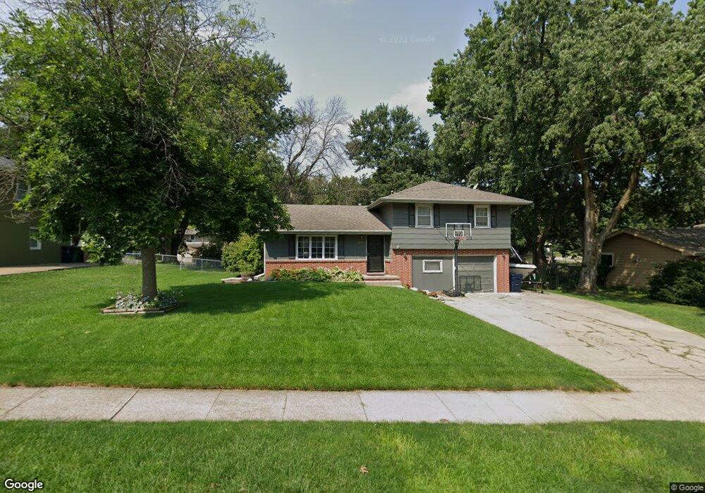
3208 92nd St Urbandale, IA 50322
Estimated Value: $252,000 - $294,000
3
Beds
3
Baths
1,382
Sq Ft
$202/Sq Ft
Est. Value
About This Home
This home is located at 3208 92nd St, Urbandale, IA 50322 and is currently estimated at $279,649, approximately $202 per square foot. 3208 92nd St is a home located in Polk County with nearby schools including Valerius Elementary School, Urbandale Middle School, and Urbandale High School.
Ownership History
Date
Name
Owned For
Owner Type
Purchase Details
Closed on
Sep 14, 2001
Sold by
Wunsch Jeffrey P and Wunsch Stacey M
Bought by
Stroud James Brian and Stroud Amy
Current Estimated Value
Home Financials for this Owner
Home Financials are based on the most recent Mortgage that was taken out on this home.
Original Mortgage
$113,050
Outstanding Balance
$44,212
Interest Rate
7.03%
Estimated Equity
$235,437
Create a Home Valuation Report for This Property
The Home Valuation Report is an in-depth analysis detailing your home's value as well as a comparison with similar homes in the area
Home Values in the Area
Average Home Value in this Area
Purchase History
| Date | Buyer | Sale Price | Title Company |
|---|---|---|---|
| Stroud James Brian | $119,500 | -- |
Source: Public Records
Mortgage History
| Date | Status | Borrower | Loan Amount |
|---|---|---|---|
| Open | Stroud James Brian | $113,050 |
Source: Public Records
Tax History Compared to Growth
Tax History
| Year | Tax Paid | Tax Assessment Tax Assessment Total Assessment is a certain percentage of the fair market value that is determined by local assessors to be the total taxable value of land and additions on the property. | Land | Improvement |
|---|---|---|---|---|
| 2025 | $4,494 | $280,700 | $73,200 | $207,500 |
| 2024 | $4,494 | $248,100 | $63,900 | $184,200 |
| 2023 | $4,542 | $248,100 | $63,900 | $184,200 |
| 2022 | $4,490 | $211,700 | $55,900 | $155,800 |
| 2021 | $4,518 | $211,700 | $55,900 | $155,800 |
| 2020 | $4,442 | $202,200 | $53,300 | $148,900 |
| 2019 | $4,056 | $202,200 | $53,300 | $148,900 |
| 2018 | $3,908 | $176,400 | $45,700 | $130,700 |
| 2017 | $3,622 | $176,400 | $45,700 | $130,700 |
| 2016 | $3,534 | $160,700 | $41,100 | $119,600 |
| 2015 | $3,534 | $160,700 | $41,100 | $119,600 |
| 2014 | $3,192 | $149,700 | $37,700 | $112,000 |
Source: Public Records
Map
Nearby Homes
- Lot 1 Hillsdale Dr
- 4500 90th St
- 4505 90th St
- 4517 90th St
- 37 89th St
- 3320 Patricia Dr
- 2908 88th Ct
- 3808 Mary Lynn Dr
- 3805 Melanie Cir
- 3889 92nd Dr
- 1590 Parkside Ln
- 1630 Parkside Ln
- 1550 Parkside Ln
- 1600 Parkside Ln
- 3916 Greenview Dr
- 3957 92nd Dr
- 3913 Horton Trail
- 8178 Dellwood Dr Unit 8178
- 3900 Rolling Green Dr
- 8047 Dellwood Dr
- 3204 92nd St
- 3210 92nd St
- 3205 Hillsdale Dr
- 3207 92nd St
- 3207 Hillsdale Dr
- 3200 92nd St
- 3203 Hillsdale Dr
- 3212 92nd St
- 3209 Hillsdale Dr
- 9111 Beechwood Dr
- 3201 Hillsdale Dr
- 9108 Boston Ave
- 3114 92nd St
- 9109 Beechwood Dr
- 9109 Boston Ave
- 3109 Hillsdale Dr
- 9104 Boston Ave
- 3112 92nd St
- 9209 Dewey Gibbs Rd
- 3206 Hillsdale Dr