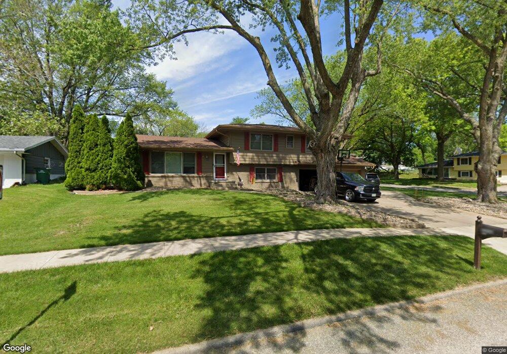
3208 Hillsdale Dr Urbandale, IA 50322
Estimated Value: $306,000 - $356,224
4
Beds
3
Baths
1,982
Sq Ft
$169/Sq Ft
Est. Value
About This Home
This home is located at 3208 Hillsdale Dr, Urbandale, IA 50322 and is currently estimated at $335,056, approximately $169 per square foot. 3208 Hillsdale Dr is a home located in Polk County with nearby schools including Valerius Elementary School, Urbandale Middle School, and Urbandale High School.
Ownership History
Date
Name
Owned For
Owner Type
Purchase Details
Closed on
Apr 30, 2025
Sold by
Winger Kathryn and Winger Douglas E
Bought by
Winger Kathryn and Winger Douglas E
Current Estimated Value
Purchase Details
Closed on
Aug 31, 2009
Sold by
Long George W and Long Marie B
Bought by
Winger Kathryn
Home Financials for this Owner
Home Financials are based on the most recent Mortgage that was taken out on this home.
Original Mortgage
$137,000
Interest Rate
4.63%
Mortgage Type
New Conventional
Purchase Details
Closed on
Apr 21, 2006
Sold by
Fitz Jo Ann and Fitz Eric W
Bought by
Long George W and Long Marie B
Home Financials for this Owner
Home Financials are based on the most recent Mortgage that was taken out on this home.
Original Mortgage
$80,000
Interest Rate
6.37%
Mortgage Type
Fannie Mae Freddie Mac
Create a Home Valuation Report for This Property
The Home Valuation Report is an in-depth analysis detailing your home's value as well as a comparison with similar homes in the area
Home Values in the Area
Average Home Value in this Area
Purchase History
| Date | Buyer | Sale Price | Title Company |
|---|---|---|---|
| Winger Kathryn | -- | None Listed On Document | |
| Winger Kathryn | -- | None Listed On Document | |
| Winger Kathryn | $184,500 | None Available | |
| Long George W | $174,500 | None Available |
Source: Public Records
Mortgage History
| Date | Status | Borrower | Loan Amount |
|---|---|---|---|
| Previous Owner | Winger Kathryn | $137,000 | |
| Previous Owner | Long George W | $80,000 |
Source: Public Records
Tax History Compared to Growth
Tax History
| Year | Tax Paid | Tax Assessment Tax Assessment Total Assessment is a certain percentage of the fair market value that is determined by local assessors to be the total taxable value of land and additions on the property. | Land | Improvement |
|---|---|---|---|---|
| 2025 | $5,604 | $342,500 | $88,200 | $254,300 |
| 2024 | $5,604 | $319,900 | $81,200 | $238,700 |
| 2023 | $5,394 | $319,900 | $81,200 | $238,700 |
| 2022 | $5,330 | $260,300 | $68,100 | $192,200 |
| 2021 | $5,298 | $260,300 | $68,100 | $192,200 |
| 2020 | $5,204 | $245,700 | $64,200 | $181,500 |
| 2019 | $4,676 | $245,700 | $64,200 | $181,500 |
| 2018 | $4,372 | $211,900 | $54,200 | $157,700 |
| 2017 | $3,978 | $206,000 | $54,200 | $151,800 |
| 2016 | $3,876 | $185,000 | $48,200 | $136,800 |
| 2015 | $3,876 | $185,000 | $48,200 | $136,800 |
| 2014 | $3,688 | $181,900 | $46,700 | $135,200 |
Source: Public Records
Map
Nearby Homes
- Lot 1 Hillsdale Dr
- 4500 90th St
- 4505 90th St
- 4517 90th St
- 37 89th St
- 3320 Patricia Dr
- 3808 Mary Lynn Dr
- 2908 88th Ct
- 3805 Melanie Cir
- 3889 92nd Dr
- 1590 Parkside Ln
- 1630 Parkside Ln
- 1550 Parkside Ln
- 1600 Parkside Ln
- 3916 Greenview Dr
- 3913 Horton Trail
- 3957 92nd Dr
- 8178 Dellwood Dr Unit 8178
- 4016 Patricia Dr
- 3900 Rolling Green Dr
- 3206 Hillsdale Dr
- 9301 Dewey Gibbs Rd
- 3209 Mary Lynn Dr
- 3202 Hillsdale Dr
- 3209 Hillsdale Dr
- 3207 Hillsdale Dr
- 9305 Dewey Gibbs Rd
- 3205 Mary Lynn Dr
- 3304 Hillsdale Dr
- 3205 Hillsdale Dr
- 3200 Hillsdale Dr
- Lot 12 Hillsdale Dr
- Lot 11 Hillsdale Dr
- Lot 8 Hillsdale Dr
- Lot 6 Hillsdale Dr
- Lot 3 Hillsdale Dr
- 9209 Dewey Gibbs Rd
- 3201 Mary Lynn Dr
- 3308 Hillsdale Dr
- 3203 Hillsdale Dr