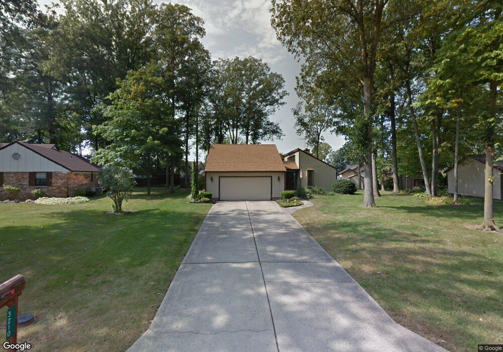
3210 Byrnwyck Dr Findlay, OH 45840
Estimated Value: $290,946 - $347,000
3
Beds
3
Baths
2,016
Sq Ft
$163/Sq Ft
Est. Value
About This Home
This home is located at 3210 Byrnwyck Dr, Findlay, OH 45840 and is currently estimated at $329,237, approximately $163 per square foot. 3210 Byrnwyck Dr is a home located in Hancock County with nearby schools including Liberty-Benton Elementary School, Liberty-Benton Middle School, and Liberty-Benton High School.
Ownership History
Date
Name
Owned For
Owner Type
Purchase Details
Closed on
May 12, 2020
Sold by
Nemrava Joseph P and Nemrava Nancy A
Bought by
Nemrava Joseph P and Nemrava Nancy A
Current Estimated Value
Purchase Details
Closed on
Mar 25, 1991
Bought by
Nemrava Joseph P and Nemrava Nancy A
Purchase Details
Closed on
Apr 25, 1990
Bought by
Willadsen Kay A
Purchase Details
Closed on
Feb 25, 1981
Bought by
Willadsen Michael C and Willadsen Kay
Create a Home Valuation Report for This Property
The Home Valuation Report is an in-depth analysis detailing your home's value as well as a comparison with similar homes in the area
Home Values in the Area
Average Home Value in this Area
Purchase History
| Date | Buyer | Sale Price | Title Company |
|---|---|---|---|
| Nemrava Joseph P | -- | None Available | |
| Nemrava Joseph P | $109,500 | -- | |
| Willadsen Kay A | -- | -- | |
| Willadsen Michael C | -- | -- |
Source: Public Records
Tax History Compared to Growth
Tax History
| Year | Tax Paid | Tax Assessment Tax Assessment Total Assessment is a certain percentage of the fair market value that is determined by local assessors to be the total taxable value of land and additions on the property. | Land | Improvement |
|---|---|---|---|---|
| 2024 | $2,337 | $72,660 | $13,380 | $59,280 |
| 2023 | $2,304 | $72,660 | $13,380 | $59,280 |
| 2022 | $2,297 | $72,660 | $13,380 | $59,280 |
| 2021 | $2,030 | $58,600 | $13,390 | $45,210 |
| 2020 | $2,047 | $58,600 | $13,390 | $45,210 |
| 2019 | $1,964 | $58,600 | $13,390 | $45,210 |
| 2018 | $1,506 | $50,950 | $11,640 | $39,310 |
| 2017 | $777 | $50,950 | $11,640 | $39,310 |
| 2016 | $1,516 | $50,950 | $11,640 | $39,310 |
| 2015 | $1,789 | $57,610 | $11,640 | $45,970 |
| 2014 | $1,805 | $57,610 | $11,640 | $45,970 |
| 2012 | $1,886 | $57,610 | $11,640 | $45,970 |
Source: Public Records
Map
Nearby Homes
- 3018 Gleneagle Dr
- 3106 Saddlebrook
- 1405 Cypress Lake
- 1310 Muirfield Dr
- 6535 Silver Lake Dr
- 933 Laurel Ln
- 615 Hillcrest Ave
- 0 County Road 95 Unit 6097574
- 0 Allen Township 142
- 0 Bushwillow Dr Or Rock Candy Rd Unit Lot 157
- 0 Township Highway 99
- 12325 Township Highway 99
- 506 Hillcrest Ave
- 0 Rock Candy Rd Or Bushwillow Dr Unit Lot 173
- 0 Bearcat Way Or Rock Candy Rd Unit Lot 167
- 0 Rock Candy Rd Unit Lot 159
- 0 Rock Candy Rd Unit Lot 170
- 0 Rock Candy Rd Unit Lot 172 206819
- 0 Rock Candy Rd Unit Lot 162
- 0 Rock Candy Rd Unit Lot 171
- 3218 Byrnwyck Dr
- 3200 Byrnwyck Dr
- 3111 Pepper Pike
- 3121 Pepper Pike
- 3101 Pepper Pike
- 3200 Gleneagle Dr
- 3211 Byrnwyck Dr
- 3226 Byrnwyck Dr
- 3023 Pepper Pike
- 3108 Gleneagle Dr
- 3201 Pepper Pike
- 3210 Gleneagle Dr
- 3221 Byrnwyck Dr
- 3121 Gleneagle Dr
- 3110 Pepper Pike
- 3234 Byrnwyck Dr
- 3118 Pepper Pike
- 3201 Gleneagle Dr
- 3100 Pepper Pike
- 3015 Pepper Pike