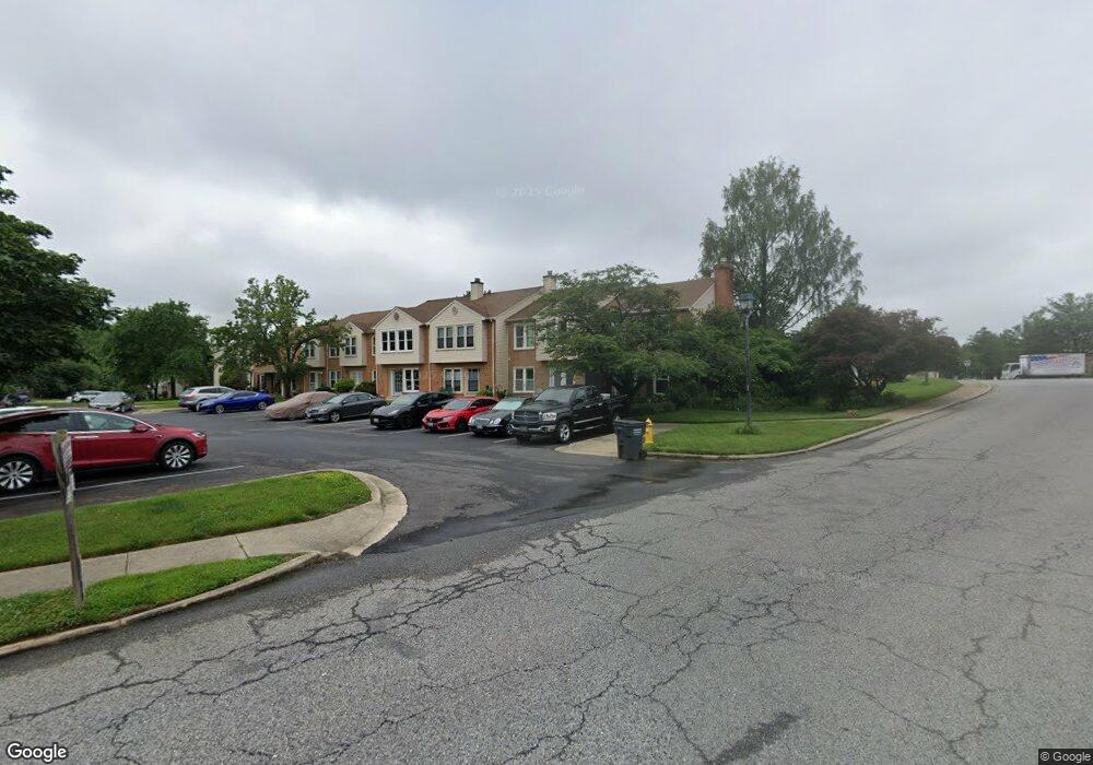
3212 Westdale Ct Waldorf, MD 20601
Estimated Value: $275,000 - $312,000
--
Bed
2
Baths
1,120
Sq Ft
$258/Sq Ft
Est. Value
About This Home
This home is located at 3212 Westdale Ct, Waldorf, MD 20601 and is currently estimated at $289,327, approximately $258 per square foot. 3212 Westdale Ct is a home located in Charles County with nearby schools including Daniel of St. Thomas Jenifer Elementary School, Mattawoman Middle School, and Thomas Stone High School.
Ownership History
Date
Name
Owned For
Owner Type
Purchase Details
Closed on
Jul 28, 2008
Sold by
Irvin Brenda M
Bought by
Vargas Brenda M and Vargas Philip A
Current Estimated Value
Purchase Details
Closed on
Jul 26, 2008
Sold by
Irvin Brenda M
Bought by
Vargas Brenda M and Vargas Philip A
Purchase Details
Closed on
Aug 2, 1994
Sold by
Rl Ross
Bought by
Irvin Brenda M
Home Financials for this Owner
Home Financials are based on the most recent Mortgage that was taken out on this home.
Original Mortgage
$88,850
Interest Rate
8.25%
Purchase Details
Closed on
Oct 27, 1988
Sold by
Acton Village Limited Partnership
Bought by
Ross Randy L and Esser Nanette L
Home Financials for this Owner
Home Financials are based on the most recent Mortgage that was taken out on this home.
Original Mortgage
$96,482
Interest Rate
10.28%
Create a Home Valuation Report for This Property
The Home Valuation Report is an in-depth analysis detailing your home's value as well as a comparison with similar homes in the area
Home Values in the Area
Average Home Value in this Area
Purchase History
| Date | Buyer | Sale Price | Title Company |
|---|---|---|---|
| Vargas Brenda M | -- | -- | |
| Vargas Brenda M | -- | -- | |
| Irvin Brenda M | $99,250 | -- | |
| Ross Randy L | $94,000 | -- |
Source: Public Records
Mortgage History
| Date | Status | Borrower | Loan Amount |
|---|---|---|---|
| Previous Owner | Irvin Brenda M | $88,850 | |
| Previous Owner | Ross Randy L | $96,482 |
Source: Public Records
Tax History Compared to Growth
Tax History
| Year | Tax Paid | Tax Assessment Tax Assessment Total Assessment is a certain percentage of the fair market value that is determined by local assessors to be the total taxable value of land and additions on the property. | Land | Improvement |
|---|---|---|---|---|
| 2025 | $8,038 | $251,267 | -- | -- |
| 2024 | $3,504 | $241,600 | $120,000 | $121,600 |
| 2023 | $3,143 | $219,967 | $0 | $0 |
| 2022 | $2,879 | $198,333 | $0 | $0 |
| 2021 | $2,427 | $176,700 | $90,000 | $86,700 |
| 2020 | $2,427 | $167,467 | $0 | $0 |
| 2019 | $2,288 | $158,233 | $0 | $0 |
| 2018 | $2,128 | $149,000 | $80,000 | $69,000 |
| 2017 | $2,052 | $143,767 | $0 | $0 |
| 2016 | -- | $138,533 | $0 | $0 |
| 2015 | $2,018 | $133,300 | $0 | $0 |
| 2014 | $2,018 | $133,300 | $0 | $0 |
Source: Public Records
Map
Nearby Homes
- 231 Westdale Dr
- HAYDEN Plan at Acton Park
- 2522 Regal Place
- 2545 Enterprise Place
- 11519 Shearwater Dr
- 2073 Tanglewood Dr
- 11613 Gallinule Ct
- 11824 Murre Ct
- 2031 Tanglewood Dr
- 11565 Timberbrook Dr
- 11540 Leland Place
- 11748 Torcello Ct
- 11616 Kipling Dr
- 2717 Stanford Place
- 12113 Farrar Place
- 0 Hamilton Rd Unit MDCH2045568
- 11507 Timberbrook Dr
- 2448 Shellcove Ct
- 2765 Hamilton Rd
- 11800 Railroad Place
- 3213 Westdale Ct
- 3214 Westdale Ct
- 3215 Westdale Ct
- 3216 Westdale Ct
- 3217 Westdale Ct
- 3218 Westdale Ct
- 3219 Westdale Ct
- 3194 Westdale Ct
- 3195 Westdale Ct
- 3196 Westdale Ct
- 3197 Westdale Ct
- 3220 Westdale Ct
- 3198 Westdale Ct
- 3192 Westdale Ct
- 3221 Westdale Ct
- 3208 Westdale Ct
- 3209 Westdale Ct
- 3207 Westdale Ct
- 3210 Westdale Ct
- 3206 Westdale Ct