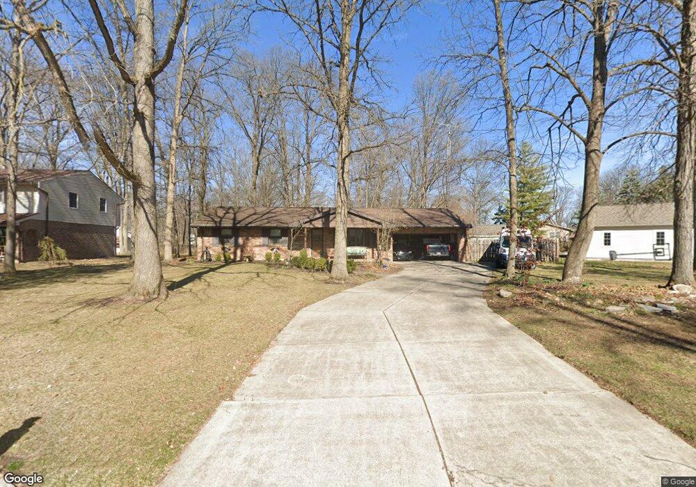
3234 Gleneagle Dr Findlay, OH 45840
Estimated Value: $291,831 - $359,000
3
Beds
2
Baths
2,653
Sq Ft
$127/Sq Ft
Est. Value
About This Home
This home is located at 3234 Gleneagle Dr, Findlay, OH 45840 and is currently estimated at $336,458, approximately $126 per square foot. 3234 Gleneagle Dr is a home located in Hancock County with nearby schools including Liberty-Benton Elementary School, Liberty-Benton Middle School, and Liberty-Benton High School.
Ownership History
Date
Name
Owned For
Owner Type
Purchase Details
Closed on
Feb 13, 2020
Sold by
Walker Walter H and Walker Karen Sue
Bought by
Walker Walter H and Walker Karen Sue
Current Estimated Value
Purchase Details
Closed on
May 2, 1990
Bought by
Walker Walter H and Walker Karen
Purchase Details
Closed on
Sep 30, 1987
Bought by
Jones Rick J
Purchase Details
Closed on
May 1, 1984
Bought by
Johnson Brian C
Create a Home Valuation Report for This Property
The Home Valuation Report is an in-depth analysis detailing your home's value as well as a comparison with similar homes in the area
Home Values in the Area
Average Home Value in this Area
Purchase History
| Date | Buyer | Sale Price | Title Company |
|---|---|---|---|
| Walker Walter H | -- | Accommodation | |
| Walker Walter H | $82,300 | -- | |
| Jones Rick J | $89,500 | -- | |
| Johnson Brian C | $73,000 | -- |
Source: Public Records
Tax History Compared to Growth
Tax History
| Year | Tax Paid | Tax Assessment Tax Assessment Total Assessment is a certain percentage of the fair market value that is determined by local assessors to be the total taxable value of land and additions on the property. | Land | Improvement |
|---|---|---|---|---|
| 2024 | $2,956 | $79,500 | $13,380 | $66,120 |
| 2023 | $2,886 | $79,500 | $13,380 | $66,120 |
| 2022 | $2,858 | $79,500 | $13,380 | $66,120 |
| 2021 | $2,635 | $64,720 | $13,360 | $51,360 |
| 2020 | $2,658 | $64,720 | $13,360 | $51,360 |
| 2019 | $2,550 | $64,720 | $13,360 | $51,360 |
| 2018 | $2,010 | $56,310 | $11,610 | $44,700 |
| 2017 | $1,037 | $56,310 | $11,610 | $44,700 |
| 2016 | $2,017 | $56,310 | $11,610 | $44,700 |
| 2015 | $2,443 | $66,710 | $11,610 | $55,100 |
| 2014 | $2,465 | $66,710 | $11,610 | $55,100 |
| 2012 | $2,575 | $66,710 | $11,610 | $55,100 |
Source: Public Records
Map
Nearby Homes
- 3018 Gleneagle Dr
- 1310 Muirfield Dr
- 3106 Saddlebrook
- 1405 Cypress Lake
- 933 Laurel Ln
- 6535 Silver Lake Dr
- 0 Township Highway 99
- 12325 Township Highway 99
- 615 Hillcrest Ave
- 0 Allen Township 142
- 506 Hillcrest Ave
- 0 Bushwillow Dr Or Rock Candy Rd Unit Lot 157
- 0 Rock Candy Rd Or Bushwillow Dr Unit Lot 173
- 0 Bearcat Way Or Rock Candy Rd Unit Lot 167
- 0 Rock Candy Rd Unit Lot 159
- 0 Rock Candy Rd Unit Lot 170
- 0 Rock Candy Rd Unit Lot 172 206819
- 0 Rock Candy Rd Unit Lot 162
- 0 Rock Candy Rd Unit Lot 171
- 0 Rock Candy Rd Unit Lot 168
- 3226 Gleneagle Dr
- 3242 Gleneagle Dr
- 1117 Ironwood Dr
- 3218 Gleneagle Dr
- 3231 Gleneagle Dr
- 3250 Gleneagle Dr
- 3225 Gleneagle Dr
- 3237 Gleneagle Dr
- 3231 Byrnwyck Dr
- 1133 Ironwood Dr
- 3221 Byrnwyck Dr
- 3243 Gleneagle Dr
- 3210 Gleneagle Dr
- 1118 Ironwood Dr
- 1124 Ironwood Dr
- 3211 Byrnwyck Dr
- 3213 Gleneagle Dr
- 3249 Gleneagle Dr
- 1112 Ironwood Dr
- 1130 Ironwood Dr