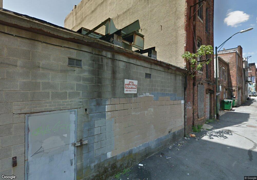
325 N Howard St Baltimore, MD 21201
Downtown Baltimore NeighborhoodEstimated Value: $768,200
--
Bed
--
Bath
6,680
Sq Ft
$115/Sq Ft
Est. Value
About This Home
This home is located at 325 N Howard St, Baltimore, MD 21201 and is currently estimated at $768,200, approximately $115 per square foot. 325 N Howard St is a home located in Baltimore City with nearby schools including The Historic Samuel Coleridge-Taylor Elementary School, Booker T. Washington Middle School, and Paul Laurence Dunbar High School.
Ownership History
Date
Name
Owned For
Owner Type
Purchase Details
Closed on
Apr 18, 2007
Sold by
325 Howard Street Llc
Current Estimated Value
Purchase Details
Closed on
Apr 17, 2007
Sold by
325 Howard Street Llc
Purchase Details
Closed on
Mar 18, 2004
Sold by
Duke David
Bought by
325 Howard Street Llc
Purchase Details
Closed on
Mar 11, 2004
Sold by
Duke David
Bought by
325 Howard Street Llc
Purchase Details
Closed on
Dec 3, 1997
Sold by
Derito Marie
Bought by
Duke David and Benor Yossi
Create a Home Valuation Report for This Property
The Home Valuation Report is an in-depth analysis detailing your home's value as well as a comparison with similar homes in the area
Home Values in the Area
Average Home Value in this Area
Purchase History
| Date | Buyer | Sale Price | Title Company |
|---|---|---|---|
| -- | $399,000 | -- | |
| -- | $399,000 | -- | |
| 325 Howard Street Llc | $100,000 | -- | |
| 325 Howard Street Llc | $100,000 | -- | |
| Duke David | $85,000 | -- |
Source: Public Records
Tax History Compared to Growth
Tax History
| Year | Tax Paid | Tax Assessment Tax Assessment Total Assessment is a certain percentage of the fair market value that is determined by local assessors to be the total taxable value of land and additions on the property. | Land | Improvement |
|---|---|---|---|---|
| 2025 | $9,303 | $393,400 | $200,400 | $193,000 |
| 2024 | $9,303 | $394,200 | $200,400 | $193,800 |
| 2023 | $9,179 | $390,800 | $0 | $0 |
| 2022 | $9,143 | $387,400 | $0 | $0 |
| 2021 | $9,062 | $384,000 | $200,400 | $183,600 |
| 2020 | $8,997 | $381,233 | $0 | $0 |
| 2019 | $8,889 | $378,467 | $0 | $0 |
| 2018 | $8,867 | $375,700 | $200,400 | $175,300 |
| 2017 | $8,210 | $347,900 | $0 | $0 |
| 2016 | $7,040 | $320,100 | $0 | $0 |
| 2015 | $7,040 | $292,300 | $0 | $0 |
| 2014 | $7,040 | $292,300 | $0 | $0 |
Source: Public Records
Map
Nearby Homes
- 18 W Franklin St
- 319 N Paca St
- 328 N Paca St
- 615 Jasper St
- 404 Saint Paul St
- 523 N Charles St
- 3 W Mount Vernon Place Unit 1
- 216 W Monument St
- 503 W Lexington St
- 645 N Paca St
- 700 Washington Place Unit 2D
- 700 Washington Place Unit 1F
- 700 Washington Place Unit 4B
- 700 Washington Place Unit 3B
- 801 Park Ave Unit 2
- 14 E Mount Vernon Place Unit 15 (B4)
- 15 E Branch Ln Unit 22
- 10 W Madison St Unit 21
- 10 W Madison St
- 591 Orchard St
- 327 N Howard St
- 321 N Howard St
- 225 W Mulberry St Unit 3
- 314 Tyson St
- 329 N Howard St
- 323 N Howard St
- 223 W Mulberry St
- 317 N Howard St
- 315 N Howard St
- 219 W Mulberry St
- 313 N Howard St
- 309 N Howard St
- 319 Tyson St
- 401 N Howard St
- 211 W Mulberry St
- 313 Tyson St
- 214 W Mulberry St
- 407 N Howard St Unit 204
- 407-415 N Howard St
- 407-415 N Howard St