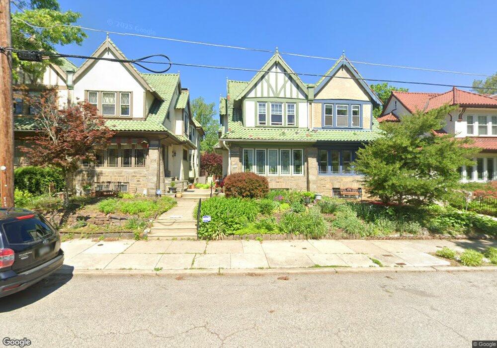
325 W Mount Airy Ave Philadelphia, PA 19119
West Mount Airy NeighborhoodEstimated Value: $524,000 - $662,000
4
Beds
1
Bath
1,827
Sq Ft
$310/Sq Ft
Est. Value
About This Home
This home is located at 325 W Mount Airy Ave, Philadelphia, PA 19119 and is currently estimated at $567,220, approximately $310 per square foot. 325 W Mount Airy Ave is a home with nearby schools including Henry H. Houston School, Roxborough High School, and Renaissance Charter School.
Ownership History
Date
Name
Owned For
Owner Type
Purchase Details
Closed on
Sep 3, 2002
Sold by
Dunbar Youngshil and Dunbar Youngshil K
Bought by
Stone Stephen B and Williams Sheppard V
Current Estimated Value
Home Financials for this Owner
Home Financials are based on the most recent Mortgage that was taken out on this home.
Original Mortgage
$179,550
Outstanding Balance
$75,168
Interest Rate
6.27%
Estimated Equity
$492,052
Create a Home Valuation Report for This Property
The Home Valuation Report is an in-depth analysis detailing your home's value as well as a comparison with similar homes in the area
Home Values in the Area
Average Home Value in this Area
Purchase History
| Date | Buyer | Sale Price | Title Company |
|---|---|---|---|
| Stone Stephen B | $189,500 | Commonwealth Land Title Ins |
Source: Public Records
Mortgage History
| Date | Status | Borrower | Loan Amount |
|---|---|---|---|
| Open | Stone Stephen B | $179,550 |
Source: Public Records
Tax History Compared to Growth
Tax History
| Year | Tax Paid | Tax Assessment Tax Assessment Total Assessment is a certain percentage of the fair market value that is determined by local assessors to be the total taxable value of land and additions on the property. | Land | Improvement |
|---|---|---|---|---|
| 2025 | $6,028 | $459,900 | $91,900 | $368,000 |
| 2024 | $6,028 | $459,900 | $91,900 | $368,000 |
| 2023 | $6,028 | $430,600 | $86,120 | $344,480 |
| 2022 | $3,933 | $385,600 | $86,120 | $299,480 |
| 2021 | $4,563 | $0 | $0 | $0 |
| 2020 | $4,563 | $0 | $0 | $0 |
| 2019 | $4,764 | $0 | $0 | $0 |
| 2018 | $4,076 | $0 | $0 | $0 |
| 2017 | $4,076 | $0 | $0 | $0 |
| 2016 | $3,656 | $0 | $0 | $0 |
| 2015 | $3,500 | $0 | $0 | $0 |
| 2014 | -- | $291,200 | $94,762 | $196,438 |
| 2012 | -- | $34,400 | $6,452 | $27,948 |
Source: Public Records
Map
Nearby Homes
- 358 W Mount Airy Ave
- 442 Wellesley Rd
- 439 W Durham St
- 7141 Cresheim Rd
- 7213 Cresheim Rd
- 7009 Lincoln Dr
- 116 W Sedgwick St
- 121 W Mount Pleasant Ave
- 165 Carpenter Ln
- 7330 Bryan St
- 161 Carpenter Ln
- 7019 Pipers Glen Way
- 109 15 Carpenter Ln
- 7005 Pipers Glen Way
- 7100 Germantown Ave
- 542 W Ellet St
- 18 E Mount Pleasant Ave
- 20 E Mount Pleasant Ave
- 26 E Mount Pleasant Ave
- 60 E Durham St
- 323 W Mount Airy Ave
- 327 W Mount Airy Ave
- 321 W Mount Airy Ave
- 329 W Mount Airy Ave
- 319 W Mount Airy Ave
- 317 W Mount Airy Ave
- 333 W Mount Airy Ave
- 337 W Mount Airy Ave
- 7204 Lincoln Dr
- 7202 Lincoln Dr
- 7206 Lincoln Dr
- 334 W Mount Airy Ave
- 336 W Mount Airy Ave
- 338 W Mount Airy Ave
- 341 W Mount Airy Ave
- 340 W Mount Airy Ave
- 332 W Mount Airy Ave
- 7200 Lincoln Dr
- 7208 Lincoln Dr
- 342 W Mount Airy Ave