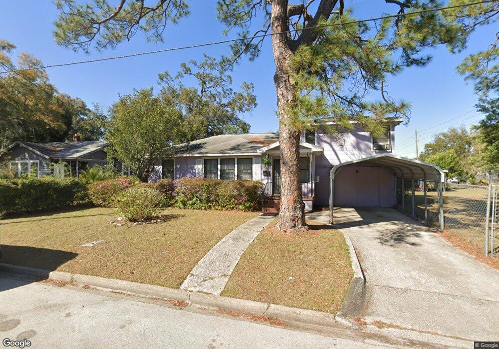
3270 Liberty Cir Jacksonville, FL 32206
Brentwood NeighborhoodEstimated Value: $115,000 - $179,000
3
Beds
2
Baths
1,337
Sq Ft
$105/Sq Ft
Est. Value
About This Home
This home is located at 3270 Liberty Cir, Jacksonville, FL 32206 and is currently estimated at $140,092, approximately $104 per square foot. 3270 Liberty Cir is a home located in Duval County with nearby schools including Long Branch Elementary School, John Love Elementary School, and Matthew W. Gilbert Middle School.
Ownership History
Date
Name
Owned For
Owner Type
Purchase Details
Closed on
Mar 16, 1995
Sold by
City Of Jacksonville
Bought by
Brooks Patricia A
Current Estimated Value
Home Financials for this Owner
Home Financials are based on the most recent Mortgage that was taken out on this home.
Original Mortgage
$49,600
Interest Rate
4%
Mortgage Type
Seller Take Back
Purchase Details
Closed on
Dec 1, 1994
Sold by
Corbin Charles E and Corbin Nancy D
Bought by
City Of Jacksonville
Create a Home Valuation Report for This Property
The Home Valuation Report is an in-depth analysis detailing your home's value as well as a comparison with similar homes in the area
Home Values in the Area
Average Home Value in this Area
Purchase History
| Date | Buyer | Sale Price | Title Company |
|---|---|---|---|
| Brooks Patricia A | $49,500 | -- | |
| City Of Jacksonville | $49,500 | -- |
Source: Public Records
Mortgage History
| Date | Status | Borrower | Loan Amount |
|---|---|---|---|
| Previous Owner | Brooks Patricia A | $49,600 |
Source: Public Records
Tax History Compared to Growth
Tax History
| Year | Tax Paid | Tax Assessment Tax Assessment Total Assessment is a certain percentage of the fair market value that is determined by local assessors to be the total taxable value of land and additions on the property. | Land | Improvement |
|---|---|---|---|---|
| 2025 | $1,268 | $56,293 | -- | -- |
| 2024 | $1,199 | $73,503 | $26,144 | $47,359 |
| 2023 | $1,199 | $70,093 | $23,362 | $46,731 |
| 2022 | $1,041 | $62,110 | $18,356 | $43,754 |
| 2021 | $885 | $38,450 | $11,125 | $27,325 |
| 2020 | $371 | $34,057 | $0 | $0 |
| 2019 | $360 | $33,292 | $0 | $0 |
| 2018 | $350 | $32,672 | $0 | $0 |
| 2017 | $339 | $32,000 | $0 | $0 |
| 2016 | $330 | $31,342 | $0 | $0 |
| 2015 | $362 | $32,929 | $0 | $0 |
| 2014 | $358 | $32,668 | $0 | $0 |
Source: Public Records
Map
Nearby Homes
- 228 E 25th St
- 0 E 27th St Unit 2089523
- 0 E 27th St Unit 2105816
- 419 Springfield Ct N
- 230 E 19th St
- 231 E 18th St
- 225 E 18th St
- 2903 Hubbard St
- 333 E 18th St
- 218 E 18th St
- 0 E 31st St Unit 2111861
- 3317 N Laura St
- 2724 Hubbard St
- 59 E 32nd St
- 2622 N Market St
- 74 W 27th St
- 1168 Claudia Spencer St
- 1125 Claudia Spencer St
- 16 W 32nd St
- 135 W 23rd St
- 3264 Liberty Cir
- 274 Ravine St
- 282 Ravine St
- 264 Ravine St
- 3265 Liberty Cir
- 3260 N Liberty St
- 3257 Liberty Cir
- 258 Ravine St
- 3305 N Liberty St
- 3225 N Liberty St
- 3260 Liberty Cir
- 3254 Liberty Cir
- 3219 N Liberty St
- 275 Ravine St
- 250 Ravine St
- 281 Ravine St
- 3244 Liberty Cir
- 3215 N Liberty St
- 267 Ravine St
- 3201 N Liberty St