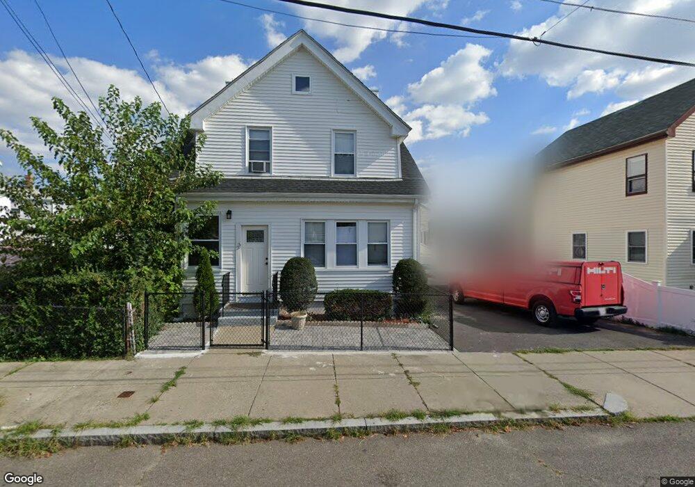
33 Hancock Rd Unit 2 Malden, MA 02148
Linden NeighborhoodEstimated Value: $778,992 - $1,027,000
3
Beds
1
Bath
1,300
Sq Ft
$682/Sq Ft
Est. Value
About This Home
This home is located at 33 Hancock Rd Unit 2, Malden, MA 02148 and is currently estimated at $886,998, approximately $682 per square foot. 33 Hancock Rd Unit 2 is a home located in Middlesex County with nearby schools including Malden High School and Malden Catholic.
Ownership History
Date
Name
Owned For
Owner Type
Purchase Details
Closed on
May 8, 2017
Sold by
Atiki Bouchra
Bought by
Castillo Jesus M
Current Estimated Value
Home Financials for this Owner
Home Financials are based on the most recent Mortgage that was taken out on this home.
Original Mortgage
$562,000
Outstanding Balance
$469,029
Interest Rate
4.23%
Mortgage Type
New Conventional
Estimated Equity
$417,969
Purchase Details
Closed on
Apr 28, 2010
Sold by
Prop Acquisition Grp L
Bought by
Atiki Bouchra
Home Financials for this Owner
Home Financials are based on the most recent Mortgage that was taken out on this home.
Original Mortgage
$294,566
Interest Rate
3.75%
Mortgage Type
FHA
Purchase Details
Closed on
Dec 21, 2009
Sold by
Munoz Clara I
Bought by
Prop Acquisition Grp L
Home Financials for this Owner
Home Financials are based on the most recent Mortgage that was taken out on this home.
Original Mortgage
$135,000
Interest Rate
5.12%
Purchase Details
Closed on
Jul 27, 2006
Sold by
Macfadgen Clara I and Gutierrez Natalia
Bought by
Macfadgen Clara I
Home Financials for this Owner
Home Financials are based on the most recent Mortgage that was taken out on this home.
Original Mortgage
$440,000
Interest Rate
6.67%
Mortgage Type
Purchase Money Mortgage
Purchase Details
Closed on
Jun 29, 2004
Sold by
Telfort Diana A
Bought by
Macfadgen Clara I and Gutierrez Natalia
Home Financials for this Owner
Home Financials are based on the most recent Mortgage that was taken out on this home.
Original Mortgage
$351,200
Interest Rate
6.32%
Mortgage Type
Purchase Money Mortgage
Purchase Details
Closed on
Dec 15, 1999
Sold by
Rollo Maria G
Bought by
Telfort Diana A
Home Financials for this Owner
Home Financials are based on the most recent Mortgage that was taken out on this home.
Original Mortgage
$251,750
Interest Rate
7.81%
Mortgage Type
Purchase Money Mortgage
Purchase Details
Closed on
May 30, 1990
Sold by
Meyers Patrick J
Bought by
Rollo Cesare
Create a Home Valuation Report for This Property
The Home Valuation Report is an in-depth analysis detailing your home's value as well as a comparison with similar homes in the area
Home Values in the Area
Average Home Value in this Area
Purchase History
| Date | Buyer | Sale Price | Title Company |
|---|---|---|---|
| Castillo Jesus M | $562,000 | -- | |
| Atiki Bouchra | $300,000 | -- | |
| Prop Acquisition Grp L | $225,000 | -- | |
| Macfadgen Clara I | -- | -- | |
| Macfadgen Clara I | $439,000 | -- | |
| Telfort Diana A | $265,000 | -- | |
| Rollo Cesare | $189,000 | -- |
Source: Public Records
Mortgage History
| Date | Status | Borrower | Loan Amount |
|---|---|---|---|
| Open | Castillo Jesus M | $562,000 | |
| Previous Owner | Atiki Bouchra | $294,566 | |
| Previous Owner | Rollo Cesare | $135,000 | |
| Previous Owner | Macfadgen Clara I | $440,000 | |
| Previous Owner | Macfadgen Clara I | $41,000 | |
| Previous Owner | Macfadgen Clara I | $351,200 | |
| Previous Owner | Rollo Cesare | $251,750 | |
| Previous Owner | Rollo Cesare | $36,000 |
Source: Public Records
Tax History Compared to Growth
Tax History
| Year | Tax Paid | Tax Assessment Tax Assessment Total Assessment is a certain percentage of the fair market value that is determined by local assessors to be the total taxable value of land and additions on the property. | Land | Improvement |
|---|---|---|---|---|
| 2025 | $78 | $690,100 | $265,100 | $425,000 |
| 2024 | $7,573 | $647,800 | $249,500 | $398,300 |
| 2023 | $7,299 | $598,800 | $226,100 | $372,700 |
| 2022 | $7,007 | $567,400 | $206,700 | $360,700 |
| 2021 | $6,830 | $555,700 | $195,000 | $360,700 |
| 2020 | $6,630 | $524,100 | $180,100 | $344,000 |
| 2019 | $6,331 | $477,100 | $171,600 | $305,500 |
| 2018 | $5,918 | $420,000 | $142,300 | $277,700 |
| 2017 | $5,743 | $405,300 | $142,300 | $263,000 |
| 2016 | $5,508 | $363,300 | $130,600 | $232,700 |
| 2015 | $5,276 | $335,400 | $124,400 | $211,000 |
| 2014 | $4,893 | $303,900 | $113,100 | $190,800 |
Source: Public Records
Map
Nearby Homes
- 770 Washington Ave Unit 405
- 33 Blaine St
- 75 Goldie St
- 563 Lynn St
- 690 Washington Ave
- 4 Anderson Way Unit 2
- 19 Bellvale St
- 1135 Salem St
- 32 Delta Terrace
- 70 Cecilian Ave
- 51 Keayne St
- 109 Salem St Unit 405
- 45 Ann Rd Unit B
- 45 Assunta Rd
- 77 Roland Rd
- 36 Central Ave
- 133 Salem St Unit 418
- 133 Salem St Unit 412
- 133 Salem St Unit 213
- 133 Salem St Unit 416
- 33 Hancock Rd
- 27 Hancock Rd
- 15 Shurtleff St
- 19 Monroe St
- 19 Monroe St Unit 2
- 25 Monroe St
- 25 Monroe St Unit 2
- 38 Hancock Rd
- 32 Hancock Rd
- 28 Hancock Rd
- 27 Monroe St
- 27 Monroe St Unit 1
- 27 Monroe St Unit 2
- 19 Shurtleff St
- 33 Monroe St
- 18 Shurtleff St
- 45 Hancock Rd Unit 47
- 45-47 Hancock Rd
- 24 Hancock Rd
- 24 Shurtleff St