Estimated Value: $739,000 - $1,074,000
3
Beds
3
Baths
1,930
Sq Ft
$446/Sq Ft
Est. Value
About This Home
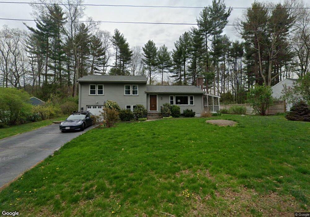
This home is located at 33 Mohegan Rd, Acton, MA 01720 and is currently estimated at $861,595, approximately $446 per square foot. 33 Mohegan Rd is a home located in Middlesex County with nearby schools including Acton-Boxborough Regional High School.
Ownership History
Date
Name
Owned For
Owner Type
Purchase Details
Closed on
Jul 11, 2017
Sold by
Billings Sandra C
Bought by
Billings Sandra Crane
Current Estimated Value
Purchase Details
Closed on
Aug 30, 1995
Sold by
Berkwits Patricia L
Bought by
Billings Stephen R and Billings Sandra C
Home Financials for this Owner
Home Financials are based on the most recent Mortgage that was taken out on this home.
Original Mortgage
$203,000
Interest Rate
7.61%
Mortgage Type
Purchase Money Mortgage
Purchase Details
Closed on
Apr 29, 1994
Sold by
Licari Philip R and Licari Caroline P
Bought by
Berkwits Patricia L
Purchase Details
Closed on
Jun 26, 1992
Sold by
Franzosa Richard G and Gormally Franzosa M
Bought by
Licari Philip R and Licari Caroline P
Create a Home Valuation Report for This Property
The Home Valuation Report is an in-depth analysis detailing your home's value as well as a comparison with similar homes in the area
Home Values in the Area
Average Home Value in this Area
Purchase History
| Date | Buyer | Sale Price | Title Company |
|---|---|---|---|
| Billings Sandra Crane | -- | -- | |
| Billings Stephen R | $261,000 | -- | |
| Berkwits Patricia L | $239,000 | -- | |
| Licari Philip R | $229,000 | -- |
Source: Public Records
Mortgage History
| Date | Status | Borrower | Loan Amount |
|---|---|---|---|
| Previous Owner | Licari Philip R | $351,000 | |
| Previous Owner | Licari Philip R | $191,000 | |
| Previous Owner | Licari Philip R | $203,000 |
Source: Public Records
Tax History Compared to Growth
Tax History
| Year | Tax Paid | Tax Assessment Tax Assessment Total Assessment is a certain percentage of the fair market value that is determined by local assessors to be the total taxable value of land and additions on the property. | Land | Improvement |
|---|---|---|---|---|
| 2025 | $11,317 | $659,900 | $311,200 | $348,700 |
| 2024 | $11,204 | $672,100 | $311,200 | $360,900 |
| 2023 | $10,568 | $601,800 | $282,700 | $319,100 |
| 2022 | $9,768 | $502,200 | $245,900 | $256,300 |
| 2021 | $9,680 | $478,500 | $227,500 | $251,000 |
| 2020 | $9,497 | $493,600 | $227,500 | $266,100 |
| 2019 | $9,311 | $480,700 | $227,500 | $253,200 |
| 2018 | $8,539 | $440,600 | $227,500 | $213,100 |
| 2017 | $8,327 | $436,900 | $227,500 | $209,400 |
| 2016 | $7,911 | $411,400 | $227,500 | $183,900 |
| 2015 | $7,470 | $392,100 | $227,500 | $164,600 |
| 2014 | $7,482 | $384,700 | $227,500 | $157,200 |
Source: Public Records
Map
Nearby Homes
- 4 Huron Rd
- 31 Mohawk Dr
- 9 Elm St Unit 1
- 5 Elm St Unit 1
- 285 Central St Unit 285
- 4 Omega Way
- 89 Windsor Ave
- 68 Macintosh Ln
- 23 John Swift Rd
- 134 Russet Ln
- 4,7,8 Crestwood Ln
- 92 Willow St Unit 3
- 92 Willow St Unit 2
- 90 Willow St Unit 1
- 491 Main St
- 524 Main St
- 709 Main St
- 169 Main St
- 777 Depot Rd
- 159 Skyline Dr Unit 159
- 31 Mohegan Rd
- 35 Mohegan Rd
- 29 Mohegan Rd
- 34 Mohegan Rd
- 32 Mohegan Rd
- 36 Mohegan Rd
- 30 Mohegan Rd
- 30 Mohegan Rd Unit 1
- 21 Freedom Farme Rd
- 37 Mohegan Rd
- 19 Freedom Farme Rd
- 27 Mohegan Rd
- 88 Seminole Rd
- 86 Seminole Rd
- 17 Freedom Farme Rd
- 25 Mohegan Rd
- 84 Seminole Rd
- 11 Freedom Farme Rd
- 24 Mohegan Rd
- 20 Freedom Farme Rd