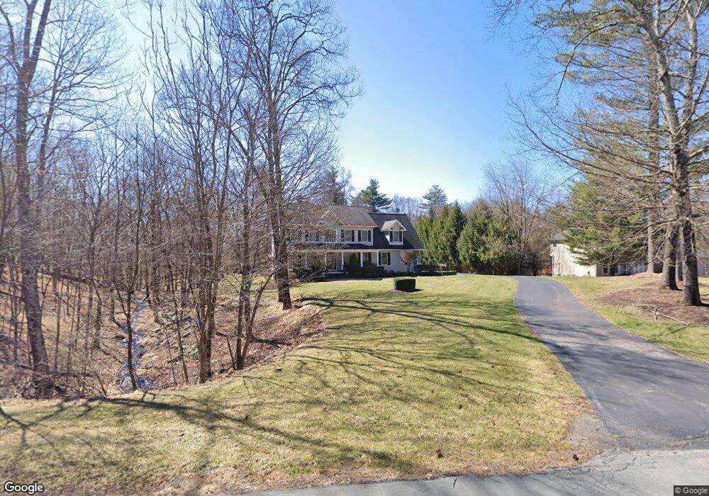
33 Philip Dr Montgomery, NY 12549
Estimated Value: $657,328 - $725,000
4
Beds
3
Baths
2,294
Sq Ft
$298/Sq Ft
Est. Value
About This Home
This home is located at 33 Philip Dr, Montgomery, NY 12549 and is currently estimated at $683,582, approximately $297 per square foot. 33 Philip Dr is a home located in Orange County with nearby schools including Valley Central High School and Montgomery Montessori School.
Ownership History
Date
Name
Owned For
Owner Type
Purchase Details
Closed on
Sep 30, 2003
Sold by
Feder Doron
Bought by
Feder Doron
Current Estimated Value
Purchase Details
Closed on
Jul 1, 2002
Sold by
Hillside Homes & Development Corp
Bought by
Feder Doron and Coates Maureen B
Home Financials for this Owner
Home Financials are based on the most recent Mortgage that was taken out on this home.
Original Mortgage
$200,000
Interest Rate
6.61%
Purchase Details
Closed on
Dec 3, 2001
Sold by
Gjv Enterprises Inc
Bought by
Hillside Homes & Development Corp
Create a Home Valuation Report for This Property
The Home Valuation Report is an in-depth analysis detailing your home's value as well as a comparison with similar homes in the area
Home Values in the Area
Average Home Value in this Area
Purchase History
| Date | Buyer | Sale Price | Title Company |
|---|---|---|---|
| Feder Doron | -- | Esther Mildner | |
| Feder Doron | $357,900 | Attorneys Title Ins Agency I | |
| Hillside Homes & Development Corp | $60,000 | -- |
Source: Public Records
Mortgage History
| Date | Status | Borrower | Loan Amount |
|---|---|---|---|
| Previous Owner | Feder Doron | $200,000 |
Source: Public Records
Tax History Compared to Growth
Tax History
| Year | Tax Paid | Tax Assessment Tax Assessment Total Assessment is a certain percentage of the fair market value that is determined by local assessors to be the total taxable value of land and additions on the property. | Land | Improvement |
|---|---|---|---|---|
| 2024 | $11,774 | $237,240 | $82,200 | $155,040 |
| 2023 | $11,774 | $237,240 | $82,200 | $155,040 |
| 2022 | $12,086 | $237,240 | $82,200 | $155,040 |
| 2021 | $11,996 | $237,240 | $82,200 | $155,040 |
| 2020 | $12,234 | $237,240 | $82,200 | $155,040 |
| 2019 | $11,068 | $237,240 | $82,200 | $155,040 |
| 2018 | $11,068 | $237,240 | $82,200 | $155,040 |
| 2017 | $10,704 | $237,240 | $82,200 | $155,040 |
| 2016 | $10,644 | $237,240 | $82,200 | $155,040 |
| 2015 | -- | $237,240 | $82,200 | $155,040 |
| 2014 | -- | $237,240 | $82,200 | $155,040 |
Source: Public Records
Map
Nearby Homes
- 822 W Kaisertown Rd
- 135 Benedict Rd
- 68 Union School Rd
- 531 State Route 211
- 947 Scotchtown Collabar Rd Unit 947-8
- 83 Little Collabar Rd
- 243 Union St
- 907 Scotchtown Collabar Rd
- 236 Freida St
- 138 Camp Orange Rd
- 0 Chandler Ln
- 145 Youngblood Rd
- 205 Oriole Dr
- 200 Cardinal Dr
- 18 Ohaire Rd
- 114 Union St
- 529 5th Ave
- 509 5th Ave
- 560 Winding Hill Rd
- 132 Boyd St
- 41 Philip Dr
- 38 Philip Dr
- 45 Philip Dr
- 16 Philip Dr
- 44 Philip Dr
- 47 Philip Dr
- 4 Eleanor Dr
- 738 W Kaisertown Rd
- 760 W Kaisertown Rd
- 42 Philip Dr
- 780 W Kaisertown Rd Unit NS
- 739 W Kaisertown Rd
- 723 W Kaisertown Rd
- 804 W Kaisertown Rd
- 722 W Kaisertown Rd
- 714 W Kaisertown Rd
- 789 W Kaisertown Rd
- 818 W Kaisertown Rd
- 807 W Kaisertown Rd
- 48 Philip Dr