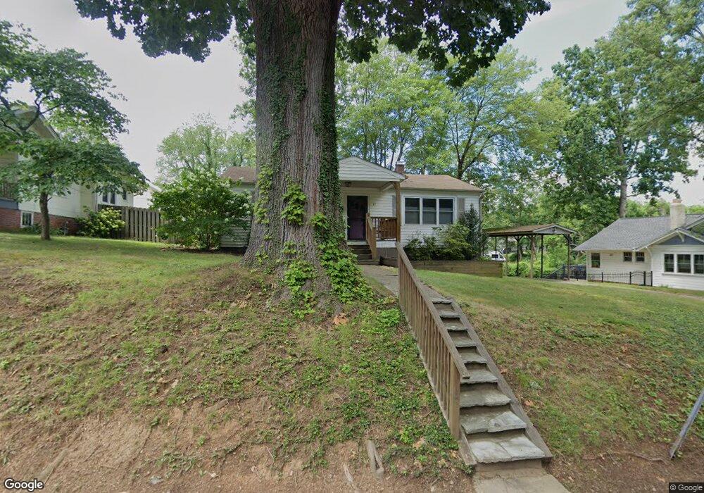
33 Wamboldt Ave Asheville, NC 28806
West Asheville NeighborhoodEstimated Value: $326,000 - $451,000
2
Beds
1
Bath
960
Sq Ft
$393/Sq Ft
Est. Value
About This Home
This home is located at 33 Wamboldt Ave, Asheville, NC 28806 and is currently estimated at $377,702, approximately $393 per square foot. 33 Wamboldt Ave is a home located in Buncombe County with nearby schools including Hall Fletcher Elementary, Isaac Dickson Elementary, and Ira B Jones Elementary.
Ownership History
Date
Name
Owned For
Owner Type
Purchase Details
Closed on
Feb 16, 2023
Sold by
Harding Mark and Harding Polly
Bought by
33 Wamboldt Llc
Current Estimated Value
Purchase Details
Closed on
Nov 9, 2012
Sold by
Burleson Ben and Burleson Christine R
Bought by
Harding Mark and Harding Polly
Purchase Details
Closed on
May 27, 2004
Sold by
Turner Bill
Bought by
Turner Bill and Turner Louella Jackson
Create a Home Valuation Report for This Property
The Home Valuation Report is an in-depth analysis detailing your home's value as well as a comparison with similar homes in the area
Home Values in the Area
Average Home Value in this Area
Purchase History
| Date | Buyer | Sale Price | Title Company |
|---|---|---|---|
| 33 Wamboldt Llc | -- | -- | |
| Harding Mark | $125,000 | None Available | |
| Burleson Ben Lee | -- | None Available | |
| Turner Bill | -- | -- |
Source: Public Records
Tax History Compared to Growth
Tax History
| Year | Tax Paid | Tax Assessment Tax Assessment Total Assessment is a certain percentage of the fair market value that is determined by local assessors to be the total taxable value of land and additions on the property. | Land | Improvement |
|---|---|---|---|---|
| 2025 | $2,479 | $240,000 | $146,200 | $93,800 |
| 2024 | $2,479 | $240,000 | $146,200 | $93,800 |
| 2023 | $2,479 | $240,000 | $146,200 | $93,800 |
| 2022 | $2,393 | $240,000 | $0 | $0 |
| 2021 | $2,393 | $240,000 | $0 | $0 |
| 2020 | $1,871 | $173,600 | $0 | $0 |
| 2019 | $1,871 | $173,600 | $0 | $0 |
| 2018 | $1,871 | $173,600 | $0 | $0 |
| 2017 | $1,889 | $120,200 | $0 | $0 |
| 2016 | $1,477 | $120,200 | $0 | $0 |
| 2015 | $1,477 | $120,200 | $0 | $0 |
| 2014 | $1,459 | $120,200 | $0 | $0 |
Source: Public Records
Map
Nearby Homes
- 40 Brownwood Ave
- 253 Haywood Rd
- 104 Deaver St
- 107 Riverview Dr
- 140 Waynesville Ave
- 30 Waynesville Ave Unit 22
- 315 Haywood Rd Unit 111/211
- 9 Pennsylvania Ave
- 77 Tremont St
- 266 Waynesville Ave
- 85 Tremont St
- 81 Tremont St
- 259 Waynesville Ave Unit 1
- 9 Reynolds Rd
- 0 Haywood Rd
- 74 Logan Ave Unit A1
- 135 Westwood Place
- 60 Sunrise Dr
- 31 Westwood Place
- 45 Waynesville Ave
- 27 Wamboldt Ave
- 35 Wamboldt Ave
- 58 Brownwood Ave
- 58 Brownwood Ave Unit 2
- 21 Wamboldt Ave
- 37 Wamboldt Ave
- 62 Brownwood Ave
- 60 Brownwood Ave
- 64 Brownwood Ave
- 34 Wamboldt Ave
- 40 Wamboldt Ave
- 54 Brownwood Ave
- 66 Brownwood Ave
- 66 Brownwood Ave Unit 7
- 30 Wamboldt Ave
- 25 Wamboldt Ave
- 44 Wamboldt Ave
- 50 Brownwood Ave
- 15 Wamboldt Ave
- 51 Wamboldt Ave