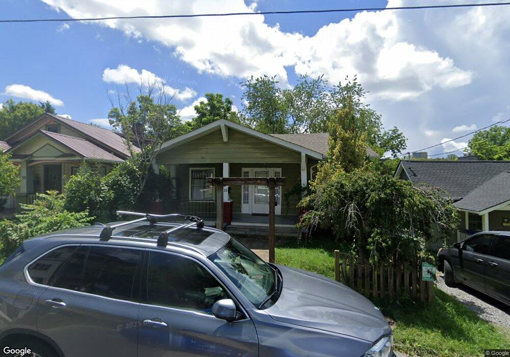
33 Woodrow Ave Asheville, NC 28801
North Asheville NeighborhoodEstimated Value: $499,000 - $652,000
2
Beds
1
Bath
1,454
Sq Ft
$376/Sq Ft
Est. Value
About This Home
This home is located at 33 Woodrow Ave, Asheville, NC 28801 and is currently estimated at $546,845, approximately $376 per square foot. 33 Woodrow Ave is a home located in Buncombe County with nearby schools including Isaac Dickson Elementary, Ira B Jones Elementary, and Hall Fletcher Elementary.
Ownership History
Date
Name
Owned For
Owner Type
Purchase Details
Closed on
Feb 11, 2010
Sold by
Withrow Rebecca Lee and Wurst Brian
Bought by
Withrow Rebecca Lee and Wurst Brian
Current Estimated Value
Home Financials for this Owner
Home Financials are based on the most recent Mortgage that was taken out on this home.
Original Mortgage
$48,000
Interest Rate
5.07%
Mortgage Type
New Conventional
Purchase Details
Closed on
Mar 14, 1997
Sold by
Marlborough Road Properties
Bought by
Withrow
Create a Home Valuation Report for This Property
The Home Valuation Report is an in-depth analysis detailing your home's value as well as a comparison with similar homes in the area
Home Values in the Area
Average Home Value in this Area
Purchase History
| Date | Buyer | Sale Price | Title Company |
|---|---|---|---|
| Withrow Rebecca Lee | -- | None Available | |
| Withrow | $63,000 | -- |
Source: Public Records
Mortgage History
| Date | Status | Borrower | Loan Amount |
|---|---|---|---|
| Closed | Withrow Rebecca Lee | $48,000 |
Source: Public Records
Tax History Compared to Growth
Tax History
| Year | Tax Paid | Tax Assessment Tax Assessment Total Assessment is a certain percentage of the fair market value that is determined by local assessors to be the total taxable value of land and additions on the property. | Land | Improvement |
|---|---|---|---|---|
| 2025 | $3,498 | $338,600 | $129,100 | $209,500 |
| 2024 | $3,498 | $338,600 | $129,100 | $209,500 |
| 2023 | $3,498 | $338,600 | $129,100 | $209,500 |
| 2022 | $3,377 | $338,600 | $0 | $0 |
| 2021 | $3,377 | $338,600 | $0 | $0 |
| 2020 | $2,732 | $253,500 | $0 | $0 |
| 2019 | $2,732 | $253,500 | $0 | $0 |
| 2018 | $2,732 | $253,500 | $0 | $0 |
| 2017 | $2,758 | $184,700 | $0 | $0 |
| 2016 | $2,270 | $184,700 | $0 | $0 |
| 2015 | $2,270 | $184,700 | $0 | $0 |
| 2014 | $2,242 | $184,700 | $0 | $0 |
Source: Public Records
Map
Nearby Homes
- 15 Forsythe St
- 26 Mount Clare Ave
- 54 Holland St
- 118 Woodrow Ave
- 30 Monroe Place
- 102 Holland St
- 233 Broadway St
- 152 Mount Clare Ave
- 229 Broadway St
- 19 Northview St
- 177 Cumberland Ave
- 167 Mount Clare Ave
- 16 Spears Ave Unit 39
- 16 Spears Ave Unit 3
- 181 Merrimon Ave
- 28 Spears Ave
- 190 Broadway St Unit 310
- 84 Elizabeth St
- 13 North St
- 120 Flint St
- 29 Woodrow Ave Unit 1
- 29 Woodrow Ave
- 29 Woodrow Ave Unit 2 (downstairs)
- 35 Woodrow Ave
- 37 Woodrow Ave
- 25 Woodrow Ave
- 999 Woodrow Ave
- 30 Woodrow Ave
- 39 Woodrow Ave
- 21 Woodrow Ave
- 28 Woodrow Ave
- 24 Woodrow Ave
- 49 Woodrow Ave
- 15 Woodrow Ave
- 36 Woodrow Ave
- 43 Mount Clare Ave
- 45 Mount Clare Ave
- 39 Mount Clare Ave
- 51 Mount Clare Ave
- 55 Mount Clare Ave