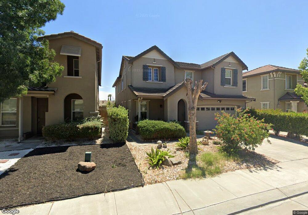
330 Blue Sky Dr Lathrop, CA 95330
East Lathrop NeighborhoodEstimated Value: $469,000 - $647,000
3
Beds
3
Baths
2,417
Sq Ft
$239/Sq Ft
Est. Value
About This Home
This home is located at 330 Blue Sky Dr, Lathrop, CA 95330 and is currently estimated at $577,615, approximately $238 per square foot. 330 Blue Sky Dr is a home located in San Joaquin County with nearby schools including Lathrop Elementary School, Lathrop High School, and Nextgeneration Steam Academy.
Ownership History
Date
Name
Owned For
Owner Type
Purchase Details
Closed on
Aug 18, 2008
Sold by
Richmond American Homes Of Maryland Inc
Bought by
Casil Leine D and Casil Henydin D
Current Estimated Value
Home Financials for this Owner
Home Financials are based on the most recent Mortgage that was taken out on this home.
Original Mortgage
$250,200
Outstanding Balance
$163,729
Interest Rate
6.27%
Mortgage Type
Purchase Money Mortgage
Estimated Equity
$413,886
Create a Home Valuation Report for This Property
The Home Valuation Report is an in-depth analysis detailing your home's value as well as a comparison with similar homes in the area
Home Values in the Area
Average Home Value in this Area
Purchase History
| Date | Buyer | Sale Price | Title Company |
|---|---|---|---|
| Casil Leine D | $278,000 | Chicago Title Company |
Source: Public Records
Mortgage History
| Date | Status | Borrower | Loan Amount |
|---|---|---|---|
| Open | Casil Leine D | $250,200 |
Source: Public Records
Tax History Compared to Growth
Tax History
| Year | Tax Paid | Tax Assessment Tax Assessment Total Assessment is a certain percentage of the fair market value that is determined by local assessors to be the total taxable value of land and additions on the property. | Land | Improvement |
|---|---|---|---|---|
| 2025 | $4,616 | $357,977 | $106,876 | $251,101 |
| 2024 | $4,514 | $350,959 | $104,781 | $246,178 |
| 2023 | $4,391 | $344,078 | $102,727 | $241,351 |
| 2022 | $4,315 | $337,332 | $100,713 | $236,619 |
| 2021 | $4,251 | $330,719 | $98,739 | $231,980 |
| 2020 | $4,093 | $327,329 | $97,727 | $229,602 |
| 2019 | $4,039 | $320,911 | $95,811 | $225,100 |
| 2018 | $3,983 | $314,620 | $93,933 | $220,687 |
| 2017 | $3,924 | $308,452 | $92,092 | $216,360 |
| 2016 | $3,833 | $302,406 | $90,287 | $212,119 |
| 2014 | $3,519 | $291,000 | $87,000 | $204,000 |
Source: Public Records
Map
Nearby Homes
- 15820 S Harlan Rd Unit 85
- 15820 S Harlan Rd Unit 51
- 15820 S Harlan Rd Unit 111
- 15820 S Harlan Rd Unit 158
- 334 Osage Place
- 365 E Louise Ave Unit 3
- 16280 Julie Ln
- 3104 Needham Ave
- 2859 Wylin Blvd
- 337 Gardner Place
- Plan 2 at Westwind at River Islands
- Plan 1 at Westwind at River Islands
- Plan 3 at Westwind at River Islands
- 323 Sacramento St
- Oban Plan at Stanford Crossing - Pacifica
- Macon II Plan at Stanford Crossing - Pacifica
- Knoxville Plan at Stanford Crossing - Pacifica
- 197 E Louise Ave
- 726 Milestone Dr
- 407 Sacramento St
- 322 Blue Sky Dr
- 338 Blue Sky Dr
- 314 Blue Sky Dr
- 346 Blue Sky Dr
- 351 Orlando Ln
- 339 Orlando Ln
- 306 Blue Sky Dr
- 363 Orlando Ln
- 327 Orlando Ln
- 350 Blue Sky Dr
- 339 Blue Sky Dr
- 321 Blue Sky Dr
- 347 Blue Sky Dr
- 298 Blue Sky Dr
- 313 Blue Sky Dr
- 375 Orlando Ln
- 299 Blue Sky Dr
- 315 Orlando Ln
- 358 Blue Sky Dr
- 272 Blue Sky Dr