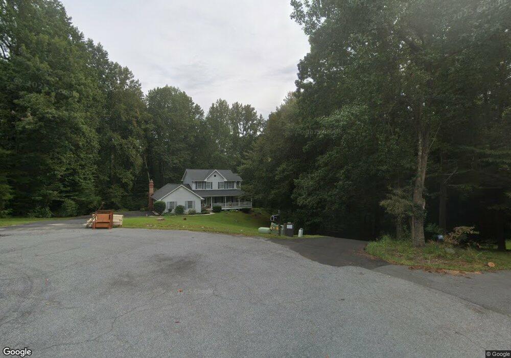
3305 Tiswood Ct Chesapeake Beach, MD 20732
Estimated Value: $517,583 - $597,000
--
Bed
3
Baths
2,388
Sq Ft
$228/Sq Ft
Est. Value
About This Home
This home is located at 3305 Tiswood Ct, Chesapeake Beach, MD 20732 and is currently estimated at $545,646, approximately $228 per square foot. 3305 Tiswood Ct is a home located in Calvert County with nearby schools including Sunderland Elementary School, Plum Point Middle School, and Huntingtown High School.
Ownership History
Date
Name
Owned For
Owner Type
Purchase Details
Closed on
Mar 10, 2003
Sold by
Norris Joseph C and Norris Marian R
Bought by
Norris Marian Rae
Current Estimated Value
Purchase Details
Closed on
Sep 26, 1989
Sold by
Cleary Frank J
Bought by
Norris Joseph C and Norris Marian R
Home Financials for this Owner
Home Financials are based on the most recent Mortgage that was taken out on this home.
Original Mortgage
$161,250
Interest Rate
10.03%
Create a Home Valuation Report for This Property
The Home Valuation Report is an in-depth analysis detailing your home's value as well as a comparison with similar homes in the area
Home Values in the Area
Average Home Value in this Area
Purchase History
| Date | Buyer | Sale Price | Title Company |
|---|---|---|---|
| Norris Marian Rae | -- | -- | |
| Norris Joseph C | $201,600 | -- |
Source: Public Records
Mortgage History
| Date | Status | Borrower | Loan Amount |
|---|---|---|---|
| Previous Owner | Norris Joseph C | $161,250 |
Source: Public Records
Tax History Compared to Growth
Tax History
| Year | Tax Paid | Tax Assessment Tax Assessment Total Assessment is a certain percentage of the fair market value that is determined by local assessors to be the total taxable value of land and additions on the property. | Land | Improvement |
|---|---|---|---|---|
| 2025 | $4,869 | $452,300 | $158,900 | $293,400 |
| 2024 | $4,869 | $431,167 | $0 | $0 |
| 2023 | $4,474 | $410,033 | $0 | $0 |
| 2022 | $4,252 | $388,900 | $158,900 | $230,000 |
| 2021 | $4,061 | $379,133 | $0 | $0 |
| 2020 | $4,061 | $369,367 | $0 | $0 |
| 2019 | $3,974 | $359,600 | $158,900 | $200,700 |
| 2018 | $3,961 | $359,600 | $158,900 | $200,700 |
| 2017 | $4,012 | $359,600 | $0 | $0 |
| 2016 | -- | $363,300 | $0 | $0 |
| 2015 | $4,003 | $363,300 | $0 | $0 |
| 2014 | $4,003 | $363,300 | $0 | $0 |
Source: Public Records
Map
Nearby Homes
- 2785 Ponds Wood Rd
- 3545 Christiana Ct
- 2970 Stinnett Rd
- 3750 Elberta Ln
- 4685 Camp Roosevelt Dr
- 4115 Calvert Dr
- 3164 Dalrymple Rd
- 4950 Hardesty Rd
- 5150 Lenoir Dr
- 4790 Howard Place
- 5209 Larchmont Dr
- 2950 Tobacco Rd
- 3605 Samanthas Way
- 3402 Hillside Place
- 3106 Highview Rd
- 2825 Karen Dr
- 2424 Wildflower Ln
- 3671 Dory Brooks Rd
- 4327 Dalrymple Rd
- 2825 Ridge Rd
- 3307 Tiswood Ct
- 3310 Tiswood Ct
- 3320 Tiswood Ct
- 3345 Tiswood Ct
- 3340 Tiswood Ct
- 4300 Bristol Dr
- 3315 Tiswood Ct
- 4230 Bristol Dr
- 4405 Bristol Dr
- 3402 Bristol Ct
- 4220 Bristol Dr
- 4430 Bristol Dr
- 3420 Charing Ct
- 4210 Bristol Dr
- 4411 Bristol Dr
- 4415 Bristol Dr
- 3430 Charing Ct
- 3306 Tiswood Ct
- 4440 Bristol Dr
- 4160 Bristol Dr