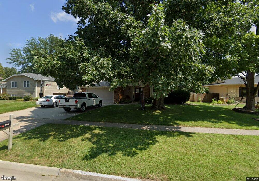
3309 Melanie Dr Urbandale, IA 50322
Estimated Value: $348,000 - $370,000
4
Beds
2
Baths
2,100
Sq Ft
$171/Sq Ft
Est. Value
About This Home
This home is located at 3309 Melanie Dr, Urbandale, IA 50322 and is currently estimated at $359,395, approximately $171 per square foot. 3309 Melanie Dr is a home located in Polk County with nearby schools including Valerius Elementary School, Urbandale Middle School, and Urbandale High School.
Ownership History
Date
Name
Owned For
Owner Type
Purchase Details
Closed on
Nov 9, 2011
Sold by
Nieuwsma Gary P and Nieuwsma Patricia A
Bought by
Lunders Brian W and Lunders Nicole K
Current Estimated Value
Home Financials for this Owner
Home Financials are based on the most recent Mortgage that was taken out on this home.
Original Mortgage
$188,452
Outstanding Balance
$128,035
Interest Rate
4.02%
Mortgage Type
FHA
Estimated Equity
$231,360
Create a Home Valuation Report for This Property
The Home Valuation Report is an in-depth analysis detailing your home's value as well as a comparison with similar homes in the area
Home Values in the Area
Average Home Value in this Area
Purchase History
| Date | Buyer | Sale Price | Title Company |
|---|---|---|---|
| Lunders Brian W | $197,000 | None Available |
Source: Public Records
Mortgage History
| Date | Status | Borrower | Loan Amount |
|---|---|---|---|
| Open | Lunders Brian W | $188,452 |
Source: Public Records
Tax History Compared to Growth
Tax History
| Year | Tax Paid | Tax Assessment Tax Assessment Total Assessment is a certain percentage of the fair market value that is determined by local assessors to be the total taxable value of land and additions on the property. | Land | Improvement |
|---|---|---|---|---|
| 2025 | $5,700 | $348,900 | $75,200 | $273,700 |
| 2024 | $5,700 | $325,200 | $69,200 | $256,000 |
| 2023 | $5,484 | $325,200 | $69,200 | $256,000 |
| 2022 | $5,420 | $264,500 | $58,000 | $206,500 |
| 2021 | $5,402 | $264,500 | $58,000 | $206,500 |
| 2020 | $5,308 | $250,400 | $54,700 | $195,700 |
| 2019 | $4,826 | $250,400 | $54,700 | $195,700 |
| 2018 | $4,646 | $218,400 | $46,200 | $172,200 |
| 2017 | $4,252 | $218,400 | $46,200 | $172,200 |
| 2016 | $4,142 | $197,100 | $41,100 | $156,000 |
| 2015 | $4,142 | $197,100 | $41,100 | $156,000 |
| 2014 | $4,124 | $202,300 | $41,700 | $160,600 |
Source: Public Records
Map
Nearby Homes
- Lot 1 Hillsdale Dr
- 3320 Patricia Dr
- 4500 90th St
- 4505 90th St
- 4517 90th St
- 3808 Mary Lynn Dr
- 3805 Melanie Cir
- 37 89th St
- 3889 92nd Dr
- 3913 Horton Trail
- 3916 Greenview Dr
- 1590 Parkside Ln
- 1630 Parkside Ln
- 1550 Parkside Ln
- 1600 Parkside Ln
- 2908 88th Ct
- 3957 92nd Dr
- 4016 Patricia Dr
- 2 Quail Ridge
- 3 Quail Ridge
- 3313 Melanie Dr
- 3305 Melanie Dr
- 3308 Mary Lynn Dr
- 3317 Melanie Dr
- 3312 Mary Lynn Dr
- 3301 Melanie Dr
- 3304 Mary Lynn Dr
- 3308 Melanie Dr
- 3312 Melanie Dr
- 3401 Melanie Dr
- 3400 Mary Lynn Dr
- 9401 Dewey Gibbs Rd
- 3316 Melanie Dr
- 3300 Melanie Dr
- 3400 Melanie Dr
- 3405 Melanie Dr
- 3315 Mary Lynn Dr
- 3305 Eula Dr
- 3309 Mary Lynn Dr
- 3309 Eula Dr