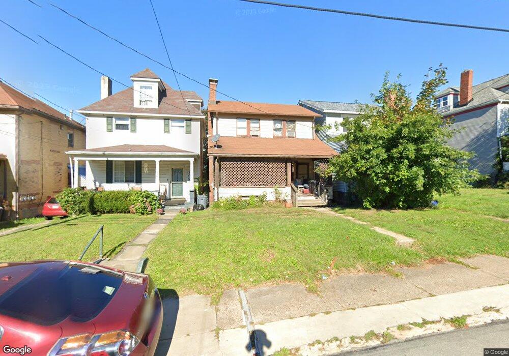
331 Freeport Rd New Kensington, PA 15068
Estimated Value: $74,000 - $111,000
--
Bed
--
Bath
--
Sq Ft
3,746
Sq Ft Lot
About This Home
This home is located at 331 Freeport Rd, New Kensington, PA 15068 and is currently estimated at $87,619. 331 Freeport Rd is a home located in Westmoreland County with nearby schools including Mary Queen of Apostles School.
Ownership History
Date
Name
Owned For
Owner Type
Purchase Details
Closed on
Aug 14, 2019
Sold by
Lipanot Janice L and Lipanot Gregg E
Bought by
Seger Judie
Current Estimated Value
Home Financials for this Owner
Home Financials are based on the most recent Mortgage that was taken out on this home.
Original Mortgage
$40,000
Outstanding Balance
$35,033
Interest Rate
3.7%
Mortgage Type
New Conventional
Estimated Equity
$52,586
Purchase Details
Closed on
Oct 11, 2016
Sold by
Keller Debra L
Bought by
Lipanot Janice L
Purchase Details
Closed on
May 6, 2005
Sold by
Keller Debra L
Bought by
Keller Debra L
Create a Home Valuation Report for This Property
The Home Valuation Report is an in-depth analysis detailing your home's value as well as a comparison with similar homes in the area
Home Values in the Area
Average Home Value in this Area
Purchase History
| Date | Buyer | Sale Price | Title Company |
|---|---|---|---|
| Seger Judie | $40,000 | None Available | |
| Lipanot Janice L | $45,000 | None Available | |
| Keller Debra L | -- | -- |
Source: Public Records
Mortgage History
| Date | Status | Borrower | Loan Amount |
|---|---|---|---|
| Open | Seger Judie | $40,000 |
Source: Public Records
Tax History Compared to Growth
Tax History
| Year | Tax Paid | Tax Assessment Tax Assessment Total Assessment is a certain percentage of the fair market value that is determined by local assessors to be the total taxable value of land and additions on the property. | Land | Improvement |
|---|---|---|---|---|
| 2025 | $1,467 | $9,190 | $1,940 | $7,250 |
| 2024 | $1,453 | $9,190 | $1,940 | $7,250 |
| 2023 | $1,375 | $9,190 | $1,940 | $7,250 |
| 2022 | $1,333 | $9,190 | $1,940 | $7,250 |
| 2021 | $1,303 | $9,190 | $1,940 | $7,250 |
| 2020 | $1,275 | $9,190 | $1,940 | $7,250 |
| 2019 | $1,243 | $9,190 | $1,940 | $7,250 |
| 2018 | $1,225 | $9,190 | $1,940 | $7,250 |
| 2017 | $1,207 | $9,190 | $1,940 | $7,250 |
| 2016 | $1,207 | $9,190 | $1,940 | $7,250 |
| 2015 | $1,207 | $9,190 | $1,940 | $7,250 |
| 2014 | $1,159 | $9,190 | $1,940 | $7,250 |
Source: Public Records
Map
Nearby Homes
- 318 Ridge Ave
- 486 McCargo St
- 327 Charles Ave
- 254 Ridge Ave
- 1025 Kenneth Ave
- 225 Highland Ave
- 1134 Leishman Ave
- 168 Short St
- 1218 Woodmont Ave
- 159 Freeport Rd
- 201 Locust St
- 105 Locust St
- 1240 Victoria Ave
- 533 Freeport Rd
- 1233 Kenneth Ave
- 1312 Woodmont Ave
- 1308 Taylor Ave
- 125 North St
- 1512 Kenneth Ave
- Lots 12-14 Ross Ave
- 333 Freeport Rd
- 329 Freeport Rd
- 335 Freeport Rd
- 325 Freeport Rd
- 337 Freeport Rd
- 339 Freeport Rd
- 323 Freeport Rd
- 321 Freeport Rd
- 340 Ridge Ave
- 344 Ridge Ave
- 326 Freeport Rd
- 336 Ridge Ave
- 330 Freeport Rd
- 348 Ridge Ave
- 332 Ridge Ave
- 324 Freeport Rd
- 352 Ridge Ave
- 332 Freeport Rd
- 328 Ridge Ave
- 315 Freeport Rd