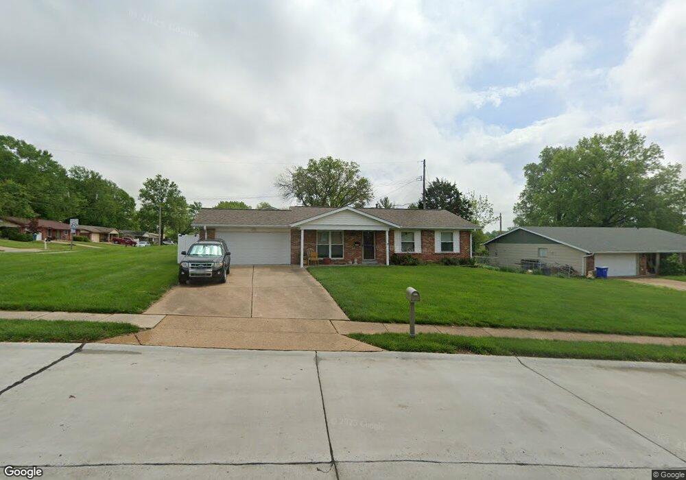
3320 Taylor Ave Bridgeton, MO 63044
Estimated Value: $249,000 - $284,000
3
Beds
2
Baths
1,120
Sq Ft
$238/Sq Ft
Est. Value
About This Home
This home is located at 3320 Taylor Ave, Bridgeton, MO 63044 and is currently estimated at $266,984, approximately $238 per square foot. 3320 Taylor Ave is a home located in St. Louis County with nearby schools including Bridgeway Elementary School, Pattonville Heights Middle School, and Pattonville High School.
Ownership History
Date
Name
Owned For
Owner Type
Purchase Details
Closed on
Nov 21, 2008
Sold by
Anderson Wilma E and Anderson Dennis
Bought by
Bail Diana M
Current Estimated Value
Home Financials for this Owner
Home Financials are based on the most recent Mortgage that was taken out on this home.
Original Mortgage
$140,000
Outstanding Balance
$93,697
Interest Rate
6.48%
Mortgage Type
Purchase Money Mortgage
Estimated Equity
$173,287
Create a Home Valuation Report for This Property
The Home Valuation Report is an in-depth analysis detailing your home's value as well as a comparison with similar homes in the area
Home Values in the Area
Average Home Value in this Area
Purchase History
| Date | Buyer | Sale Price | Title Company |
|---|---|---|---|
| Bail Diana M | $148,500 | Ust |
Source: Public Records
Mortgage History
| Date | Status | Borrower | Loan Amount |
|---|---|---|---|
| Open | Bail Diana M | $140,000 |
Source: Public Records
Tax History Compared to Growth
Tax History
| Year | Tax Paid | Tax Assessment Tax Assessment Total Assessment is a certain percentage of the fair market value that is determined by local assessors to be the total taxable value of land and additions on the property. | Land | Improvement |
|---|---|---|---|---|
| 2025 | $3,404 | $47,200 | $11,440 | $35,760 |
| 2024 | $3,404 | $41,970 | $9,650 | $32,320 |
| 2023 | $3,418 | $41,970 | $9,650 | $32,320 |
| 2022 | $3,073 | $34,040 | $7,900 | $26,140 |
| 2021 | $3,033 | $34,040 | $7,900 | $26,140 |
| 2020 | $2,790 | $30,380 | $7,900 | $22,480 |
| 2019 | $2,797 | $30,380 | $7,900 | $22,480 |
| 2018 | $2,669 | $26,730 | $5,280 | $21,450 |
| 2017 | $2,628 | $26,730 | $5,280 | $21,450 |
| 2016 | $2,305 | $23,010 | $5,280 | $17,730 |
| 2015 | $2,283 | $23,010 | $5,280 | $17,730 |
| 2014 | $2,393 | $24,020 | $6,370 | $17,650 |
Source: Public Records
Map
Nearby Homes
- 11525 Ivy Green Dr
- 3202 Denmark Dr Unit C
- 3206 Denmark Dr Unit D
- 11410 Essex Ave
- 3106 Carnaby Ln Unit C
- 3107 Garnette Dr Unit C12
- 3107 Garnette Dr Unit A7
- 3137 Roger Williams Dr Unit A
- 3137 Roger Williams Dr Unit C
- 3142 Roger Williams Dr
- 11533 Old Saint Charles Rd
- 11482 Essex Ave
- 3623 Bridgeton Valley Cir
- 3114 Edwards Place Unit 304
- 3108 Edwards Place Unit 201
- 11342 de Runtz Ave
- 3291 Bristol Hall Dr
- 11140 Fort Samuel Dr
- 11128 Fort Samuel Dr
- 3754 Red Hawk Ct
- 11482 Burgess Ave
- 3316 Taylor Ave
- 3315 Taylor Ave
- 11474 Burgess Ave
- 3330 Taylor Ave
- 11481 Burgess Ave
- 3308 Taylor Ave
- 3307 Taylor Ave
- 11508 Burgess Ave
- 3325 Taylor Ave
- 11466 Burgess Ave
- 11475 Burgess Ave
- 11515 Ivy Green Dr
- 3298 Taylor Ave
- 11511 Burgess Ave
- 11467 Burgess Ave
- 11516 Burgess Ave
- 3350 Taylor Ave
- 3295 Bridgeport Place Dr
- 3297 Taylor Ave