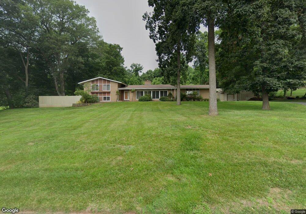
333 Brownstone Ridge Meriden, CT 06451
Estimated Value: $472,000 - $578,000
3
Beds
2
Baths
3,058
Sq Ft
$166/Sq Ft
Est. Value
About This Home
This home is located at 333 Brownstone Ridge, Meriden, CT 06451 and is currently estimated at $506,384, approximately $165 per square foot. 333 Brownstone Ridge is a home located in New Haven County with nearby schools including Hanover School, Lincoln Middle School, and Orville H. Platt High School.
Ownership History
Date
Name
Owned For
Owner Type
Purchase Details
Closed on
Nov 2, 2001
Sold by
Lemieux Gilmay M
Bought by
May Jeffrey and Duffy Marston S
Current Estimated Value
Home Financials for this Owner
Home Financials are based on the most recent Mortgage that was taken out on this home.
Original Mortgage
$263,600
Interest Rate
6.82%
Create a Home Valuation Report for This Property
The Home Valuation Report is an in-depth analysis detailing your home's value as well as a comparison with similar homes in the area
Home Values in the Area
Average Home Value in this Area
Purchase History
| Date | Buyer | Sale Price | Title Company |
|---|---|---|---|
| May Jeffrey | $329,500 | -- |
Source: Public Records
Mortgage History
| Date | Status | Borrower | Loan Amount |
|---|---|---|---|
| Open | May Jeffrey | $256,000 | |
| Closed | May Jeffrey | $263,600 | |
| Previous Owner | May Jeffrey | $150,000 |
Source: Public Records
Tax History Compared to Growth
Tax History
| Year | Tax Paid | Tax Assessment Tax Assessment Total Assessment is a certain percentage of the fair market value that is determined by local assessors to be the total taxable value of land and additions on the property. | Land | Improvement |
|---|---|---|---|---|
| 2025 | $10,043 | $250,460 | $62,020 | $188,440 |
| 2024 | $9,094 | $250,460 | $62,020 | $188,440 |
| 2023 | $8,714 | $250,460 | $62,020 | $188,440 |
| 2022 | $8,263 | $250,460 | $62,020 | $188,440 |
| 2021 | $8,603 | $210,560 | $70,140 | $140,420 |
| 2020 | $8,603 | $210,560 | $70,140 | $140,420 |
| 2019 | $8,440 | $206,570 | $70,070 | $136,500 |
| 2018 | $8,478 | $206,570 | $70,070 | $136,500 |
| 2017 | $8,246 | $206,570 | $70,070 | $136,500 |
| 2016 | $7,503 | $204,820 | $62,720 | $142,100 |
| 2015 | $7,503 | $204,820 | $62,720 | $142,100 |
| 2014 | $7,320 | $204,820 | $62,720 | $142,100 |
Source: Public Records
Map
Nearby Homes
- 171 Oregon Rd
- 274 Riverside Dr
- 295 & 305 (Lot 103 & Oregon St
- 0 River Rd
- 163 Glen Hills Rd
- 125 Dana Ln
- 350 Glen Hills Rd
- 661 Allen Ave
- 66 Dana Ln
- 56 Glen Hills Rd
- 16 Greenway Place
- 55 Peacock Dr
- 25 Suzy Ct
- 176 Hancock St
- 24 Harrington St
- 44 Douglas Dr
- 36 Red Fox Ln
- 73 Sunrise Hill
- 194 Debbie Dr
- 145 Deer Run Rd
- 351 Brownstone Ridge
- 309 Brownstone Ridge
- 340 Brownstone Ridge
- 31 Orchard Hill Rd
- 300 Brownstone Ridge
- 350 Brownstone Ridge
- 285 Brownstone Ridge
- 280 Brownstone Ridge
- 2 Orchard Hill Rd
- 53 Orchard Hill Rd
- 428 Brownstone Ridge
- 370 Brownstone Ridge
- 32 Orchard Hill Rd
- 406 Brownstone Ridge
- 448 Brownstone Ridge
- 464 Brownstone Ridge
- 265 Brownstone Ridge
- 478 Brownstone Ridge
- 52 Orchard Hill Rd
- 256 Brownstone Ridge