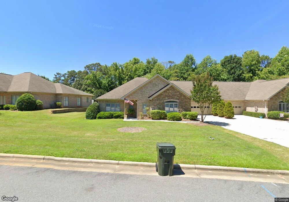
333 Cannon Ct Asheboro, NC 27205
Estimated Value: $509,000 - $547,202
--
Bed
3
Baths
2,960
Sq Ft
$180/Sq Ft
Est. Value
About This Home
This home is located at 333 Cannon Ct, Asheboro, NC 27205 and is currently estimated at $533,301, approximately $180 per square foot. 333 Cannon Ct is a home located in Randolph County with nearby schools including Charles W. McCrary Elementary School, North Asheboro Middle School, and Asheboro High School.
Ownership History
Date
Name
Owned For
Owner Type
Purchase Details
Closed on
Feb 2, 2004
Sold by
Mid Atlantic Town Homes Llc
Bought by
Koonce Philip H and Koonce Marilyn M
Current Estimated Value
Home Financials for this Owner
Home Financials are based on the most recent Mortgage that was taken out on this home.
Original Mortgage
$200,000
Outstanding Balance
$93,337
Interest Rate
5.87%
Mortgage Type
Purchase Money Mortgage
Estimated Equity
$439,964
Create a Home Valuation Report for This Property
The Home Valuation Report is an in-depth analysis detailing your home's value as well as a comparison with similar homes in the area
Home Values in the Area
Average Home Value in this Area
Purchase History
| Date | Buyer | Sale Price | Title Company |
|---|---|---|---|
| Koonce Philip H | $251,000 | -- |
Source: Public Records
Mortgage History
| Date | Status | Borrower | Loan Amount |
|---|---|---|---|
| Open | Koonce Philip H | $200,000 |
Source: Public Records
Tax History Compared to Growth
Tax History
| Year | Tax Paid | Tax Assessment Tax Assessment Total Assessment is a certain percentage of the fair market value that is determined by local assessors to be the total taxable value of land and additions on the property. | Land | Improvement |
|---|---|---|---|---|
| 2025 | $5,731 | $432,440 | $50,000 | $382,440 |
| 2024 | $5,731 | $432,440 | $50,000 | $382,440 |
| 2023 | $5,731 | $432,440 | $50,000 | $382,440 |
| 2022 | $5,195 | $360,390 | $45,000 | $315,390 |
| 2021 | $5,195 | $360,390 | $45,000 | $315,390 |
| 2020 | $5,195 | $360,390 | $45,000 | $315,390 |
| 2019 | $5,195 | $360,390 | $45,000 | $315,390 |
| 2018 | $4,622 | $314,960 | $30,000 | $284,960 |
| 2016 | $4,622 | $314,956 | $30,000 | $284,956 |
| 2015 | $4,630 | $314,956 | $30,000 | $284,956 |
| 2014 | -- | $314,956 | $30,000 | $284,956 |
Source: Public Records
Map
Nearby Homes
- 1263 Winslow Ave Unit A, B & C
- 923 Arnold St
- 135 West St
- 627 Oakmont Dr
- 830 Sunset Ave
- 435 Peachtree St
- 711 Sunset Ave Unit E
- 516 and 518 Peachtree St
- 866 Mountain Rd
- 612 Sunset Ave Unit 6
- 1110 Park Dr
- TBD Oakland Ave
- 401 Uwharrie St
- 135 Dixon St
- 0000 Little Gate Dr
- 0 Highwood Dr
- 1011 Westmont Dr
- 1582 Westmont Dr
- 617 Uwharrie St Unit N
- 330 W Presnell St Unit 37
- 339 Cannon Ct
- 323 Cannon Ct
- 317 Cannon Ct
- 334 Cannon Ct
- 326 Cannon Ct
- 345 Cannon Ct
- 340 Cannon Ct
- 320 Cannon Ct
- 351 Cannon Ct
- 311 Cannon Ct
- 314 Cannon Ct
- 305 Cannon Ct
- 308 Cannon Ct
- 238 Southway Rd
- 319 Lexington Rd
- 1164 Lexington Commons Dr
- 232 Southway Rd
- 366 Lexington Rd
- 1185 Lexington Commons Dr
- 1177 Lexington Commons Dr