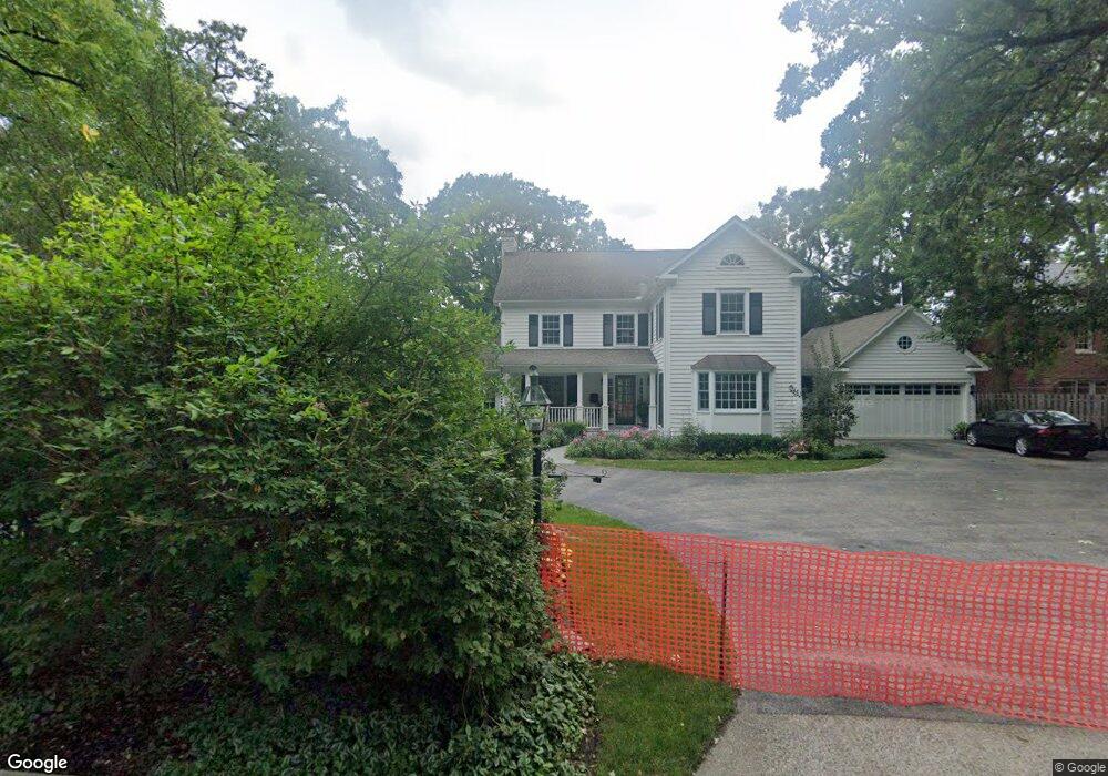
333 Forest Ln Libertyville, IL 60048
Estimated Value: $991,000 - $1,293,000
3
Beds
3
Baths
1,777
Sq Ft
$649/Sq Ft
Est. Value
About This Home
This home is located at 333 Forest Ln, Libertyville, IL 60048 and is currently estimated at $1,153,813, approximately $649 per square foot. 333 Forest Ln is a home located in Lake County with nearby schools including Butterfield School, Highland Middle School, and Libertyville High School.
Ownership History
Date
Name
Owned For
Owner Type
Purchase Details
Closed on
Dec 23, 2024
Sold by
Alde Carl W and Alde Lindsay B
Bought by
Carl Walter Alde And Lindsay Buss Alde Revoca and Alde
Current Estimated Value
Create a Home Valuation Report for This Property
The Home Valuation Report is an in-depth analysis detailing your home's value as well as a comparison with similar homes in the area
Home Values in the Area
Average Home Value in this Area
Purchase History
| Date | Buyer | Sale Price | Title Company |
|---|---|---|---|
| Carl Walter Alde And Lindsay Buss Alde Revoca | -- | None Listed On Document | |
| Carl Walter Alde And Lindsay Buss Alde Revoca | -- | None Listed On Document |
Source: Public Records
Tax History Compared to Growth
Tax History
| Year | Tax Paid | Tax Assessment Tax Assessment Total Assessment is a certain percentage of the fair market value that is determined by local assessors to be the total taxable value of land and additions on the property. | Land | Improvement |
|---|---|---|---|---|
| 2024 | $28,849 | $405,720 | $194,427 | $211,293 |
| 2023 | $23,959 | $374,212 | $179,328 | $194,884 |
| 2022 | $23,959 | $305,571 | $172,365 | $133,206 |
| 2021 | $23,075 | $298,994 | $168,655 | $130,339 |
| 2020 | $20,286 | $293,967 | $165,819 | $128,148 |
| 2019 | $19,762 | $291,171 | $164,242 | $126,929 |
| 2018 | $11,385 | $361,561 | $171,008 | $190,553 |
| 2017 | $23,900 | $350,146 | $165,609 | $184,537 |
| 2016 | $22,142 | $295,326 | $157,020 | $138,306 |
| 2015 | $21,884 | $274,936 | $146,761 | $128,175 |
| 2014 | $20,134 | $258,329 | $137,897 | $120,432 |
| 2012 | $18,888 | $250,551 | $133,745 | $116,806 |
Source: Public Records
Map
Nearby Homes
- 420 W Cook Ave
- 505 Lange Ct
- 551 W Park Ave Unit E
- 212 Elm Ct
- 308 Mckinley Ave
- 423 Ames St
- 1754 Glenmore Rd
- 0 Ames St
- 217 E Church St
- 619 Parkside Ct
- 533 Drake St
- 212 W Ellis Ave
- 616 Parkside Ct
- 662 Parkside Ct
- 694 Parkside Ct
- 208 W Ellis Ave
- 204 W Ellis Ave
- 922 N Milwaukee Ave Unit A
- 224 Newberry Ave
- 426 S Milwaukee Ave
- 317 Forest Ln
- 400 Forest Ln
- 309 Forest Ln
- 309 Forest Ln
- 217 Homewood Ave
- 215 Homewood Ave
- 404 Forest Ln
- 225 Homewood Ave
- 213 Homewood Ave
- 309 Homewood Ave
- 205 Homewood Ave
- 315 Homewood Ave
- 405 Laurel Ave
- 422 Laurel Ave
- 503 Linden Ln
- 236 Sunset Dr
- 216 Homewood Ave
- 220 Homewood Ave
- 232 Sunset Dr
- 226 Homewood Ave