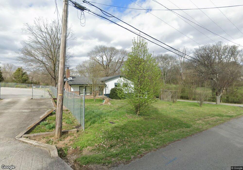
333 Homestead Rd Nashville, TN 37207
Talbot's Corner NeighborhoodEstimated Value: $368,000 - $590,000
3
Beds
2
Baths
2,351
Sq Ft
$196/Sq Ft
Est. Value
About This Home
This home is located at 333 Homestead Rd, Nashville, TN 37207 and is currently estimated at $460,213, approximately $195 per square foot. 333 Homestead Rd is a home located in Davidson County with nearby schools including Chadwell Elementary School, Jere Baxter Middle, and Maplewood Comprehensive High School.
Ownership History
Date
Name
Owned For
Owner Type
Purchase Details
Closed on
Sep 2, 2009
Sold by
Coats William M
Bought by
Xu Shu Qian and Sun Dong Lian
Current Estimated Value
Purchase Details
Closed on
Oct 20, 2008
Sold by
Lambert Robert and Lambert Lesley
Bought by
Coats William M
Purchase Details
Closed on
Mar 2, 2006
Sold by
Coats William M
Bought by
Lambert Robert and Lambert Lesley M
Home Financials for this Owner
Home Financials are based on the most recent Mortgage that was taken out on this home.
Original Mortgage
$92,000
Interest Rate
10.4%
Mortgage Type
Unknown
Purchase Details
Closed on
Sep 22, 2000
Sold by
Rist John C and Rist Nina E
Bought by
Coats William M
Create a Home Valuation Report for This Property
The Home Valuation Report is an in-depth analysis detailing your home's value as well as a comparison with similar homes in the area
Home Values in the Area
Average Home Value in this Area
Purchase History
| Date | Buyer | Sale Price | Title Company |
|---|---|---|---|
| Xu Shu Qian | $101,000 | None Available | |
| Coats William M | $76,000 | None Available | |
| Lambert Robert | $115,000 | None Available | |
| Coats William M | $69,000 | -- |
Source: Public Records
Mortgage History
| Date | Status | Borrower | Loan Amount |
|---|---|---|---|
| Previous Owner | Lambert Robert | $92,000 |
Source: Public Records
Tax History Compared to Growth
Tax History
| Year | Tax Paid | Tax Assessment Tax Assessment Total Assessment is a certain percentage of the fair market value that is determined by local assessors to be the total taxable value of land and additions on the property. | Land | Improvement |
|---|---|---|---|---|
| 2024 | $2,331 | $71,650 | $51,825 | $19,825 |
| 2023 | $2,331 | $71,650 | $51,825 | $19,825 |
| 2022 | $2,332 | $71,650 | $51,825 | $19,825 |
| 2021 | $2,356 | $71,650 | $51,825 | $19,825 |
| 2020 | $1,874 | $44,400 | $25,925 | $18,475 |
| 2019 | $1,401 | $44,400 | $25,925 | $18,475 |
| 2018 | $1,401 | $44,400 | $25,925 | $18,475 |
| 2017 | $1,401 | $44,400 | $25,925 | $18,475 |
| 2016 | $1,445 | $32,000 | $19,450 | $12,550 |
| 2015 | $1,445 | $32,000 | $19,450 | $12,550 |
| 2014 | $1,445 | $32,000 | $19,450 | $12,550 |
Source: Public Records
Map
Nearby Homes
- 318 Homestead Rd
- 316 Homestead Rd
- 3129 Oak Ridge Dr
- 413 Vailview Dr
- 393 Oakview Dr
- 166 Oak Valley Dr
- 216 Broadmoor Dr
- 2113 Creekland View Blvd
- 3047 Hillside Rd
- 0 Robb Rd N Unit RTC2820869
- 3005 Stanwyck Dr
- 3313 Leondale Terrace
- 2952 Hillhurst Dr
- 329 E Village Ln
- 3229 Moorewood Dr
- 339 E Village Ln
- 106 Mammoth Pass
- 102 Mammoth Pass
- 3061 Richmond Hill Dr
- 354 E Village Ln
- 329 Homestead Rd
- 335 Homestead Rd
- 330 Homestead Rd
- 332 Homestead Rd
- 336 Homestead Rd
- 326 Homestead Rd
- 339 Homestead Rd
- 322 Homestead Rd
- 129 Southridge Dr
- 340 Oakview Dr
- 133 Southridge Dr
- 344 Oakview Dr
- 348 Oakview Dr
- 336 Oakview Dr
- 137 Southridge Dr
- 356 Oakview Dr
- 310 Homestead Rd
- 3135 Oak Ridge Dr
- 3539 Dickerson Pike
- 2700 Dickerson Pike