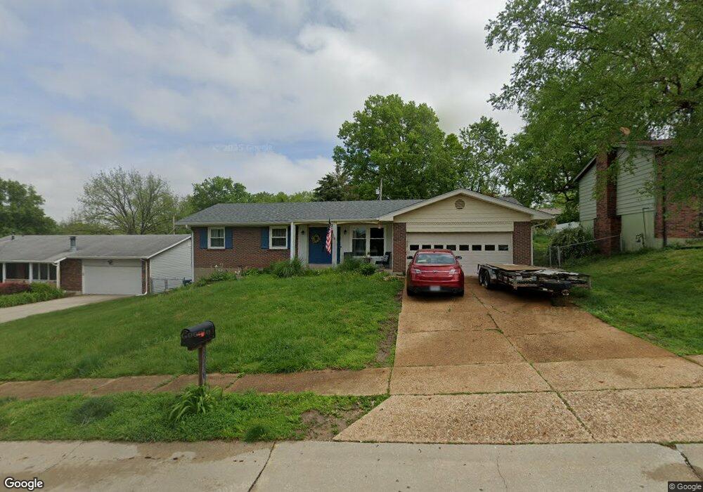
3338 Greenbridge Dr Bridgeton, MO 63044
Estimated Value: $236,000 - $302,000
3
Beds
2
Baths
1,305
Sq Ft
$209/Sq Ft
Est. Value
About This Home
This home is located at 3338 Greenbridge Dr, Bridgeton, MO 63044 and is currently estimated at $272,960, approximately $209 per square foot. 3338 Greenbridge Dr is a home located in St. Louis County with nearby schools including Bridgeway Elementary School, Pattonville Heights Middle School, and Pattonville High School.
Ownership History
Date
Name
Owned For
Owner Type
Purchase Details
Closed on
Apr 26, 2004
Sold by
Cole Alicia R and Cole Robert F
Bought by
Cole Robert F and Cole Alicia R
Current Estimated Value
Home Financials for this Owner
Home Financials are based on the most recent Mortgage that was taken out on this home.
Original Mortgage
$144,000
Outstanding Balance
$65,929
Interest Rate
5.38%
Mortgage Type
Stand Alone Refi Refinance Of Original Loan
Estimated Equity
$207,031
Purchase Details
Closed on
Dec 1, 2000
Sold by
Cole Robert F
Bought by
Cole Robert F and Raley Alicia R
Home Financials for this Owner
Home Financials are based on the most recent Mortgage that was taken out on this home.
Original Mortgage
$92,025
Interest Rate
7.72%
Mortgage Type
FHA
Create a Home Valuation Report for This Property
The Home Valuation Report is an in-depth analysis detailing your home's value as well as a comparison with similar homes in the area
Home Values in the Area
Average Home Value in this Area
Purchase History
| Date | Buyer | Sale Price | Title Company |
|---|---|---|---|
| Cole Robert F | -- | Residential Title Svcs Inc | |
| Cole Robert F | $105,000 | -- | |
| Cole Robert F | -- | -- |
Source: Public Records
Mortgage History
| Date | Status | Borrower | Loan Amount |
|---|---|---|---|
| Open | Cole Robert F | $144,000 | |
| Closed | Cole Robert F | $92,025 |
Source: Public Records
Tax History Compared to Growth
Tax History
| Year | Tax Paid | Tax Assessment Tax Assessment Total Assessment is a certain percentage of the fair market value that is determined by local assessors to be the total taxable value of land and additions on the property. | Land | Improvement |
|---|---|---|---|---|
| 2025 | $3,426 | $49,490 | $11,550 | $37,940 |
| 2024 | $3,426 | $42,240 | $9,770 | $32,470 |
| 2023 | $3,426 | $42,240 | $9,770 | $32,470 |
| 2022 | $3,080 | $34,110 | $7,980 | $26,130 |
| 2021 | $3,039 | $34,110 | $7,980 | $26,130 |
| 2020 | $3,038 | $33,100 | $7,980 | $25,120 |
| 2019 | $3,045 | $33,100 | $7,980 | $25,120 |
| 2018 | $2,816 | $28,220 | $5,320 | $22,900 |
| 2017 | $2,773 | $28,220 | $5,320 | $22,900 |
| 2016 | $2,461 | $24,590 | $5,320 | $19,270 |
| 2015 | $2,438 | $24,590 | $5,320 | $19,270 |
| 2014 | $2,633 | $26,460 | $6,400 | $20,060 |
Source: Public Records
Map
Nearby Homes
- 11525 Ivy Green Dr
- 11410 Essex Ave
- 3202 Denmark Dr Unit C
- 11482 Essex Ave
- 3107 Garnette Dr Unit C12
- 3107 Garnette Dr Unit A7
- 3206 Denmark Dr Unit D
- 3106 Carnaby Ln Unit C
- 11533 Old Saint Charles Rd
- 3137 Roger Williams Dr Unit A
- 3137 Roger Williams Dr Unit C
- 3142 Roger Williams Dr
- 11342 de Runtz Ave
- 3114 Edwards Place Unit 304
- 3108 Edwards Place Unit 201
- 3623 Bridgeton Valley Cir
- 11140 Fort Samuel Dr
- 3191 Donnycave Ln
- 3291 Bristol Hall Dr
- 11128 Fort Samuel Dr
- 3334 Greenbridge Dr
- 3342 Greenbridge Dr
- 11548 Burgess Ave
- 11556 Burgess Ave
- 3326 Greenbridge Dr
- 3350 Greenbridge Dr
- 11540 Burgess Ave
- 3341 Greenbridge Dr
- 11564 Burgess Ave
- 3349 Greenbridge Dr
- 3333 Greenbridge Dr
- 11574 Burgess Ave
- 3318 Greenbridge Dr
- 3357 Greenbridge Dr
- 11532 Burgess Ave
- 3325 Greenbridge Dr
- 3284 Gwengreen Dr
- 3290 Gwengreen Dr
- 3280 Gwengreen Dr