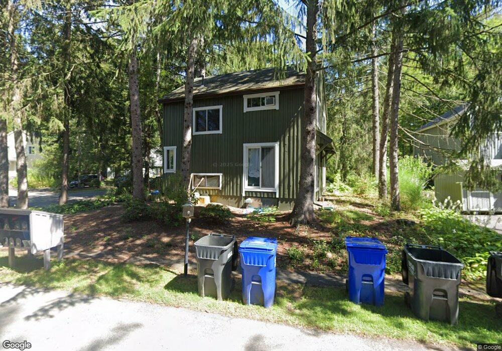
34 The Hollow Amherst, MA 01002
Estimated Value: $376,000 - $676,000
2
Beds
2
Baths
1,144
Sq Ft
$403/Sq Ft
Est. Value
About This Home
This home is located at 34 The Hollow, Amherst, MA 01002 and is currently estimated at $460,639, approximately $402 per square foot. 34 The Hollow is a home located in Hampshire County with nearby schools including Fort River Elementary School, Amherst Regional Middle School, and Amherst Regional High School.
Ownership History
Date
Name
Owned For
Owner Type
Purchase Details
Closed on
Dec 20, 2019
Sold by
Bass-Green Ruth
Bought by
Stevens Andrea P
Current Estimated Value
Purchase Details
Closed on
May 6, 2004
Sold by
Green John J and Green Ruth Bass
Bought by
Green Ruth Bass
Home Financials for this Owner
Home Financials are based on the most recent Mortgage that was taken out on this home.
Original Mortgage
$88,000
Interest Rate
5.39%
Mortgage Type
Purchase Money Mortgage
Create a Home Valuation Report for This Property
The Home Valuation Report is an in-depth analysis detailing your home's value as well as a comparison with similar homes in the area
Home Values in the Area
Average Home Value in this Area
Purchase History
| Date | Buyer | Sale Price | Title Company |
|---|---|---|---|
| Stevens Andrea P | -- | None Available | |
| Green Ruth Bass | -- | -- |
Source: Public Records
Mortgage History
| Date | Status | Borrower | Loan Amount |
|---|---|---|---|
| Previous Owner | Green Ruth Bass | $88,000 | |
| Previous Owner | Green Ruth Bass | $15,000 | |
| Previous Owner | Green Ruth Bass | $75,000 |
Source: Public Records
Tax History Compared to Growth
Tax History
| Year | Tax Paid | Tax Assessment Tax Assessment Total Assessment is a certain percentage of the fair market value that is determined by local assessors to be the total taxable value of land and additions on the property. | Land | Improvement |
|---|---|---|---|---|
| 2025 | $56 | $314,500 | $146,300 | $168,200 |
| 2024 | $5,594 | $302,200 | $143,300 | $158,900 |
| 2023 | $5,361 | $266,700 | $130,200 | $136,500 |
| 2022 | $5,107 | $240,100 | $118,400 | $121,700 |
| 2021 | $4,866 | $223,000 | $109,700 | $113,300 |
| 2020 | $4,754 | $223,000 | $109,700 | $113,300 |
| 2019 | $4,654 | $213,500 | $109,700 | $103,800 |
| 2018 | $4,513 | $213,500 | $109,700 | $103,800 |
| 2017 | $4,547 | $208,300 | $104,400 | $103,900 |
| 2016 | $4,420 | $208,300 | $104,400 | $103,900 |
| 2015 | $4,278 | $208,300 | $104,400 | $103,900 |
Source: Public Records
Map
Nearby Homes
- 53 Pine Grove Unit 53
- 481 Old Farm Rd
- 57 Tanglewood Rd
- 96 Logtown Rd
- 265 Stanley St
- 100 Larkspur Dr
- 130 Linden Ridge Rd
- 14 Pebble Ridge Rd
- 0 Heatherstone Rd
- 324 Pomeroy Ln
- 61 S Valley Rd
- 9 Harkness Rd
- 170 E Hadley Rd Unit 123
- 170 E Hadley Rd Unit 46
- 48 Gray St
- 500 West St Unit 6
- 41 Arnold Rd
- 365 Middle St
- 0 Red Gate Ln Unit 73348273
- 18 N Prospect St
- 32 The Hollow
- 36 The Hollow
- 35 The Hollow
- 28 The Hollow
- 41 The Hollow
- 30 The Hollow
- 89 Crossbrook Ave
- 27 The Hollow
- 91 Crossbrook Ave
- 39 The Hollow
- 37 The Hollow
- 26 The Hollow
- 71 Pine Grove
- 68 Pine Grove
- 71 Pine Grove Unit 71
- 68 Pine Grove Unit 68
- 87 Crossbrook Ave
- 87 Crossbrook Ave Unit 87
- 24 The Hollow
- 93 Crossbrook Ave