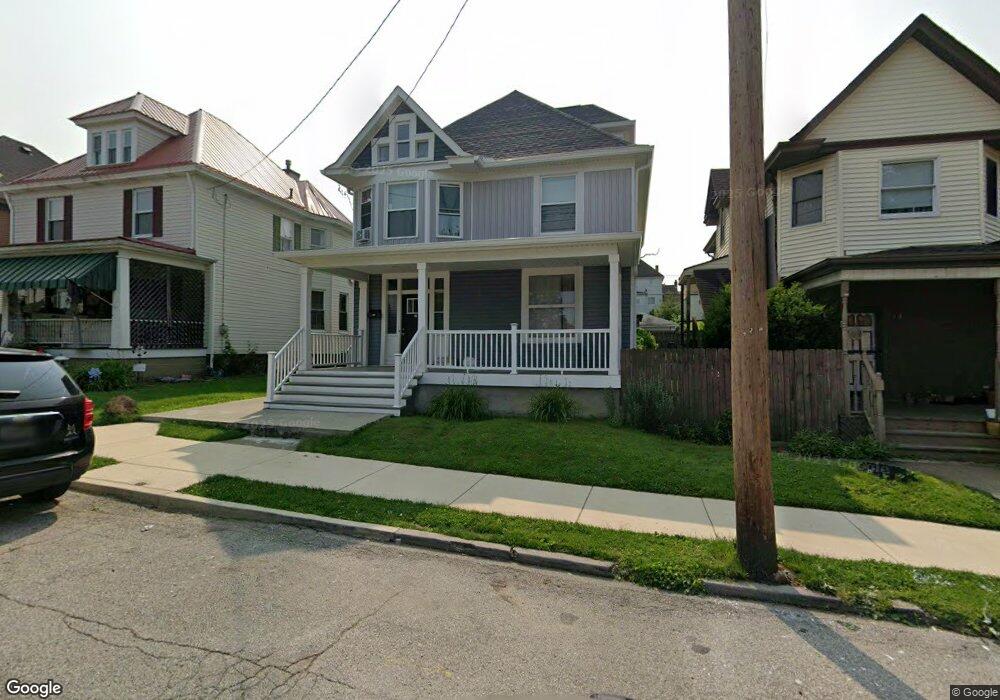
340 Ridge Ave New Kensington, PA 15068
Estimated Value: $47,160 - $150,000
--
Bed
--
Bath
2,436
Sq Ft
$39/Sq Ft
Est. Value
About This Home
This home is located at 340 Ridge Ave, New Kensington, PA 15068 and is currently estimated at $95,290, approximately $39 per square foot. 340 Ridge Ave is a home located in Westmoreland County with nearby schools including Mary Queen of Apostles School.
Ownership History
Date
Name
Owned For
Owner Type
Purchase Details
Closed on
Sep 11, 2021
Sold by
Penninvest Group Llc
Bought by
Sandoval Luis A
Current Estimated Value
Purchase Details
Closed on
May 29, 2019
Sold by
Caliguri Darcy and Caliguri Janice
Bought by
Penninvest Group Llc
Home Financials for this Owner
Home Financials are based on the most recent Mortgage that was taken out on this home.
Original Mortgage
$142,500
Interest Rate
4.1%
Mortgage Type
Commercial
Create a Home Valuation Report for This Property
The Home Valuation Report is an in-depth analysis detailing your home's value as well as a comparison with similar homes in the area
Home Values in the Area
Average Home Value in this Area
Purchase History
| Date | Buyer | Sale Price | Title Company |
|---|---|---|---|
| Sandoval Luis A | $30,000 | None Available | |
| Penninvest Group Llc | $150,000 | None Available |
Source: Public Records
Mortgage History
| Date | Status | Borrower | Loan Amount |
|---|---|---|---|
| Previous Owner | Penninvest Group Llc | $142,500 |
Source: Public Records
Tax History Compared to Growth
Tax History
| Year | Tax Paid | Tax Assessment Tax Assessment Total Assessment is a certain percentage of the fair market value that is determined by local assessors to be the total taxable value of land and additions on the property. | Land | Improvement |
|---|---|---|---|---|
| 2025 | $2,376 | $14,880 | $2,800 | $12,080 |
| 2024 | $2,353 | $14,880 | $2,800 | $12,080 |
| 2023 | $2,227 | $14,880 | $2,800 | $12,080 |
| 2022 | $2,159 | $14,880 | $2,800 | $12,080 |
| 2021 | $2,110 | $14,880 | $2,800 | $12,080 |
| 2020 | $2,065 | $14,880 | $2,800 | $12,080 |
| 2019 | $2,013 | $14,880 | $2,800 | $12,080 |
| 2018 | $1,983 | $14,880 | $2,800 | $12,080 |
| 2017 | $1,954 | $14,880 | $2,800 | $12,080 |
| 2016 | $1,954 | $14,880 | $2,800 | $12,080 |
| 2015 | $1,954 | $14,880 | $2,800 | $12,080 |
| 2014 | $1,877 | $14,880 | $2,800 | $12,080 |
Source: Public Records
Map
Nearby Homes
- 318 Ridge Ave
- 327 Charles Ave
- 486 McCargo St
- 254 Ridge Ave
- 225 Highland Ave
- 1134 Leishman Ave
- 1025 Kenneth Ave
- 1218 Woodmont Ave
- 168 Short St
- 159 Freeport Rd
- 201 Locust St
- 533 Freeport Rd
- 1240 Victoria Ave
- 105 Locust St
- 1233 Kenneth Ave
- 1312 Woodmont Ave
- 1308 Taylor Ave
- 1506 Victoria Ave
- Lots 12-14 Ross Ave
- 125 North St
- 336 Ridge Ave
- 344 Ridge Ave
- 332 Ridge Ave
- 348 Ridge Ave
- 328 Ridge Ave
- 352 Ridge Ave
- 324 Ridge Ave
- 331 Freeport Rd
- 329 Freeport Rd
- 345 Ridge Ave
- 333 Freeport Rd
- 335 Freeport Rd
- 325 Freeport Rd
- 337 Freeport Rd
- 320 Ridge Ave
- 1030 Victoria Ave
- 323 Freeport Rd
- 1042 Victoria Ave
- 339 Freeport Rd
- 347 Ridge Ave