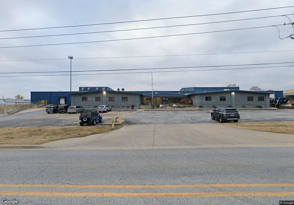
340 W Industrial Park Rd Harrison, AR 72601
Estimated Value: $651,470
--
Bed
--
Bath
62,000
Sq Ft
$11/Sq Ft
Est. Value
About This Home
This home is located at 340 W Industrial Park Rd, Harrison, AR 72601 and is currently estimated at $651,470, approximately $10 per square foot. 340 W Industrial Park Rd is a home located in Boone County with nearby schools including Skyline Heights Elementary School, Harrison Jr. High School, and Harrison High School.
Ownership History
Date
Name
Owned For
Owner Type
Purchase Details
Closed on
Dec 1, 2022
Sold by
Methvin Sanitation Inc
Bought by
Waste Connections Of Arkansas Inc
Current Estimated Value
Purchase Details
Closed on
Feb 8, 1999
Bought by
Duncan
Purchase Details
Closed on
Feb 11, 1972
Bought by
Qonaar Corp (Duncan Indus.)
Create a Home Valuation Report for This Property
The Home Valuation Report is an in-depth analysis detailing your home's value as well as a comparison with similar homes in the area
Home Values in the Area
Average Home Value in this Area
Purchase History
| Date | Buyer | Sale Price | Title Company |
|---|---|---|---|
| Waste Connections Of Arkansas Inc | $4,720,000 | -- | |
| Duncan | -- | -- | |
| Qonaar Corp (Duncan Indus.) | -- | -- |
Source: Public Records
Tax History Compared to Growth
Tax History
| Year | Tax Paid | Tax Assessment Tax Assessment Total Assessment is a certain percentage of the fair market value that is determined by local assessors to be the total taxable value of land and additions on the property. | Land | Improvement |
|---|---|---|---|---|
| 2025 | $11,471 | $224,920 | $20,470 | $204,450 |
| 2024 | $11,471 | $224,920 | $20,470 | $204,450 |
| 2023 | $11,471 | $224,920 | $20,470 | $204,450 |
| 2022 | $11,471 | $224,920 | $20,470 | $204,450 |
| 2021 | $11,471 | $224,920 | $20,470 | $204,450 |
| 2020 | $12,194 | $239,090 | $33,110 | $205,980 |
| 2019 | $12,212 | $239,090 | $33,110 | $205,980 |
| 2018 | $12,212 | $239,090 | $33,110 | $205,980 |
| 2017 | $4,452 | $239,090 | $33,110 | $205,980 |
| 2016 | $4,452 | $87,290 | $33,110 | $54,180 |
| 2015 | $3,682 | $72,200 | $20,040 | $52,160 |
| 2014 | $3,682 | $72,200 | $20,040 | $52,160 |
Source: Public Records
Map
Nearby Homes
- 1800 Airport Rd
- 3602 Shields Dr
- 1912 Mcelroy Dr
- 2014 Cedar Ridge Rd
- 900 Oriole Dr
- 0 Arkansas 397
- 0 Gipson Rd
- 709 Gipson Rd
- 213 Glenview St
- 2 Cresthaven Ave
- 203 Glenview St
- 0 W Burls Way
- 1825 Forward Dr
- 3323 Savannah Dr
- 303 Old Farm Rd S
- 4019 Savannah Dr
- 3147 Savannah Dr
- 503 Skyline Dr
- 1 Meadow Lark Ln
- Lot 3 Cornerstone Way
- 3915 Duncan Dr
- 3905 Duncan Dr
- 0 Commerce Dr
- 3924 Commerce Dr
- 3904 Commerce Dr
- 3902 W Commercial St
- 1603 W Commerce Dr
- 2371 Highway 397 S
- 2371 Highway 397 S
- 2445 Highway 397 S
- 328 W Industrial Park Rd
- 1810 Airport Rd
- 0 Airport Rd Unit 135963
- 324 Granger Rd
- 2526 Highway 397 S
- 1910 Woodridge Dr
- Lot 18 N Wood Ridge Dr
- Lot 17 N Wood Ridge Dr
- 2545 Highway 397 S
- 320 W Industrial Park Rd