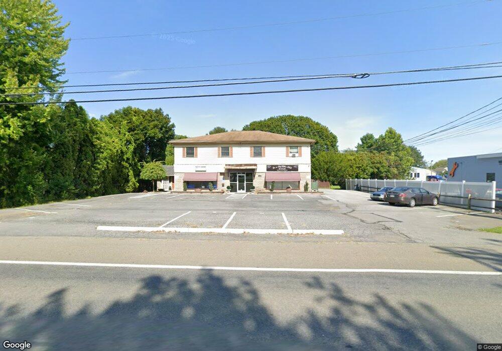
3401 Sullivan Trail Easton, PA 18040
Estimated Value: $429,511
6
Beds
8
Baths
4,608
Sq Ft
$93/Sq Ft
Est. Value
About This Home
This home is located at 3401 Sullivan Trail, Easton, PA 18040 and is currently estimated at $429,511, approximately $93 per square foot. 3401 Sullivan Trail is a home located in Northampton County with nearby schools including Shawnee Elementary School, Easton Area Middle School, and Easton Area High School.
Ownership History
Date
Name
Owned For
Owner Type
Purchase Details
Closed on
Sep 11, 2015
Sold by
Harvey Priscilla and Kunsman Kristin Harvey
Bought by
French H Douglas and French Renee A
Current Estimated Value
Purchase Details
Closed on
Sep 10, 2015
Sold by
Harvey Priscilla and Kunsman Kristin Harvey
Bought by
Harvey Priscilla and Kunsman Kristin Harvey
Purchase Details
Closed on
Sep 5, 2013
Sold by
Orth Charles and Orth Martha S
Bought by
French H Douglas and French Renee A
Purchase Details
Closed on
Sep 1, 1992
Bought by
Orth Charles
Create a Home Valuation Report for This Property
The Home Valuation Report is an in-depth analysis detailing your home's value as well as a comparison with similar homes in the area
Home Values in the Area
Average Home Value in this Area
Purchase History
| Date | Buyer | Sale Price | Title Company |
|---|---|---|---|
| French H Douglas | -- | None Available | |
| Harvey Priscilla | -- | Attorney | |
| French H Douglas | $212,000 | None Available | |
| Orth Charles | -- | -- |
Source: Public Records
Tax History Compared to Growth
Tax History
| Year | Tax Paid | Tax Assessment Tax Assessment Total Assessment is a certain percentage of the fair market value that is determined by local assessors to be the total taxable value of land and additions on the property. | Land | Improvement |
|---|---|---|---|---|
| 2025 | $834 | $77,200 | $32,600 | $44,600 |
| 2024 | $6,764 | $77,200 | $32,600 | $44,600 |
| 2023 | $6,662 | $77,200 | $32,600 | $44,600 |
| 2022 | $6,560 | $77,200 | $32,600 | $44,600 |
| 2021 | $6,539 | $77,200 | $32,600 | $44,600 |
| 2020 | $6,535 | $77,200 | $32,600 | $44,600 |
| 2019 | $6,442 | $77,200 | $32,600 | $44,600 |
| 2018 | $6,331 | $77,200 | $32,600 | $44,600 |
| 2017 | $6,141 | $77,200 | $32,600 | $44,600 |
| 2016 | -- | $77,200 | $32,600 | $44,600 |
| 2015 | -- | $77,200 | $32,600 | $44,600 |
| 2014 | -- | $77,200 | $32,600 | $44,600 |
Source: Public Records
Map
Nearby Homes
- 977 S Fork Dr
- 640 Biltmore Ave
- 677 Biltmore Ave
- 712 Winterthur Way
- 657 Winterthur Way
- 647 San Simeon Place
- 891 Biltmore Ave
- 727 Kykuit Place
- 3813 Belcourt Rd
- 117 Willow Dr
- 2755 Destiny Ln
- 2316 Wagon Wheel Dr
- 21 Cobblestone Dr
- 17 Stonecreek Ct
- 22 Cobblestone Dr
- 2735 Upstream Farm Rd
- 4128 Foxwood Cir
- 1300 Upstream Farm Rd
- 2609 Chestnut Ln
- 329 Knollwood Dr
- 3403 Sullivan Trail
- 3407 Sullivan Trail Unit 3
- 3315 Sullivan Trail
- 220 S Fork Dr Unit 220
- 3405 Sullivan Trail Unit 3405
- 212 S Fork Dr Unit 212
- 436 S Fork Dr
- 219 S Fork Dr Unit 219
- 213 S Fork Dr Unit 213
- 218 S Fork Dr Unit 218
- 430 S Fork Dr
- 110 S Fork Dr Unit 110
- 432 S Fork Dr Unit 432
- 214 S Fork Dr
- 108 S Fork Dr Unit 108
- 102 S Fork Dr
- 107 S Fork Dr
- 104 S Fork Dr
- 106 S Fork Dr
- 322 S Fork Dr Unit 322