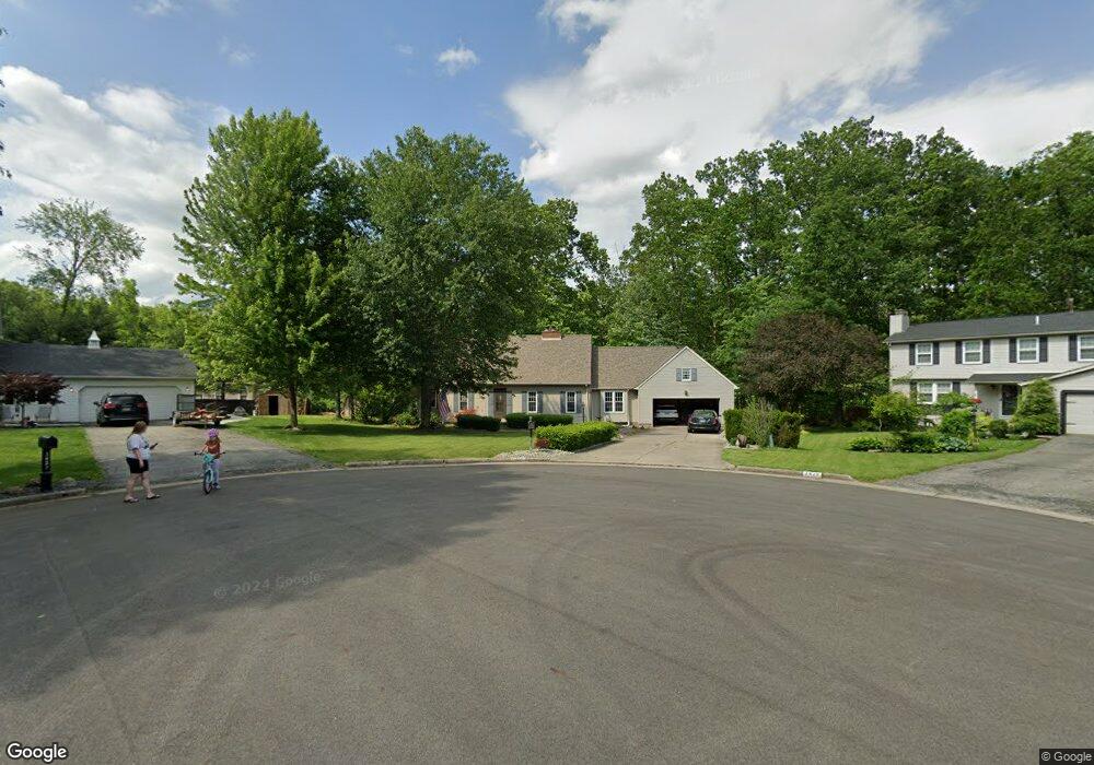
3420 Meanderwood Dr Canfield, OH 44406
Austintown NeighborhoodEstimated Value: $278,000 - $304,000
3
Beds
2
Baths
2,073
Sq Ft
$142/Sq Ft
Est. Value
About This Home
This home is located at 3420 Meanderwood Dr, Canfield, OH 44406 and is currently estimated at $294,659, approximately $142 per square foot. 3420 Meanderwood Dr is a home located in Mahoning County with nearby schools including Austintown Elementary School, Austintown Intermediate School, and Austintown Middle School.
Ownership History
Date
Name
Owned For
Owner Type
Purchase Details
Closed on
Jan 15, 2009
Sold by
Maloney Susan D and Maloney Kevin S
Bought by
Jones Jeffrey A
Current Estimated Value
Purchase Details
Closed on
Jul 3, 2008
Sold by
Jones David W and Jones Cathy
Bought by
Jones Jeffrey A
Purchase Details
Closed on
Feb 1, 2008
Sold by
Citizens First Trust Co Llc
Bought by
Hillebrand Susan D and Jones David W
Purchase Details
Closed on
Sep 21, 2000
Sold by
Estate Of Molly G Jones
Bought by
National City Bank and Molly G J Jones Trust
Purchase Details
Closed on
Sep 5, 1991
Bought by
Jones Molly G
Create a Home Valuation Report for This Property
The Home Valuation Report is an in-depth analysis detailing your home's value as well as a comparison with similar homes in the area
Home Values in the Area
Average Home Value in this Area
Purchase History
| Date | Buyer | Sale Price | Title Company |
|---|---|---|---|
| Jones Jeffrey A | -- | Attorney | |
| Jones Jeffrey A | $10,000 | Attorney | |
| Hillebrand Susan D | -- | Attorney | |
| National City Bank | -- | -- | |
| Jones Molly G | -- | -- |
Source: Public Records
Tax History Compared to Growth
Tax History
| Year | Tax Paid | Tax Assessment Tax Assessment Total Assessment is a certain percentage of the fair market value that is determined by local assessors to be the total taxable value of land and additions on the property. | Land | Improvement |
|---|---|---|---|---|
| 2024 | $4,134 | $88,260 | $12,180 | $76,080 |
| 2023 | $4,070 | $88,260 | $12,180 | $76,080 |
| 2022 | $3,818 | $66,320 | $12,180 | $54,140 |
| 2021 | $3,820 | $66,320 | $12,180 | $54,140 |
| 2020 | $3,836 | $66,320 | $12,180 | $54,140 |
| 2019 | $3,734 | $58,850 | $12,180 | $46,670 |
| 2018 | $3,599 | $58,850 | $12,180 | $46,670 |
| 2017 | $3,485 | $58,850 | $12,180 | $46,670 |
| 2016 | $3,374 | $54,670 | $12,180 | $42,490 |
| 2015 | $3,437 | $54,670 | $12,180 | $42,490 |
| 2014 | $3,201 | $54,670 | $12,180 | $42,490 |
| 2013 | $3,167 | $54,670 | $12,180 | $42,490 |
Source: Public Records
Map
Nearby Homes
- 7054 Berry Blossom Dr
- 7017 Kirk Rd
- 3013 Whispering Pines Dr
- 6856 Berry Blossom Dr
- 8148 Gibson Rd
- 6947 Winterpark Ave
- 6488 S Timberidge Dr
- 6581 N Timberidge Ave
- 6581 Country Ridge Ave
- 0 Grayson Dr
- 94 Alabaster Ave
- 0 Fairview Rd
- 0 Lake Wobegon Dr Unit 5104965
- 0 Lake Wobegon Dr Unit 5104946
- 0 Lake Wobegon Dr Unit 5104948
- 0 Lake Wobegon Dr Unit 5104960
- 301 Timber Run Dr
- 9112 New Rd
- 191 Saybrook Dr
- 2792 S Canfield Niles Rd
- 3428 Meanderwood Dr
- 7001 Kirk Rd
- 3421 Meanderwood Dr
- 3434 Meanderwood Dr
- 6983 Kirk Rd
- 6983 Kirk Rd
- 7025 Kirk Rd
- 3425 Meanderwood Dr
- 3438 Meanderwood Dr
- 3429 Meanderwood Dr
- 6975 Kirk Rd
- 7033 Kirk Rd
- 3433 Meanderwood Dr
- 3460 Meanderwood Dr
- 3446 Meanderwood Dr
- 6967 Kirk Rd
- 3464 Meanderwood Dr
- 3456 Meanderwood Dr
- 7467 Kirk Rd
- 3468 Meanderwood Dr